Estimated Value: $60,000 - $198,000
3
Beds
2
Baths
1,574
Sq Ft
$72/Sq Ft
Est. Value
About This Home
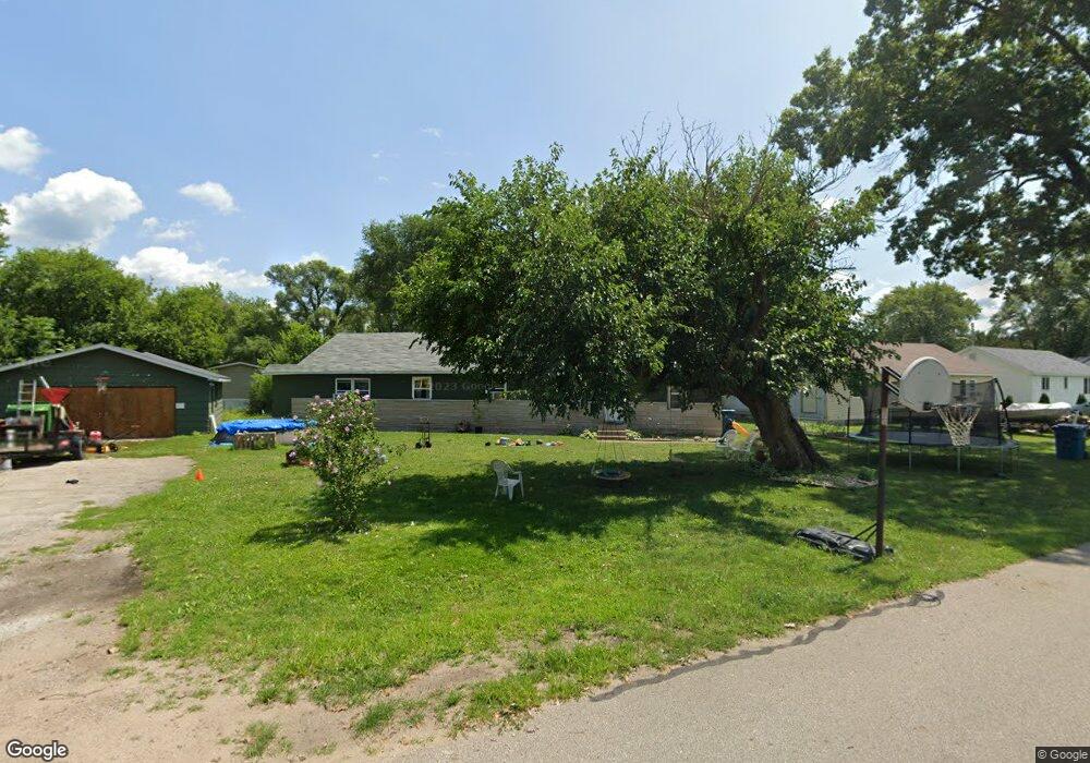
This home is located at 301 N Roosevelt Rd, Knox, IN 46534 and is currently estimated at $113,622, approximately $72 per square foot. 301 N Roosevelt Rd is a home located in Starke County with nearby schools including Knox Community Elementary School, Knox Community Middle School, and Knox Community High School.
Ownership History
Date
Name
Owned For
Owner Type
Purchase Details
Closed on
Feb 16, 2017
Sold by
Maiden England Llc
Bought by
Duane Ford
Current Estimated Value
Purchase Details
Closed on
Jun 22, 2016
Sold by
Cuautle Jose
Bought by
England Maiden
Purchase Details
Closed on
Nov 20, 2014
Sold by
Maiden England Llc
Bought by
Cuautle Jose
Purchase Details
Closed on
Jan 23, 2013
Sold by
Maiden England Llc
Bought by
Bostain Connie F and Bostain Karen M
Create a Home Valuation Report for This Property
The Home Valuation Report is an in-depth analysis detailing your home's value as well as a comparison with similar homes in the area
Home Values in the Area
Average Home Value in this Area
Purchase History
| Date | Buyer | Sale Price | Title Company |
|---|---|---|---|
| Duane Ford | $24,700 | -- | |
| England Maiden | $5,800 | -- | |
| Maiden England Llc | -- | None Available | |
| Cuautle Jose | $352 | None Available | |
| Bostain Connie F | $701 | None Available | |
| Maiden England Llc | $4,201 | None Available |
Source: Public Records
Tax History
| Year | Tax Paid | Tax Assessment Tax Assessment Total Assessment is a certain percentage of the fair market value that is determined by local assessors to be the total taxable value of land and additions on the property. | Land | Improvement |
|---|---|---|---|---|
| 2025 | $1,567 | $47,300 | $5,300 | $42,000 |
| 2024 | $1,567 | $39,600 | $5,100 | $34,500 |
| 2023 | $670 | $36,700 | $4,600 | $32,100 |
| 2022 | $670 | $33,500 | $4,600 | $28,900 |
| 2021 | $560 | $28,000 | $4,600 | $23,400 |
| 2020 | $531 | $25,200 | $4,600 | $20,600 |
| 2019 | $524 | $25,200 | $4,600 | $20,600 |
| 2018 | $514 | $24,700 | $4,600 | $20,100 |
| 2017 | $182 | $8,100 | $4,600 | $3,500 |
| 2016 | $182 | $8,100 | $4,600 | $3,500 |
| 2014 | $192 | $9,600 | $6,100 | $3,500 |
| 2013 | $354 | $17,700 | $6,700 | $11,000 |
Source: Public Records
Map
Nearby Homes
- 207 W Lake St
- 203 W Lake St
- 105 S Bower St
- 2 N Pearl St
- 305 W New York St
- 154 W New York St
- 302 S Main St
- 303 E Lake St
- 156 W Street Louis St
- 4152 S State Road 35
- 551 E Mound St
- 701 S Shield St
- 703 S Main St
- 1675 U S 35
- 601 S Heaton St
- 625 S East St
- 402 E Saint Louis St
- 14.89 Acres W Culver Rd
- 1301 W Culver Rd
- 1103 E Lake St
- 416 W Maple Dr
- 415 Fear Ct
- 412 W Elm Dr
- 209 N Roosevelt Rd
- 420 W Maple Dr
- 419 W Fear Ct
- 302 N Roosevelt Rd
- 205 N Roosevelt Rd
- 401 N Roosevelt Rd Unit 403 N Roosevelt Rd
- 401 N Roosevelt Rd
- 413 W Maple Dr
- 403 N Roosevelt Rd
- 424 W Maple Dr
- 413 W Maple Ave
- 404 W Giles Ct
- 425 W Fear Ct
- 322 N Clark St
- 405 N Roosevelt Rd
- 405 N Roosevelt Rd Unit 407 N Roosevelt Rd
Your Personal Tour Guide
Ask me questions while you tour the home.