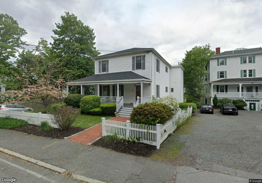
301 Nahant Rd Nahant, MA 01908
Estimated Value: $1,332,000 - $1,940,000
7
Beds
4
Baths
4,519
Sq Ft
$351/Sq Ft
Est. Value
About This Home
This home is located at 301 Nahant Rd, Nahant, MA 01908 and is currently estimated at $1,587,190, approximately $351 per square foot. 301 Nahant Rd is a home located in Essex County with nearby schools including Johnson Elementary School, Swampscott Middle School, and Swampscott High School.
Ownership History
Date
Name
Owned For
Owner Type
Purchase Details
Closed on
Sep 14, 2009
Sold by
Bongiorno Michael G and Bongiorno Judy L
Bought by
Sagamore Park Llc
Current Estimated Value
Purchase Details
Closed on
Apr 30, 2007
Sold by
Rooney Robert G and Rooney Sara A
Bought by
Bongiorno Michael G and Bongiorno Doris I
Purchase Details
Closed on
Sep 19, 1997
Sold by
Whiting Patricia R
Bought by
Rooney Robert G and Rooney Sara A
Purchase Details
Closed on
Jun 11, 1992
Sold by
Whiting Patricia R
Bought by
Rooney Robert G and Rooney Sara A
Create a Home Valuation Report for This Property
The Home Valuation Report is an in-depth analysis detailing your home's value as well as a comparison with similar homes in the area
Home Values in the Area
Average Home Value in this Area
Purchase History
| Date | Buyer | Sale Price | Title Company |
|---|---|---|---|
| Sagamore Park Llc | -- | -- | |
| Sagamore Park Llc | -- | -- | |
| Bongiorno Michael G | $760,000 | -- | |
| Bongiorno Michael G | $760,000 | -- | |
| Rooney Robert G | $8,000 | -- | |
| Rooney Robert G | $8,000 | -- | |
| Rooney Robert G | $112,000 | -- | |
| Rooney Robert G | $112,000 | -- |
Source: Public Records
Mortgage History
| Date | Status | Borrower | Loan Amount |
|---|---|---|---|
| Open | Rooney Robert G | $513,000 | |
| Closed | Rooney Robert G | $589,500 |
Source: Public Records
Tax History Compared to Growth
Tax History
| Year | Tax Paid | Tax Assessment Tax Assessment Total Assessment is a certain percentage of the fair market value that is determined by local assessors to be the total taxable value of land and additions on the property. | Land | Improvement |
|---|---|---|---|---|
| 2025 | $10,513 | $1,149,000 | $485,700 | $663,300 |
| 2024 | $10,103 | $1,113,900 | $465,100 | $648,800 |
| 2023 | $8,925 | $981,800 | $413,400 | $568,400 |
| 2022 | $8,569 | $875,300 | $351,400 | $523,900 |
| 2021 | $8,359 | $795,300 | $330,700 | $464,600 |
| 2020 | $8,721 | $795,000 | $330,700 | $464,300 |
| 2019 | $7,800 | $714,900 | $310,000 | $404,900 |
| 2018 | $7,328 | $714,900 | $310,000 | $404,900 |
| 2017 | $7,485 | $714,900 | $310,000 | $404,900 |
| 2016 | $7,086 | $673,600 | $268,700 | $404,900 |
| 2015 | $7,074 | $647,800 | $242,900 | $404,900 |
| 2014 | $7,145 | $647,800 | $242,900 | $404,900 |
Source: Public Records
Map
Nearby Homes
- 303 Nahant Rd
- 66 Ocean St
- 51 Cliff St
- 3 Cliff St
- 2 Goddard Dr
- 183 Bass Point Rd
- 17 Pearl Rd
- 23 Phillips Rd
- 43 Maple Ave
- 9 Little Nahant Rd
- 36 Lennox Rd
- 9 Beach Rd Unit 4
- 45 Tudor St Unit 3-8
- 41 Tudor St
- 300 Lynn Shore Dr Unit 612
- 12 Chancery Ct Unit 205
- 12 Chancery Ct Unit 207
- 285 Lynn Shore Dr Unit 508
- 285 Lynn Shore Dr Unit 203
- 281 Lynn Shore Dr Unit 4
- 293 Nahant Rd Unit A10
- 293 Nahant Rd Unit A9
- 293 Nahant Rd Unit A8
- 293 Nahant Rd Unit A7
- 293 Nahant Rd Unit A6
- 293 Nahant Rd Unit A5
- 293 Nahant Rd Unit A4
- 293 Nahant Rd Unit A3
- 293 Nahant Rd Unit A2
- 293 Nahant Rd Unit A1
- 293 Nahant Rd Unit 8
- 293 Nahant Rd Unit 10
- 293 Nahant Rd Unit 3
- 293 Nahant Rd
- 293 Nahant Rd Unit 1
- 293 Nahant Rd Unit 7
- 293 Nahant Rd Unit 5
- 293 Nahant Rd Unit 6
- 293 Nahant Rd Unit 4
- 293 Nahant Rd Unit 2