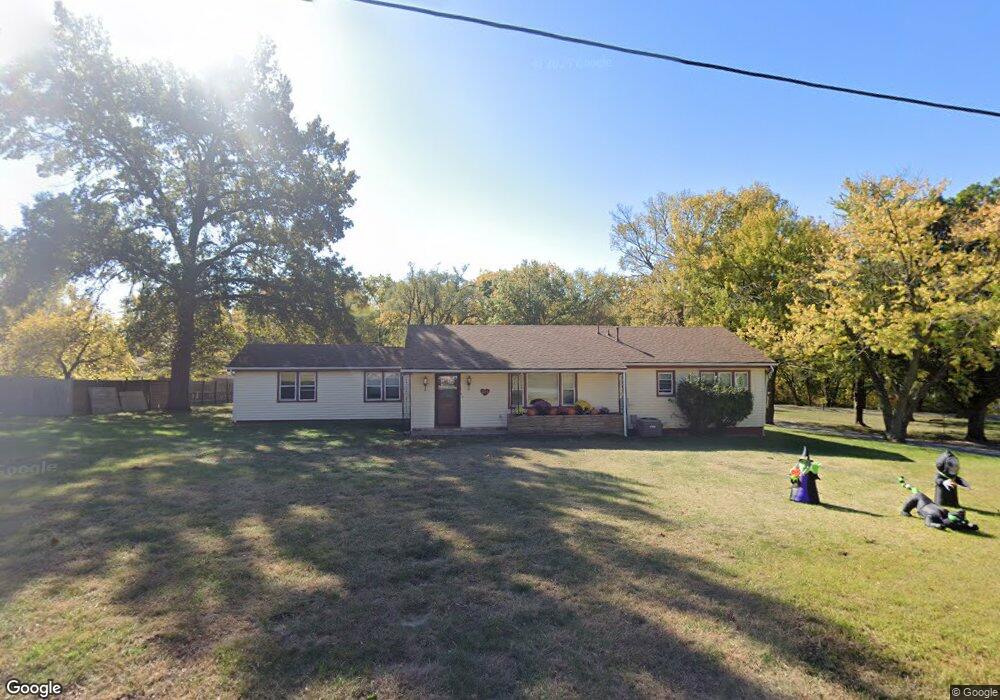
301 Norton Ave Liberty, MO 64068
Estimated Value: $271,000 - $358,000
4
Beds
2
Baths
1,702
Sq Ft
$184/Sq Ft
Est. Value
About This Home
This home is located at 301 Norton Ave, Liberty, MO 64068 and is currently estimated at $313,279, approximately $184 per square foot. 301 Norton Ave is a home located in Clay County with nearby schools including Alexander Doniphan Elementary School, Discovery Middle School, and Liberty High School.
Ownership History
Date
Name
Owned For
Owner Type
Purchase Details
Closed on
Jun 30, 2025
Sold by
Lampkin Randy
Bought by
Matthews Dorothy
Current Estimated Value
Purchase Details
Closed on
Jun 24, 2020
Sold by
Lampkin Randy
Bought by
Lampkin Randy
Purchase Details
Closed on
Mar 28, 2008
Sold by
Federal National Mortgage Association
Bought by
Lampkin Randy and Lampkin Roberta
Home Financials for this Owner
Home Financials are based on the most recent Mortgage that was taken out on this home.
Original Mortgage
$124,545
Interest Rate
6.19%
Mortgage Type
Purchase Money Mortgage
Purchase Details
Closed on
Jan 24, 2008
Sold by
Hartman Gary G and Countrywide Bank Na
Bought by
Federal National Mortgage Association
Create a Home Valuation Report for This Property
The Home Valuation Report is an in-depth analysis detailing your home's value as well as a comparison with similar homes in the area
Home Values in the Area
Average Home Value in this Area
Purchase History
| Date | Buyer | Sale Price | Title Company |
|---|---|---|---|
| Matthews Dorothy | -- | None Listed On Document | |
| Matthews Dorothy | -- | None Listed On Document | |
| Lampkin Randy | -- | None Available | |
| Lampkin Randy | -- | Continental Title Company | |
| Federal National Mortgage Association | $145,279 | None Available |
Source: Public Records
Mortgage History
| Date | Status | Borrower | Loan Amount |
|---|---|---|---|
| Previous Owner | Lampkin Randy | $124,545 |
Source: Public Records
Tax History Compared to Growth
Tax History
| Year | Tax Paid | Tax Assessment Tax Assessment Total Assessment is a certain percentage of the fair market value that is determined by local assessors to be the total taxable value of land and additions on the property. | Land | Improvement |
|---|---|---|---|---|
| 2025 | $2,681 | $41,720 | -- | -- |
| 2024 | $2,681 | $36,310 | -- | -- |
| 2023 | $2,720 | $36,310 | $0 | $0 |
| 2022 | $2,527 | $33,350 | $0 | $0 |
| 2021 | $2,537 | $33,345 | $6,954 | $26,391 |
| 2020 | $2,425 | $30,080 | $0 | $0 |
| 2019 | $2,427 | $30,077 | $6,650 | $23,427 |
| 2018 | $2,198 | $26,750 | $0 | $0 |
| 2017 | $2,174 | $26,750 | $3,420 | $23,330 |
| 2016 | $2,174 | $26,750 | $3,420 | $23,330 |
| 2015 | $2,174 | $26,750 | $3,420 | $23,330 |
| 2014 | $2,179 | $26,750 | $3,420 | $23,330 |
Source: Public Records
Map
Nearby Homes
- 1733 Welleslay Ln
- 1507 Amesbury Ave
- 2116 Winding Woods Dr
- 1537 Canterbury Ln
- 1991 Harvest Rd
- 2153 Black Walnut Dr
- 2152 Black Walnut Dr
- 2157 Black Walnut Dr
- 1929 Longview Dr
- 1841 Vintage Ln
- 2156 Black Walnut Dr
- 1852 Vintage Ln
- 1980 Longview Dr
- 1845 Arbor Trail
- 1984 Longview Dr
- 1975 Harvest Rd
- 1979 Harvest Rd
- 1971 Harvest Rd
- Lot 2A Oak Crest Dr
- 1972 Longview Dr