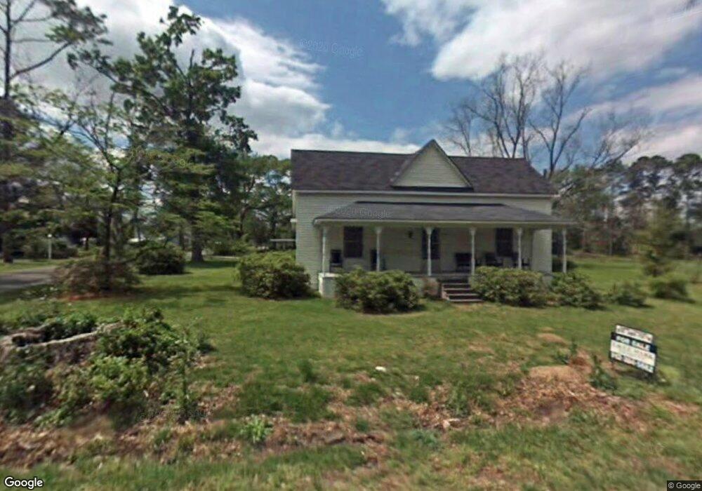
301 Ocmulgee St E Broxton, GA 31519
Estimated Value: $82,452 - $164,000
4
Beds
2
Baths
2,228
Sq Ft
$61/Sq Ft
Est. Value
About This Home
This home is located at 301 Ocmulgee St E, Broxton, GA 31519 and is currently estimated at $135,863, approximately $60 per square foot. 301 Ocmulgee St E is a home located in Coffee County with nearby schools including Broxton-Mary Hayes Elementary School, Coffee Middle School, and Coffee County High School.
Ownership History
Date
Name
Owned For
Owner Type
Purchase Details
Closed on
Nov 16, 2018
Sold by
Pryor Holdings Llc
Bought by
Croft Haley Alexis and Croft Corey Del Angel
Current Estimated Value
Home Financials for this Owner
Home Financials are based on the most recent Mortgage that was taken out on this home.
Original Mortgage
$75,905
Outstanding Balance
$65,777
Interest Rate
4.8%
Mortgage Type
New Conventional
Estimated Equity
$70,086
Purchase Details
Closed on
Dec 18, 2012
Sold by
Pryor Gerald H
Bought by
Pryor Holdings Llc
Create a Home Valuation Report for This Property
The Home Valuation Report is an in-depth analysis detailing your home's value as well as a comparison with similar homes in the area
Purchase History
| Date | Buyer | Sale Price | Title Company |
|---|---|---|---|
| Croft Haley Alexis | $79,900 | -- | |
| Pryor Holdings Llc | $77,000 | -- |
Source: Public Records
Mortgage History
| Date | Status | Borrower | Loan Amount |
|---|---|---|---|
| Open | Croft Haley Alexis | $75,905 |
Source: Public Records
Tax History
| Year | Tax Paid | Tax Assessment Tax Assessment Total Assessment is a certain percentage of the fair market value that is determined by local assessors to be the total taxable value of land and additions on the property. | Land | Improvement |
|---|---|---|---|---|
| 2025 | $656 | $21,245 | $3,648 | $17,597 |
| 2024 | $651 | $20,020 | $3,648 | $16,372 |
| 2023 | $580 | $20,020 | $3,648 | $16,372 |
| 2022 | $633 | $20,020 | $3,648 | $16,372 |
| 2021 | $633 | $20,020 | $3,648 | $16,372 |
| 2020 | $634 | $20,020 | $3,648 | $16,372 |
| 2019 | $634 | $20,020 | $3,648 | $16,372 |
| 2018 | $634 | $20,020 | $3,648 | $16,372 |
| 2017 | $636 | $20,020 | $3,648 | $16,372 |
| 2016 | $636 | $20,020 | $3,648 | $16,372 |
| 2015 | $639 | $20,020 | $3,648 | $16,372 |
| 2014 | $641 | $20,020 | $3,648 | $16,372 |
Source: Public Records
Map
Nearby Homes
- 2048 Somerset
- 4653 Douglas Braxton Hwy
- 744 Lotts Crossing
- 407 Broxton West Green Hwy
- 310 Leyland Dr
- 2002 Apache Trail
- 123 Leyland Dr
- 5495 Cross Rd
- 161 Green Tree Dr
- 699 Twin Lakes Dr
- 7789 Bowens Mill Rd
- 7468 George Deen Rd
- 1671 Warren Carter Rd
- 0 Hwy 301 Hwy Unit 1635753
- 00 Rocky Pond Rd
- 6415 George Deen Rd
- 00 Georgia 206 Connector
- 1010 Clough Blvd
- 2004 Indian Trail
- 180 Clough Blvd
- 00 Ocmulgee St E Unit n/a
- 521 Ocmulgee St E Unit n/a
- 206 Ocmulgee St E
- 209 Sweat Rd E
- 208 Lott St E
- 206 Lott St E
- 219 E Lott
- 203 Lott St E
- 201 Lott St E
- 404 Miller Ave
- 401 Ocmulgee St E
- 401 Ocmulgee St E
- 406 Miller Ave
- 401 Railroad St N
- 502 Reynolds St
- 403 Lott St E
- 403 Ocmulgee St E
- 410 Railroad St N
- 305 Railroad St N
- 228 Reynolds St
Your Personal Tour Guide
Ask me questions while you tour the home.