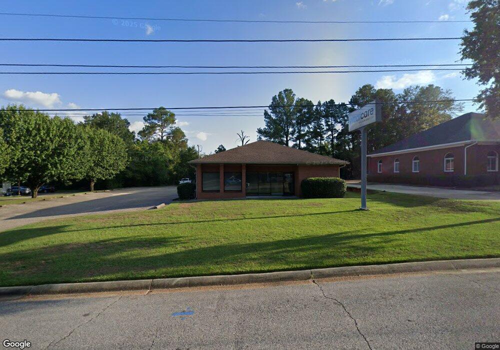
301 Perry Ave Dothan, AL 36303
Estimated Value: $531,986
--
Bed
--
Bath
3,243
Sq Ft
$164/Sq Ft
Est. Value
About This Home
This home is located at 301 Perry Ave, Dothan, AL 36303 and is currently estimated at $531,986, approximately $164 per square foot. 301 Perry Ave is a home located in Houston County with nearby schools including Dothan City Early Education Center, Dothan 6th Grade Center, and Girard Elementary School.
Ownership History
Date
Name
Owned For
Owner Type
Purchase Details
Closed on
Mar 8, 2017
Sold by
Eberhardt Guy B
Bought by
Medical Alliance Solutions Llc
Current Estimated Value
Home Financials for this Owner
Home Financials are based on the most recent Mortgage that was taken out on this home.
Original Mortgage
$320,000
Outstanding Balance
$265,361
Interest Rate
4.17%
Mortgage Type
Commercial
Estimated Equity
$266,625
Purchase Details
Closed on
Jun 26, 2014
Sold by
Arthur P Arthur P
Bought by
Eberhardy Guy B
Create a Home Valuation Report for This Property
The Home Valuation Report is an in-depth analysis detailing your home's value as well as a comparison with similar homes in the area
Home Values in the Area
Average Home Value in this Area
Purchase History
| Date | Buyer | Sale Price | Title Company |
|---|---|---|---|
| Medical Alliance Solutions Llc | $320,000 | -- | |
| Eberhardy Guy B | $137,250 | -- |
Source: Public Records
Mortgage History
| Date | Status | Borrower | Loan Amount |
|---|---|---|---|
| Open | Medical Alliance Solutions Llc | $320,000 |
Source: Public Records
Tax History Compared to Growth
Tax History
| Year | Tax Paid | Tax Assessment Tax Assessment Total Assessment is a certain percentage of the fair market value that is determined by local assessors to be the total taxable value of land and additions on the property. | Land | Improvement |
|---|---|---|---|---|
| 2024 | $2,223 | $61,760 | $0 | $0 |
| 2023 | $2,223 | $61,760 | $0 | $0 |
| 2022 | $2,131 | $61,760 | $0 | $0 |
| 2021 | $1,985 | $66,320 | $0 | $0 |
| 2020 | $1,985 | $57,540 | $0 | $0 |
| 2019 | $1,985 | $57,540 | $0 | $0 |
| 2018 | $1,985 | $57,540 | $0 | $0 |
| 2017 | $1,814 | $52,580 | $0 | $0 |
| 2016 | $1,814 | $0 | $0 | $0 |
| 2015 | $1,814 | $0 | $0 | $0 |
| 2014 | $1,811 | $0 | $0 | $0 |
Source: Public Records
Map
Nearby Homes
- 404 Craftsman Dr
- 207 Kent Dr
- 208 Craftsman Dr
- 903 Eldorado Dr
- 0 Phillips Terrace
- 1104 Cornell Ave
- 2110 Baker Trace
- 113 Cottage Ct
- 2753 Ross Clark Cir
- 1515 Plaza Dr
- 2003 Baker Trace
- 4 Woodmere Dr
- 0000 SW South Park Ext Lot 7
- 1206 Monte Carlo Dr
- 5 Danmor Place
- 706 Wildwood Ave
- 214 Royal Orleans Ct
- 907 N Cherokee Ave
- 2052 W Main St
- 1103 Rendale Rd
- 215 Perry Ave
- 1000 Forest Dr
- 201 Beecher St
- 1004 Forest Dr
- 214 Perry Ave
- 440 Westgate Pkwy
- 203 Beecher St
- 418 Westgate Pkwy
- 3265 Ross Clark Cir
- 205 Beecher St
- 3269 Ross Clark Cir
- 392 Westgate Pkwy
- 207 Beecher St
- 524 Westgate Pkwy
- 382 Westgate Pkwy
- 532 Westgate Pkwy
- 209 Beecher St
- 376 Westgate Pkwy
- 119 Wanda Ct
- 901 Forrester Rd