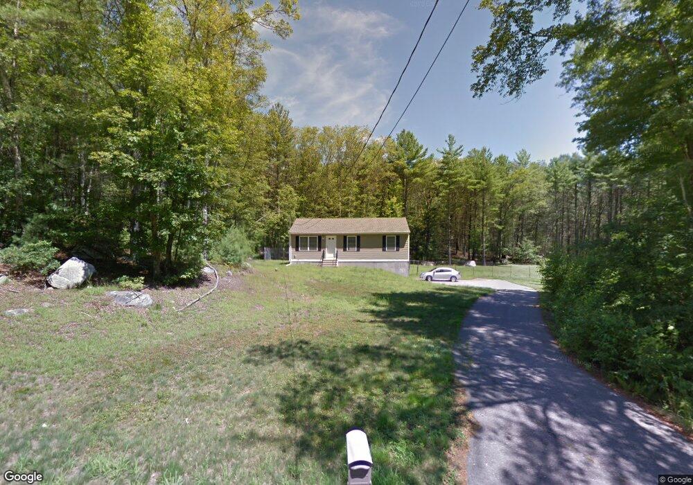
301 Quinebaug Rd North Grosvenordale, CT 06255
Estimated Value: $398,000
3
Beds
1
Bath
960
Sq Ft
$415/Sq Ft
Est. Value
About This Home
This home is located at 301 Quinebaug Rd, North Grosvenordale, CT 06255 and is currently estimated at $398,000, approximately $414 per square foot. 301 Quinebaug Rd is a home located in Windham County with nearby schools including Mary R. Fisher Elementary School, Thompson Middle School, and Tourtellotte Memorial High School.
Ownership History
Date
Name
Owned For
Owner Type
Purchase Details
Closed on
Jun 29, 2009
Sold by
Pasay Dev Llc
Bought by
Maher Patrick and Buck Irene
Current Estimated Value
Home Financials for this Owner
Home Financials are based on the most recent Mortgage that was taken out on this home.
Original Mortgage
$190,740
Outstanding Balance
$121,484
Interest Rate
4.92%
Estimated Equity
$276,516
Create a Home Valuation Report for This Property
The Home Valuation Report is an in-depth analysis detailing your home's value as well as a comparison with similar homes in the area
Home Values in the Area
Average Home Value in this Area
Purchase History
| Date | Buyer | Sale Price | Title Company |
|---|---|---|---|
| Maher Patrick | $187,000 | -- | |
| Maher Patrick | $187,000 | -- |
Source: Public Records
Mortgage History
| Date | Status | Borrower | Loan Amount |
|---|---|---|---|
| Open | Maher Patrick | $190,740 | |
| Closed | Maher Patrick | $190,740 |
Source: Public Records
Tax History Compared to Growth
Tax History
| Year | Tax Paid | Tax Assessment Tax Assessment Total Assessment is a certain percentage of the fair market value that is determined by local assessors to be the total taxable value of land and additions on the property. | Land | Improvement |
|---|---|---|---|---|
| 2025 | $4,119 | $216,800 | $55,400 | $161,400 |
| 2024 | $3,829 | $136,200 | $42,500 | $93,700 |
| 2023 | $3,541 | $136,200 | $42,500 | $93,700 |
| 2022 | $3,408 | $136,200 | $42,500 | $93,700 |
| 2021 | $3,398 | $136,200 | $42,500 | $93,700 |
| 2020 | $3,300 | $136,200 | $42,500 | $93,700 |
| 2019 | $3,294 | $118,700 | $43,800 | $74,900 |
| 2018 | $3,294 | $118,700 | $43,800 | $74,900 |
| 2017 | $3,093 | $118,700 | $43,800 | $74,900 |
| 2016 | $3,093 | $118,700 | $43,800 | $74,900 |
| 2015 | $2,944 | $118,700 | $43,800 | $74,900 |
| 2014 | $2,934 | $128,300 | $46,000 | $82,300 |
Source: Public Records
Map
Nearby Homes
- 313 Quinebaug Rd
- 433 Fabyan Rd
- 468 Fabyan Rd
- 1133 Riverside Dr
- 15 Ryler Ct
- 40 Hagstrom Rd
- 10 Green Acres Ln
- 0 Blash Rd Unit 24105055
- 0 Wilsonville Rd Unit 24140220
- 983 Riverside Dr
- 14 Buckley Hill Rd
- 942 Riverside Dr
- 10 Highland Dr
- 232 Pompeo Rd
- 37 Buckley Hill Rd
- 28 Carpenter Rd
- 71 Eagle Dr
- 220 W Main St
- 81 Parkway Dr
- 23 Central St
- 7 Linehouse Rd
- 3 Linehouse Rd
- 11 Linehouse Rd
- 15 Linehouse Rd
- 311 Quinebaug Rd
- 19 Linehouse Rd
- 25 Linehouse Rd
- 4 Linehouse Rd
- 0 Linehouse Rd Unit E228629
- 160 Jezierski Rd
- 336 Quinebaug Rd
- 148 Jezierski Rd
- 42 Linehouse Rd
- 153 Jezierski Rd
- 43 Linehouse Rd
- 291A Quinebaug Rd
- 291 Quinebaug Rd
- 124 Jerzeskia Rd
- 348 Quinebaug Rd
- 56 Linehouse Rd