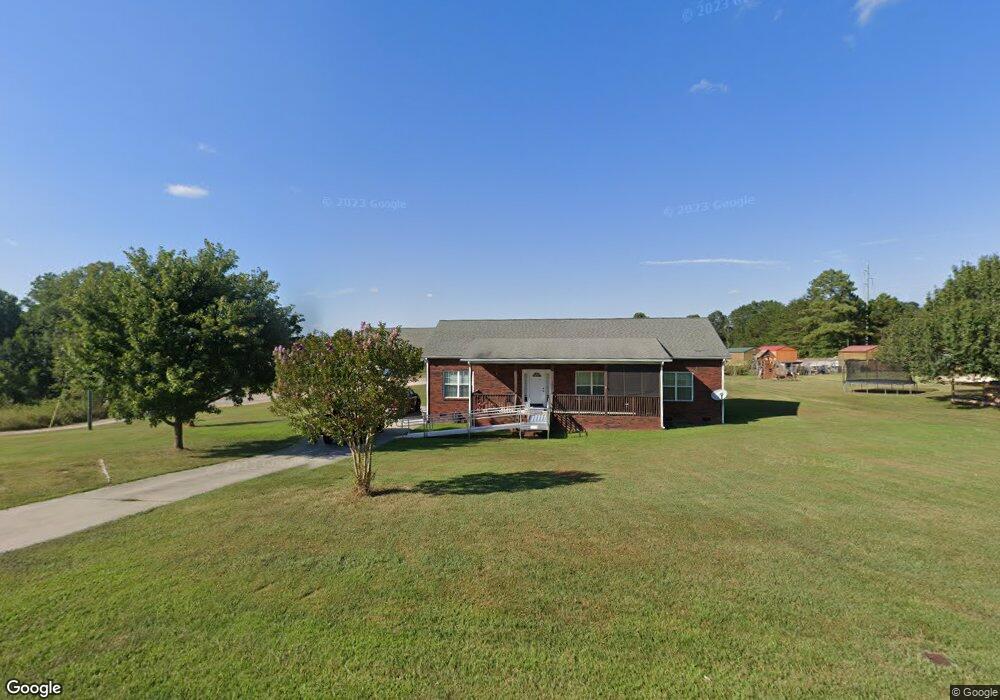
301 Range Rd Kings Mountain, NC 28086
Estimated Value: $178,000 - $262,000
Studio
--
Bath
1,539
Sq Ft
$148/Sq Ft
Est. Value
About This Home
This home is located at 301 Range Rd, Kings Mountain, NC 28086 and is currently estimated at $228,496, approximately $148 per square foot. 301 Range Rd is a home located in Cleveland County with nearby schools including Bethware Elementary School, Kings Mountain Middle, and Kings Mountain Intermediate School.
Ownership History
Date
Name
Owned For
Owner Type
Purchase Details
Closed on
Apr 12, 2021
Sold by
Cb Of Km Llc
Bought by
Agullar Sonya T
Current Estimated Value
Home Financials for this Owner
Home Financials are based on the most recent Mortgage that was taken out on this home.
Original Mortgage
$78,551
Outstanding Balance
$70,979
Interest Rate
3.05%
Mortgage Type
FHA
Estimated Equity
$157,517
Purchase Details
Closed on
May 11, 2017
Sold by
Carrigan Charles A and Carrigan Betty H
Bought by
Cb Of Km Llc
Create a Home Valuation Report for This Property
The Home Valuation Report is an in-depth analysis detailing your home's value as well as a comparison with similar homes in the area
Home Values in the Area
Average Home Value in this Area
Purchase History
| Date | Buyer | Sale Price | Title Company |
|---|---|---|---|
| Agullar Sonya T | $160 | None Listed On Document | |
| Cb Of Km Llc | -- | None Available |
Source: Public Records
Mortgage History
| Date | Status | Borrower | Loan Amount |
|---|---|---|---|
| Open | Agullar Sonya T | $78,551 |
Source: Public Records
Tax History
| Year | Tax Paid | Tax Assessment Tax Assessment Total Assessment is a certain percentage of the fair market value that is determined by local assessors to be the total taxable value of land and additions on the property. | Land | Improvement |
|---|---|---|---|---|
| 2025 | $866 | $136,439 | $23,659 | $112,780 |
| 2024 | $670 | $74,229 | $20,208 | $54,021 |
| 2023 | $598 | $65,456 | $20,208 | $45,248 |
| 2022 | $598 | $65,456 | $20,208 | $45,248 |
| 2021 | $598 | $65,456 | $20,208 | $45,248 |
| 2020 | $548 | $57,330 | $19,716 | $37,614 |
| 2019 | $548 | $57,330 | $19,716 | $37,614 |
| 2018 | $544 | $57,330 | $19,716 | $37,614 |
| 2017 | $541 | $57,330 | $19,716 | $37,614 |
| 2016 | $515 | $57,330 | $19,716 | $37,614 |
| 2015 | $693 | $79,884 | $30,774 | $49,110 |
| 2014 | $693 | $79,884 | $30,774 | $49,110 |
Source: Public Records
Map
Nearby Homes
- 507 Bethlehem Rd
- 105 Trotter Ln
- 707 Sandalwood Ln
- 907 Bethlehem Rd
- 5067 E Dixon Blvd
- 5139 E Dixon Blvd
- 106 Williams Rd
- 400 El Bethel Rd
- 143 Yarbro Rd Unit 16
- 143 Yarbro Rd Unit 2
- 143 Yarbro Rd Unit 20
- 132 Yarbro Rd Unit 13
- 116 Maple Crest Dr
- 2207 David Baptist Ch Rd
- 11111 High Ridge Ct Unit 11
- 115 High Ridge Ct Unit 26
- 213 Mullinax Dr
- 113 High Ridge Ct Unit 25
- 127 Mullinax Dr
- 107 Tara Terrace
Your Personal Tour Guide
Ask me questions while you tour the home.