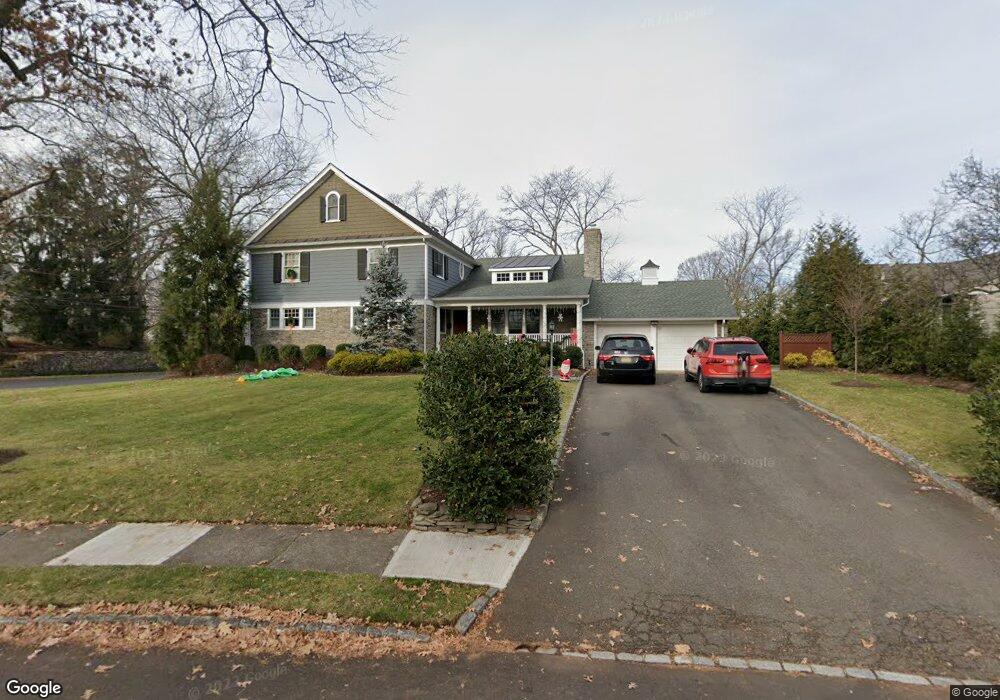
301 Roanoke Rd Westfield, NJ 07090
Estimated Value: $1,495,000 - $2,158,000
--
Bed
--
Bath
4,112
Sq Ft
$453/Sq Ft
Est. Value
About This Home
This home is located at 301 Roanoke Rd, Westfield, NJ 07090 and is currently estimated at $1,863,689, approximately $453 per square foot. 301 Roanoke Rd is a home located in Union County with nearby schools including Franklin Elementary School, Roosevelt Intermediate School, and Westfield Senior High School.
Ownership History
Date
Name
Owned For
Owner Type
Purchase Details
Closed on
Aug 17, 2005
Sold by
Miller David G
Bought by
Paone Francis J and Paone Julie E
Current Estimated Value
Home Financials for this Owner
Home Financials are based on the most recent Mortgage that was taken out on this home.
Original Mortgage
$500,000
Outstanding Balance
$262,994
Interest Rate
5.68%
Mortgage Type
New Conventional
Estimated Equity
$1,600,695
Purchase Details
Closed on
Apr 28, 1999
Sold by
Koparkar Arun D and Koparkar Sunita
Bought by
Miller David G and Miller Victoria C
Home Financials for this Owner
Home Financials are based on the most recent Mortgage that was taken out on this home.
Original Mortgage
$314,000
Interest Rate
6.92%
Mortgage Type
Stand Alone First
Create a Home Valuation Report for This Property
The Home Valuation Report is an in-depth analysis detailing your home's value as well as a comparison with similar homes in the area
Home Values in the Area
Average Home Value in this Area
Purchase History
| Date | Buyer | Sale Price | Title Company |
|---|---|---|---|
| Paone Francis J | $810,000 | -- | |
| Miller David G | $400,000 | -- |
Source: Public Records
Mortgage History
| Date | Status | Borrower | Loan Amount |
|---|---|---|---|
| Open | Paone Francis J | $500,000 | |
| Previous Owner | Miller David G | $314,000 |
Source: Public Records
Tax History Compared to Growth
Tax History
| Year | Tax Paid | Tax Assessment Tax Assessment Total Assessment is a certain percentage of the fair market value that is determined by local assessors to be the total taxable value of land and additions on the property. | Land | Improvement |
|---|---|---|---|---|
| 2025 | $24,563 | $1,090,700 | $521,100 | $569,600 |
| 2024 | $24,061 | $1,090,700 | $521,100 | $569,600 |
| 2023 | $24,061 | $1,090,700 | $521,100 | $569,600 |
| 2022 | $23,559 | $1,090,700 | $521,100 | $569,600 |
| 2021 | $23,140 | $1,069,800 | $521,100 | $548,700 |
| 2020 | $23,086 | $1,069,800 | $521,100 | $548,700 |
| 2019 | $23,001 | $1,069,800 | $521,100 | $548,700 |
| 2018 | $26,534 | $285,400 | $112,100 | $173,300 |
| 2017 | $26,388 | $285,400 | $112,100 | $173,300 |
| 2016 | $25,769 | $285,400 | $112,100 | $173,300 |
| 2015 | $25,255 | $285,400 | $112,100 | $173,300 |
| 2014 | $24,422 | $285,400 | $112,100 | $173,300 |
Source: Public Records
Map
Nearby Homes
- 825 Lawrence Ave
- 113 Barchester Way
- 1163 Lawrence Ave
- 2 Barchester Way
- 657 Hillside Ave
- 740 Lawrence Ave
- 1463 Dunn Pkwy
- 232 Beechwood Ct
- 141 Brightwood Ave
- 819 Standish Ave
- 122 Stanmore Place
- 869 Standish Ave
- 559 Lawrence Ave
- 143 Stanmore Place
- 242 Juniper Way
- 2588 Liberty Ave
- 1503 Woodacres Dr
- 2527 John St
- 234 Seneca Place
- 765 Belvidere Ave
- 303 Roanoke Rd
- 1040 Lawrence Ave
- 305 Roanoke Rd
- 300 Roanoke Rd
- 977 Lawrence Ave
- 1050 Lawrence Ave
- 1031 Lawrence Ave
- 302 Roanoke Rd
- 307 Roanoke Rd
- 304 Roanoke Rd
- 967 Lawrence Ave
- 1039 Lawrence Ave
- 309 Roanoke Rd
- 980 Lawrence Ave
- 1060 Lawrence Ave
- 306 Roanoke Rd
- 308 Roanoke Rd
- 1053 Lawrence Ave
- 955 Lawrence Ave
- 948 Wyandotte Trail