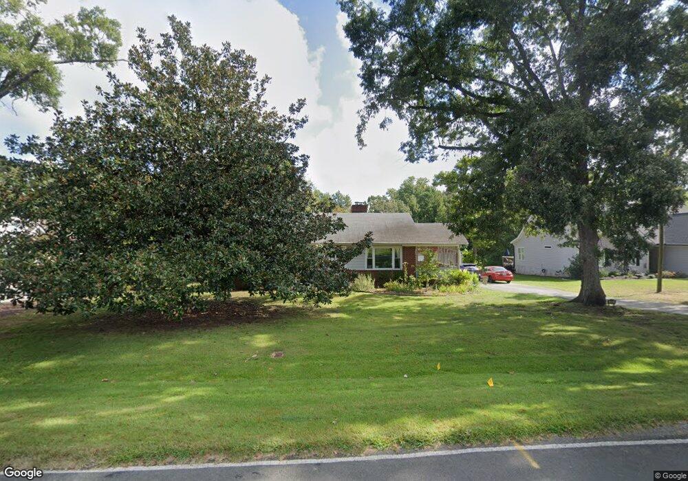
301 Robbins Rd Durham, NC 27703
Eastern Durham NeighborhoodEstimated Value: $305,000 - $352,000
3
Beds
1
Bath
1,334
Sq Ft
$249/Sq Ft
Est. Value
About This Home
This home is located at 301 Robbins Rd, Durham, NC 27703 and is currently estimated at $332,326, approximately $249 per square foot. 301 Robbins Rd is a home located in Durham County with nearby schools including Oak Grove Elementary, John W Neal Middle School, and Southern School of Energy & Sustainability.
Ownership History
Date
Name
Owned For
Owner Type
Purchase Details
Closed on
Jul 16, 2018
Sold by
Moreau Alan Edward and Moreau Jacquelyn O
Bought by
Shiflett Adam and Shiflett Jennifer
Current Estimated Value
Home Financials for this Owner
Home Financials are based on the most recent Mortgage that was taken out on this home.
Original Mortgage
$4,510
Outstanding Balance
$3,909
Interest Rate
4.5%
Mortgage Type
Purchase Money Mortgage
Estimated Equity
$328,417
Purchase Details
Closed on
Aug 24, 2011
Sold by
Wells Fargo Bank Na
Bought by
Secretary Of Housing & Urban Development
Purchase Details
Closed on
Aug 9, 2011
Sold by
Green Eric F and Emery Shelley S
Bought by
Wells Fargo Bank Na
Create a Home Valuation Report for This Property
The Home Valuation Report is an in-depth analysis detailing your home's value as well as a comparison with similar homes in the area
Home Values in the Area
Average Home Value in this Area
Purchase History
| Date | Buyer | Sale Price | Title Company |
|---|---|---|---|
| Shiflett Adam | $155,000 | None Available | |
| Secretary Of Housing & Urban Development | -- | None Available | |
| Wells Fargo Bank Na | $159,879 | None Available |
Source: Public Records
Mortgage History
| Date | Status | Borrower | Loan Amount |
|---|---|---|---|
| Open | Shiflett Adam | $4,510 |
Source: Public Records
Tax History
| Year | Tax Paid | Tax Assessment Tax Assessment Total Assessment is a certain percentage of the fair market value that is determined by local assessors to be the total taxable value of land and additions on the property. | Land | Improvement |
|---|---|---|---|---|
| 2025 | $2,420 | $336,349 | $123,975 | $212,374 |
| 2024 | $1,751 | $161,715 | $42,775 | $118,940 |
| 2023 | $1,684 | $161,715 | $42,775 | $118,940 |
| 2022 | $1,631 | $161,715 | $42,775 | $118,940 |
| 2021 | $1,418 | $161,715 | $42,775 | $118,940 |
| 2020 | $1,386 | $161,715 | $42,775 | $118,940 |
| 2019 | $1,370 | $161,715 | $42,775 | $118,940 |
| 2018 | $1,275 | $138,118 | $29,942 | $108,176 |
| 2017 | $1,233 | $138,118 | $29,942 | $108,176 |
| 2016 | $1,195 | $138,118 | $29,942 | $108,176 |
| 2015 | $1,418 | $138,606 | $31,392 | $107,214 |
| 2014 | $1,425 | $138,606 | $31,392 | $107,214 |
Source: Public Records
Map
Nearby Homes
- 442 Gus Rd
- 2800-2809 Napoli Dr
- 528 Plumleaf Ln
- 17 Plumleaf Ln
- 517 Keith St
- 13 Blackthorn Ln
- 1112 Blackthorn Ln
- 601 Crossing Dr
- 807 Outlaw Ave
- 1114 Blackthorn Ln
- 208 Lick Creek Ln
- 5002 Wake Forest Hwy
- 607 Ravenstone Ln
- 621 Wellwater Ave
- 6 Spicewood Ct
- 819 Ember Dr
- 428 Holly Blossom Dr
- 615 Southshore Pkwy
- 210 Stallings Rd
- 4 Jarvis Ct
Your Personal Tour Guide
Ask me questions while you tour the home.