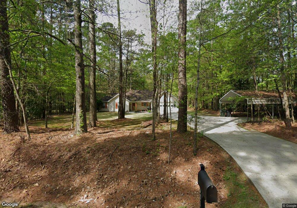
301 Rosser Rd McDonough, GA 30252
Estimated Value: $252,000 - $275,000
3
Beds
2
Baths
1,394
Sq Ft
$190/Sq Ft
Est. Value
About This Home
This home is located at 301 Rosser Rd, McDonough, GA 30252 and is currently estimated at $264,696, approximately $189 per square foot. 301 Rosser Rd is a home located in Henry County with nearby schools including Tussahaw Elementary School, McDonough Middle School, and New Creation Christian Academy.
Ownership History
Date
Name
Owned For
Owner Type
Purchase Details
Closed on
Apr 17, 2003
Sold by
Boyd Doyle F and Boyd Kelly H
Bought by
Julian Stephen C and Julian Patti
Current Estimated Value
Home Financials for this Owner
Home Financials are based on the most recent Mortgage that was taken out on this home.
Original Mortgage
$116,900
Outstanding Balance
$49,666
Interest Rate
5.6%
Mortgage Type
New Conventional
Estimated Equity
$215,030
Purchase Details
Closed on
Jun 30, 1998
Sold by
Pirigyi Howard
Bought by
Boyd Ii Doyle F and Boyd Kelly H
Home Financials for this Owner
Home Financials are based on the most recent Mortgage that was taken out on this home.
Original Mortgage
$96,115
Interest Rate
7.02%
Mortgage Type
FHA
Create a Home Valuation Report for This Property
The Home Valuation Report is an in-depth analysis detailing your home's value as well as a comparison with similar homes in the area
Home Values in the Area
Average Home Value in this Area
Purchase History
| Date | Buyer | Sale Price | Title Company |
|---|---|---|---|
| Julian Stephen C | $129,900 | -- | |
| Boyd Ii Doyle F | $103,000 | -- |
Source: Public Records
Mortgage History
| Date | Status | Borrower | Loan Amount |
|---|---|---|---|
| Open | Julian Stephen C | $116,900 | |
| Previous Owner | Boyd Ii Doyle F | $96,115 |
Source: Public Records
Tax History Compared to Growth
Tax History
| Year | Tax Paid | Tax Assessment Tax Assessment Total Assessment is a certain percentage of the fair market value that is determined by local assessors to be the total taxable value of land and additions on the property. | Land | Improvement |
|---|---|---|---|---|
| 2025 | $3,026 | $112,640 | $15,960 | $96,680 |
| 2024 | $3,026 | $113,400 | $14,600 | $98,800 |
| 2023 | $2,435 | $104,440 | $14,080 | $90,360 |
| 2022 | $2,367 | $80,200 | $13,000 | $67,200 |
| 2021 | $1,971 | $63,440 | $11,160 | $52,280 |
| 2020 | $1,836 | $57,720 | $10,480 | $47,240 |
| 2019 | $1,755 | $54,320 | $9,960 | $44,360 |
| 2018 | $1,610 | $48,160 | $9,200 | $38,960 |
| 2016 | $1,236 | $38,240 | $7,200 | $31,040 |
| 2015 | $1,163 | $35,680 | $7,760 | $27,920 |
| 2014 | $1,079 | $33,320 | $7,760 | $25,560 |
Source: Public Records
Map
Nearby Homes
- 325 Rosser Rd
- 5 Wellington Dr
- 312 Amble Side
- 297 Aylesbury Blvd
- 289 Aylesbury Blvd
- 292 Aylesbury Blvd
- 500 Elkwood Ln
- 512 Elkwood Ln
- 1449 Highway 81 E
- 536 Elkwood Ln
- 613 Vidalia Pkwy
- 1324 Cochran Crossing
- 633 Vidalia Park Way
- 645 Vidalia Pkwy
- 466 Best Friends Turn Alley
- 189 Delilah St
- 125 Steeplechase Dr
- 1829 Global Dr
- 205 Delilah St
- 283 Rosser Rd
- 384a Rosser Rd
- 384 Rosser Rd
- 110 Wellington Dr
- 343 Rosser Rd
- 271 Rosser Rd
- 120 Wellington Dr
- 292 Rosser Rd
- 100 Wellington Dr
- 130 Wellington Dr
- 90 Wellington Dr
- 140 Wellington Dr
- 80 Wellington Dr Unit 1
- 2120 Wellington Dr
- 150 Wellington Dr
- 70 Wellington Dr
- 245 Rosser Rd
- 369 Rosser Rd
- 160 Wellington Dr
- 95 Wellington Dr Unit 1