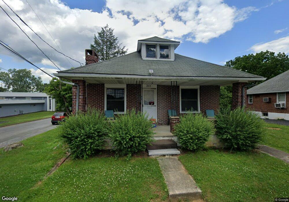
301 S 12th St Emmaus, PA 18049
Estimated Value: $243,024 - $290,000
2
Beds
1
Bath
911
Sq Ft
$284/Sq Ft
Est. Value
About This Home
This home is located at 301 S 12th St, Emmaus, PA 18049 and is currently estimated at $258,506, approximately $283 per square foot. 301 S 12th St is a home located in Lehigh County with nearby schools including Jefferson Elementary School, Lower Macungie Middle School, and Emmaus High School.
Ownership History
Date
Name
Owned For
Owner Type
Purchase Details
Closed on
Oct 2, 2009
Sold by
T L Development Co
Bought by
Peters Virginia H
Current Estimated Value
Purchase Details
Closed on
May 18, 2006
Sold by
Dsw Development Llc
Bought by
Wolfe Robert K
Purchase Details
Closed on
Oct 17, 2003
Sold by
Dormann Steven
Bought by
Dsw Development Llc
Purchase Details
Closed on
Aug 21, 2003
Sold by
Haines Rodney and Miers Sharon L
Bought by
Dormann Steven
Create a Home Valuation Report for This Property
The Home Valuation Report is an in-depth analysis detailing your home's value as well as a comparison with similar homes in the area
Home Values in the Area
Average Home Value in this Area
Purchase History
| Date | Buyer | Sale Price | Title Company |
|---|---|---|---|
| Peters Virginia H | $135,000 | -- | |
| Wolfe Robert K | $98,124 | None Available | |
| Dsw Development Llc | -- | -- | |
| Dormann Steven | $135,000 | -- |
Source: Public Records
Tax History Compared to Growth
Tax History
| Year | Tax Paid | Tax Assessment Tax Assessment Total Assessment is a certain percentage of the fair market value that is determined by local assessors to be the total taxable value of land and additions on the property. | Land | Improvement |
|---|---|---|---|---|
| 2025 | $3,928 | $111,500 | $34,800 | $76,700 |
| 2024 | $3,598 | $111,500 | $34,800 | $76,700 |
| 2023 | $3,528 | $111,500 | $34,800 | $76,700 |
| 2022 | $3,411 | $111,500 | $76,700 | $34,800 |
| 2021 | $3,326 | $111,500 | $34,800 | $76,700 |
| 2020 | $3,297 | $111,500 | $34,800 | $76,700 |
| 2019 | $2,712 | $111,500 | $34,800 | $76,700 |
| 2018 | $3,088 | $111,500 | $34,800 | $76,700 |
| 2017 | $2,993 | $111,500 | $34,800 | $76,700 |
| 2016 | -- | $111,500 | $34,800 | $76,700 |
| 2015 | -- | $111,500 | $34,800 | $76,700 |
| 2014 | -- | $111,500 | $34,800 | $76,700 |
Source: Public Records
Map
Nearby Homes
- 339 Delong Ave Unit 343
- 97 Chestnut Hill Rd
- 4109 Eveningstar Rd
- 3430 Gentlewind Way Unit IC 109
- 659 Broad St
- 618 Broad St
- 4088 Eveningstar Rd
- 657 Walnut St
- 569 Chestnut St Unit 571
- 521 Wood St
- 4160 Newport Dr
- 3623 Daylily Dr
- 3810 Allen St
- 543 Long St
- 3989 Mink Rd
- 3703 Samantha Ln Unit Lot 70
- 3736 Samantha Ln Unit Lot 7
- 3748 Samantha Ln
- 3748 Samantha Ln Unit Lot 3
- 3734 Samantha Ln Unit Lot 8