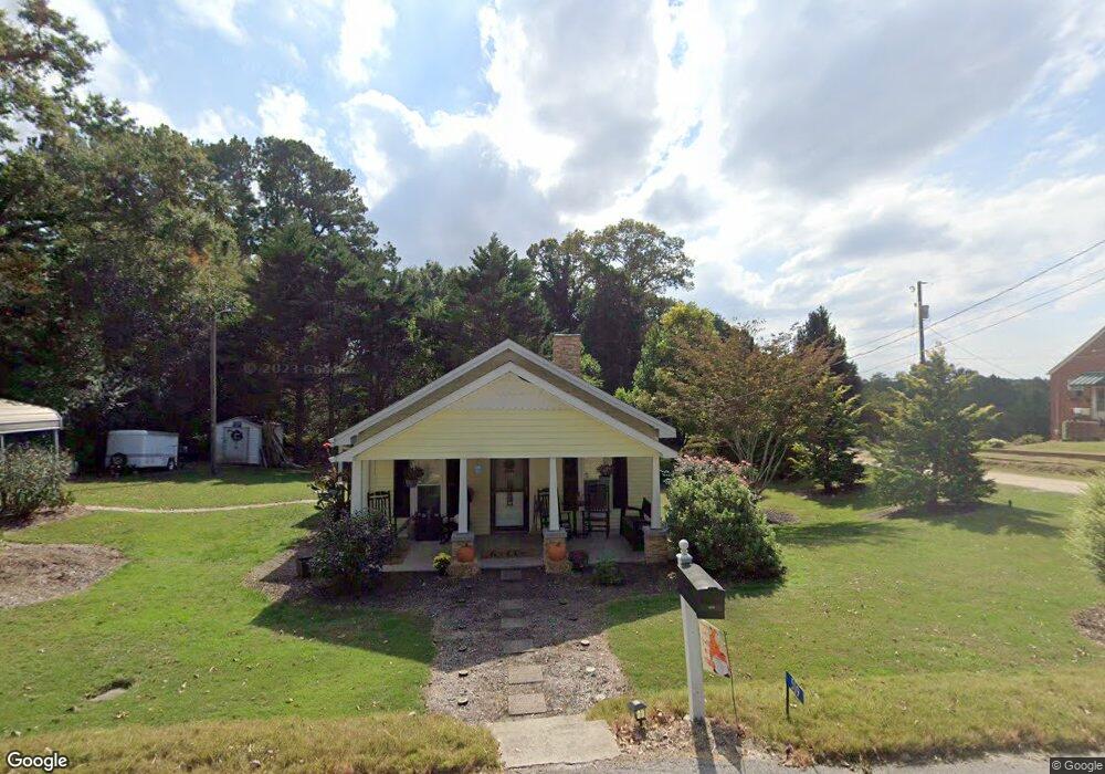
301 S Chestnut St Walhalla, SC 29691
Estimated Value: $101,000 - $161,417
1
Bed
1
Bath
784
Sq Ft
$168/Sq Ft
Est. Value
About This Home
This home is located at 301 S Chestnut St, Walhalla, SC 29691 and is currently estimated at $132,104, approximately $168 per square foot. 301 S Chestnut St is a home located in Oconee County with nearby schools including James M. Brown Elementary School, Walhalla Middle School, and Walhalla High School.
Ownership History
Date
Name
Owned For
Owner Type
Purchase Details
Closed on
May 24, 2010
Sold by
Bonilla Ana and Perez Demetrio
Bought by
Romero Atanacio and Camacho Nicolas
Current Estimated Value
Purchase Details
Closed on
Jun 18, 2008
Sold by
Fannie Mae
Bought by
Perez Demetrio and Bonilla Ana
Home Financials for this Owner
Home Financials are based on the most recent Mortgage that was taken out on this home.
Original Mortgage
$24,660
Interest Rate
7%
Purchase Details
Closed on
Feb 1, 2008
Sold by
Jones Stephanie M
Bought by
Federal National Mortgage Association
Create a Home Valuation Report for This Property
The Home Valuation Report is an in-depth analysis detailing your home's value as well as a comparison with similar homes in the area
Home Values in the Area
Average Home Value in this Area
Purchase History
| Date | Buyer | Sale Price | Title Company |
|---|---|---|---|
| Romero Atanacio | $50,000 | -- | |
| Perez Demetrio | -- | -- | |
| Federal National Mortgage Association | $2,500 | None Available |
Source: Public Records
Mortgage History
| Date | Status | Borrower | Loan Amount |
|---|---|---|---|
| Previous Owner | Perez Demetrio | $24,660 |
Source: Public Records
Tax History Compared to Growth
Tax History
| Year | Tax Paid | Tax Assessment Tax Assessment Total Assessment is a certain percentage of the fair market value that is determined by local assessors to be the total taxable value of land and additions on the property. | Land | Improvement |
|---|---|---|---|---|
| 2025 | $467 | $2,420 | $566 | $1,854 |
| 2024 | $462 | $2,420 | $566 | $1,854 |
| 2023 | $454 | $2,420 | $566 | $1,854 |
| 2022 | $454 | $2,420 | $566 | $1,854 |
| 2021 | $256 | $2,357 | $566 | $1,791 |
| 2020 | $256 | $2,357 | $566 | $1,791 |
| 2019 | $256 | $0 | $0 | $0 |
| 2018 | $517 | $0 | $0 | $0 |
| 2017 | $467 | $0 | $0 | $0 |
| 2016 | $467 | $0 | $0 | $0 |
| 2015 | -- | $0 | $0 | $0 |
| 2014 | -- | $2,514 | $470 | $2,044 |
| 2013 | -- | $0 | $0 | $0 |
Source: Public Records
Map
Nearby Homes
- 606 W South Broad St
- 804 W North Broad St
- 301 Shadybrook Dr Unit B
- 00 S Spring St
- 2423 Westminster Hwy
- 711 Campbell Town Rd
- 320 Jaynes St
- 00 N Church St
- 412 N Spring St
- 00 Keowee St
- 208 Branch St
- 00 Branch St
- 223 N Dogwood Dr
- 316 Briar Creek Rd
- 606 N Poplar St
- 117 Edney Dr
- 209 Moore Ave
- 203 Tulip Dr
- 101 Hazelwood Way
- 204 Friendship Dr
- 509 Tyre B Mauldin St
- 601 Tyre B Mauldin St
- 505 Tyre B Mauldin St
- 209 S Chestnut St
- 300 S Pine St
- 504 Tyre B Mauldin St
- 125 Mary Glenn Ln
- 502 Tyre B Mauldin St
- 306 S Pine St
- 500 Tyre B Mauldin St
- 204 S Pine St
- 303 S Pine St
- 312 S Pine St
- 301 S Pine St
- 305 S Poplar St
- 102 S Poplar St
- 305 S Pine St
- 307 S Pine St
- 103 Westview Dr
- 701 Tyre B Mauldin St