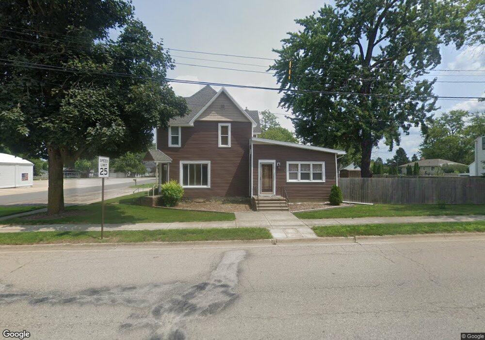
301 S Main St Fowler, MI 48835
Estimated Value: $221,648 - $267,000
6
Beds
3
Baths
2,933
Sq Ft
$86/Sq Ft
Est. Value
About This Home
This home is located at 301 S Main St, Fowler, MI 48835 and is currently estimated at $251,662, approximately $85 per square foot. 301 S Main St is a home located in Clinton County with nearby schools including Waldron Elementary/Middle School, Fowler High School, and Most Holy Trinity School.
Ownership History
Date
Name
Owned For
Owner Type
Purchase Details
Closed on
Oct 12, 2007
Sold by
Feldpausch Curtis C and Feldpausch Evangeline
Bought by
Smith Brad
Current Estimated Value
Home Financials for this Owner
Home Financials are based on the most recent Mortgage that was taken out on this home.
Original Mortgage
$94,254
Outstanding Balance
$59,733
Interest Rate
6.5%
Mortgage Type
FHA
Estimated Equity
$191,929
Create a Home Valuation Report for This Property
The Home Valuation Report is an in-depth analysis detailing your home's value as well as a comparison with similar homes in the area
Purchase History
| Date | Buyer | Sale Price | Title Company |
|---|---|---|---|
| Smith Brad | $95,000 | First American Title Company |
Source: Public Records
Mortgage History
| Date | Status | Borrower | Loan Amount |
|---|---|---|---|
| Open | Smith Brad | $94,254 |
Source: Public Records
Tax History
| Year | Tax Paid | Tax Assessment Tax Assessment Total Assessment is a certain percentage of the fair market value that is determined by local assessors to be the total taxable value of land and additions on the property. | Land | Improvement |
|---|---|---|---|---|
| 2025 | $1,650 | $98,400 | $29,300 | $69,100 |
| 2024 | $12 | $94,000 | $23,700 | $70,300 |
| 2023 | $1,151 | $84,400 | $0 | $0 |
| 2022 | $1,940 | $76,100 | $19,300 | $56,800 |
| 2021 | $1,892 | $71,600 | $18,600 | $53,000 |
| 2020 | $1,828 | $64,800 | $14,200 | $50,600 |
| 2019 | $1,539 | $60,700 | $12,100 | $48,600 |
| 2018 | $1,059 | $50,800 | $11,600 | $39,200 |
| 2017 | -- | $49,000 | $12,300 | $36,700 |
| 2016 | -- | $48,500 | $12,300 | $36,200 |
| 2015 | -- | $49,200 | $0 | $0 |
| 2011 | -- | $53,200 | $0 | $0 |
Source: Public Records
Map
Nearby Homes
- V/L W M21
- 11138 W 2nd St
- 11040 W Ionia St
- Lot 8 N Wright Rd
- 982 Norway Dr
- 154 S Yates St
- 0 Yates St
- 0 S Grange Rd
- 9515 W Moss Rd
- 7900 Church Rd
- 5550 Paxton Rd
- 10400 E Pewamo Rd Unit 19
- 0 W Colony Unit 286993
- 0 W Colony Unit 292916
- 7240 Empire Rd
- 8150 Idared Rd
- 8095 Mcintosh Rd
- 209 W Adelaide St
- 129 E Main St
- 220 N Maple Ave