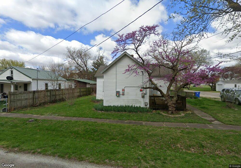
301 S Main St Middletown, IL 62666
Estimated Value: $48,266 - $107,000
--
Bed
--
Bath
944
Sq Ft
$83/Sq Ft
Est. Value
About This Home
This home is located at 301 S Main St, Middletown, IL 62666 and is currently estimated at $78,567, approximately $83 per square foot. 301 S Main St is a home located in Logan County with nearby schools including New Holland-Middletown Elementary School and Lincoln Community High School.
Ownership History
Date
Name
Owned For
Owner Type
Purchase Details
Closed on
Dec 15, 2017
Sold by
Thornton Steve R and Thornton Donna L
Bought by
Thornton Steve R
Current Estimated Value
Purchase Details
Closed on
Apr 17, 1995
Sold by
Thornton Steve and Thornton Donna
Bought by
Thornton Steve R and Thornton Donna L
Create a Home Valuation Report for This Property
The Home Valuation Report is an in-depth analysis detailing your home's value as well as a comparison with similar homes in the area
Home Values in the Area
Average Home Value in this Area
Purchase History
| Date | Buyer | Sale Price | Title Company |
|---|---|---|---|
| Thornton Steve R | -- | -- | |
| Thornton Steve R | $10,600 | -- |
Source: Public Records
Tax History Compared to Growth
Tax History
| Year | Tax Paid | Tax Assessment Tax Assessment Total Assessment is a certain percentage of the fair market value that is determined by local assessors to be the total taxable value of land and additions on the property. | Land | Improvement |
|---|---|---|---|---|
| 2024 | $150 | $9,810 | $2,200 | $7,610 |
| 2023 | $181 | $9,040 | $2,030 | $7,010 |
| 2022 | $37 | $8,430 | $1,890 | $6,540 |
| 2021 | $9 | $8,110 | $1,820 | $6,290 |
| 2020 | $9 | $7,990 | $1,790 | $6,200 |
| 2019 | $176 | $7,870 | $1,760 | $6,110 |
| 2018 | $9 | $7,870 | $1,760 | $6,110 |
| 2017 | $104 | $9,220 | $2,060 | $7,160 |
| 2016 | $104 | $9,230 | $2,060 | $7,170 |
| 2015 | $10 | $8,220 | $1,870 | $6,350 |
| 2014 | $10 | $8,220 | $1,870 | $6,350 |
| 2013 | $10 | $7,750 | $1,760 | $5,990 |
| 2012 | $10 | $7,720 | $1,750 | $5,970 |
Source: Public Records
Map
Nearby Homes
- 200 N Anson St
- 304 N Grove St
- 201 W Delavan St
- 400 N Logan St
- 16969 Peoria St
- 13 Chicory Dr
- 14 Chicory Dr
- 11-12 Chicory Dr
- 0 Blue Stem Dr
- 304 Kennedy Rd
- 1598 700th Ave
- 3 Governor's Dr
- 0 Prairie Pointe Dr Unit RMACA1027909
- 0 Prairie Pointe Dr Unit RMACA1028503
- 1668 825th Ave
- 421 N Rutledge St
- 519 W Chestnut St
- 521 N West Ave
- 223 Lester St
- 227 Lester St