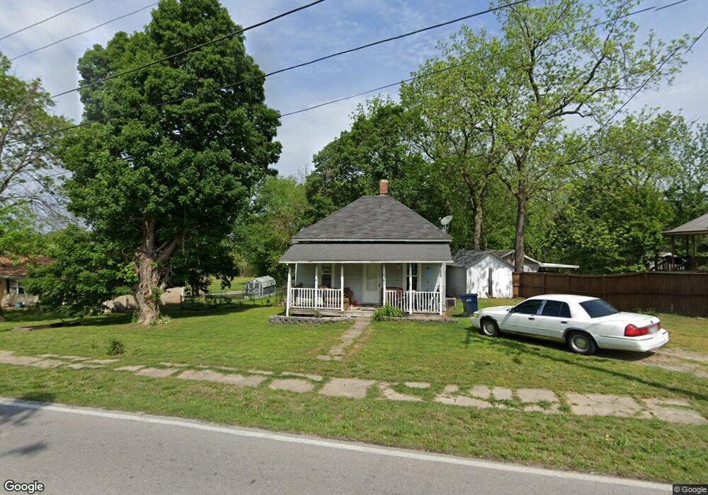
301 S State Highway F Ash Grove, MO 65604
Estimated Value: $109,974 - $166,000
2
Beds
1
Bath
960
Sq Ft
$136/Sq Ft
Est. Value
About This Home
This home is located at 301 S State Highway F, Ash Grove, MO 65604 and is currently estimated at $130,994, approximately $136 per square foot. 301 S State Highway F is a home located in Greene County with nearby schools including Bois D'Arc Elementary School and Ash Grove High School.
Ownership History
Date
Name
Owned For
Owner Type
Purchase Details
Closed on
Dec 7, 2022
Sold by
Rose Sam V and Joyce Ann
Bought by
Rose Irrevocable Trust
Current Estimated Value
Purchase Details
Closed on
Mar 17, 2022
Sold by
Rose Sam V
Bought by
Rose Sam V and Bethurem Patricia Ann
Purchase Details
Closed on
Aug 25, 2014
Sold by
Card Geraldine and Card Norman L
Bought by
Card Evans Properties B Series Llc
Purchase Details
Closed on
Mar 3, 2010
Sold by
Secretary Of Hud
Bought by
Card Norman L and Card Geraldine
Home Financials for this Owner
Home Financials are based on the most recent Mortgage that was taken out on this home.
Original Mortgage
$19,000
Interest Rate
4.93%
Mortgage Type
Future Advance Clause Open End Mortgage
Purchase Details
Closed on
Aug 11, 2009
Sold by
Bac Home Loans Servicing Lp
Bought by
Secretary Of Hud
Purchase Details
Closed on
Apr 29, 2005
Sold by
Tharp Daniel B and Claire Tharp C
Bought by
Baker Matthew E and Baker Chala A
Create a Home Valuation Report for This Property
The Home Valuation Report is an in-depth analysis detailing your home's value as well as a comparison with similar homes in the area
Home Values in the Area
Average Home Value in this Area
Purchase History
| Date | Buyer | Sale Price | Title Company |
|---|---|---|---|
| Rose Irrevocable Trust | -- | -- | |
| Rose Sam V | -- | None Listed On Document | |
| Rose Sam V | -- | None Listed On Document | |
| Card Evans Properties B Series Llc | -- | -- | |
| Card Norman L | -- | None Available | |
| Secretary Of Hud | -- | None Available | |
| Baker Matthew E | -- | None Available |
Source: Public Records
Mortgage History
| Date | Status | Borrower | Loan Amount |
|---|---|---|---|
| Previous Owner | Card Norman L | $19,000 | |
| Closed | Baker Matthew E | $0 |
Source: Public Records
Tax History Compared to Growth
Tax History
| Year | Tax Paid | Tax Assessment Tax Assessment Total Assessment is a certain percentage of the fair market value that is determined by local assessors to be the total taxable value of land and additions on the property. | Land | Improvement |
|---|---|---|---|---|
| 2025 | $461 | $9,990 | $3,800 | $6,190 |
| 2024 | $461 | $7,960 | $2,090 | $5,870 |
| 2023 | $428 | $7,960 | $2,090 | $5,870 |
| 2022 | $449 | $7,750 | $2,090 | $5,660 |
| 2021 | $418 | $7,750 | $2,090 | $5,660 |
| 2020 | $409 | $7,490 | $2,090 | $5,400 |
| 2019 | $408 | $7,490 | $2,090 | $5,400 |
| 2018 | $396 | $7,160 | $2,090 | $5,070 |
| 2017 | $392 | $7,160 | $2,090 | $5,070 |
| 2016 | $390 | $7,160 | $2,090 | $5,070 |
| 2015 | $389 | $7,160 | $2,090 | $5,070 |
| 2014 | $380 | $7,160 | $2,090 | $5,070 |
Source: Public Records
Map
Nearby Homes
- 203 E Prairie Ln
- 300 S High Ave
- 502 W Mill St
- 103 N Maple Ln
- 711 W Woodbine Rd
- 606 E Prairie Ln
- 415 S Piper Ave
- 424 Coyote Pass
- 422 Coyote Pass
- 806 E Grant St
- 407 N Crestview Ave
- 206 E Cawlfield St
- 134 Moonlight Valley Dr
- 000 State Highway V
- Tracts 2 & 3 Farm Rd 35 & 39
- Tract Tbd W Farm Road 64
- 000 W Farm Road 64
- 6896 N Farm Road 1
- 12426 W Farm Road 60
- 7681 N Farm Road 43
- 303 S State Highway F
- 303 S Hwy F
- 211 S State Highway F
- 300 State Highway F
- 205 S State Highway F
- 201 S Calhoun Ave
- 5849 N State Highway F
- 201 S State Highway F
- 206 S Calhoun Ave
- 125 S Calhoun Ave
- 200 S Calhoun Ave
- 101 S Duncan Ave
- 107 E Murray St
- 122 S Calhoun Ave
- 120 S Calhoun Ave
- 108 S Duncan Ave
- 118 S Calhoun Ave
- 104 S Duncan Ave
- 102 S Duncan Ave
- 608 S Brookside Ave