Estimated Value: $231,000 - $428,000
6
Beds
3
Baths
2,379
Sq Ft
$139/Sq Ft
Est. Value
About This Home
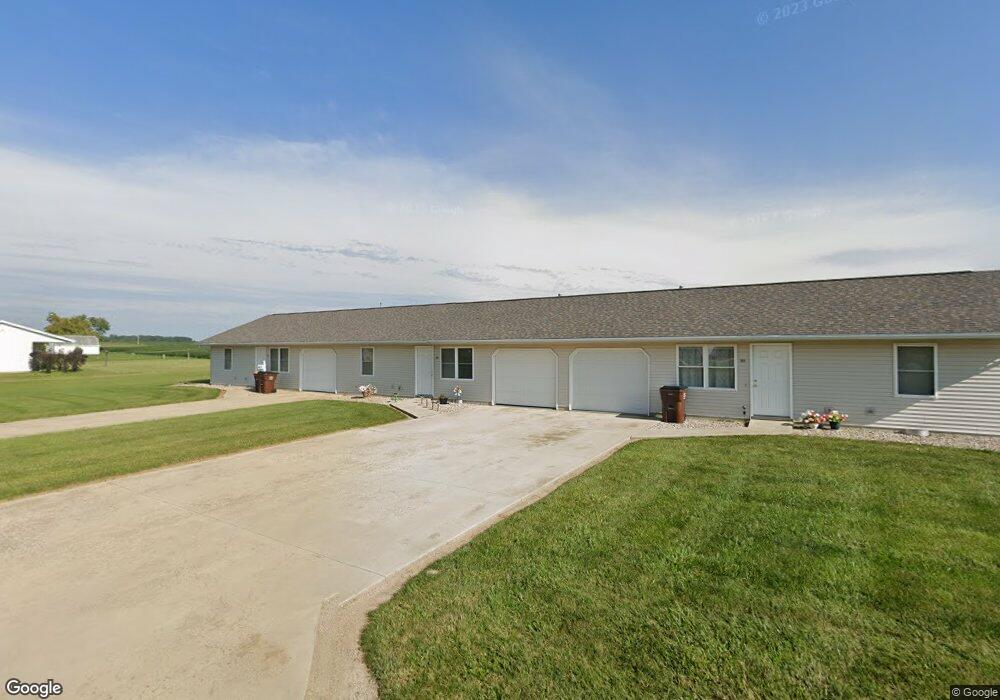
This home is located at 301 Sandy Ln, Edon, OH 43518 and is currently estimated at $329,500, approximately $138 per square foot. 301 Sandy Ln is a home located in Williams County with nearby schools including Edon Elementary School and Alvarado School.
Ownership History
Date
Name
Owned For
Owner Type
Purchase Details
Closed on
Dec 30, 2020
Sold by
Mc Nes Investments Inc
Bought by
Edon Properties Llc
Current Estimated Value
Home Financials for this Owner
Home Financials are based on the most recent Mortgage that was taken out on this home.
Original Mortgage
$89,375
Outstanding Balance
$46,841
Interest Rate
2.6%
Mortgage Type
Future Advance Clause Open End Mortgage
Estimated Equity
$282,659
Purchase Details
Closed on
May 6, 1996
Sold by
Thompson Sandra Kay
Bought by
Mc Nes Investments Inc
Purchase Details
Closed on
Jan 1, 1990
Bought by
Walz Trust
Create a Home Valuation Report for This Property
The Home Valuation Report is an in-depth analysis detailing your home's value as well as a comparison with similar homes in the area
Purchase History
| Date | Buyer | Sale Price | Title Company |
|---|---|---|---|
| Edon Properties Llc | $275,000 | None Available | |
| Mc Nes Investments Inc | $10,000 | -- | |
| Walz Trust | -- | -- |
Source: Public Records
Mortgage History
| Date | Status | Borrower | Loan Amount |
|---|---|---|---|
| Open | Edon Properties Llc | $89,375 |
Source: Public Records
Tax History
| Year | Tax Paid | Tax Assessment Tax Assessment Total Assessment is a certain percentage of the fair market value that is determined by local assessors to be the total taxable value of land and additions on the property. | Land | Improvement |
|---|---|---|---|---|
| 2025 | $2,705 | $71,760 | $3,400 | $68,360 |
| 2024 | $2,705 | $71,760 | $3,400 | $68,360 |
| 2023 | $2,724 | $53,770 | $3,120 | $50,650 |
| 2022 | $2,266 | $53,770 | $3,120 | $50,650 |
| 2021 | $2,267 | $53,770 | $3,120 | $50,650 |
| 2020 | $2,149 | $48,870 | $2,840 | $46,030 |
| 2019 | $2,122 | $48,870 | $2,840 | $46,030 |
| 2018 | $2,148 | $48,870 | $2,840 | $46,030 |
| 2017 | $1,857 | $43,270 | $2,840 | $40,430 |
| 2016 | $1,614 | $43,270 | $2,840 | $40,430 |
| 2015 | $1,694 | $43,270 | $2,840 | $40,430 |
| 2014 | $1,694 | $43,270 | $2,840 | $40,430 |
| 2013 | $1,716 | $43,270 | $2,840 | $40,430 |
Source: Public Records
Map
Nearby Homes
- 4302 County Road I
- 4746 County Road I
- 5196 County Road J
- 3487 S 800 E
- 13844 County Road 6
- 1827 Us Highway 20
- 2332 County Rd E
- 14985 County Road 4
- 7208 County Road N30
- 400 Stone St
- 5935 S State Road 1
- 00 County Road 150
- 0000 County Road C50 Tract 1-3
- 5600 S State Road 1
- 7634 County Road 9
- 440 Lane 120 Hamilton Lake
- 0 E Metz Rd
- 215 Lane 101a Unit 50
- 0 N Arthur Ct
- 4160 E Bellefontaine Rd
- 301 Sandy Ln
- 303 Sandy Ln
- 301 & 303 Sandy Ln
- 600 Mike Moore Dr
- 602 Mike Moore Dr
- 305 Sandy Ln
- 601 Mike Moore Dr
- 406 Deeanne St
- 604 Mike Moore Dr
- 603 Mike Moore Dr
- 207 Sandy Ln
- 405 Deeanne St
- 605 Mike Moore Dr
- 403 Deeanne St
- 201 Bunny Ln
- 402 Deeanne St
- 402 Deanne
- 401 Deanne Dr
- 205 Sandy Ln
- 402 Marilyn Dr
Your Personal Tour Guide
Ask me questions while you tour the home.