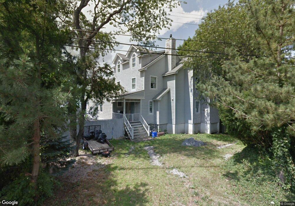
301 Seaside Dr Jamestown, RI 02835
Jamestown Shores NeighborhoodEstimated Value: $1,369,000 - $2,380,000
3
Beds
3
Baths
3,216
Sq Ft
$619/Sq Ft
Est. Value
About This Home
This home is located at 301 Seaside Dr, Jamestown, RI 02835 and is currently estimated at $1,989,734, approximately $618 per square foot. 301 Seaside Dr is a home located in Newport County with nearby schools including Melrose Avenue School and Lawn Avenue School.
Create a Home Valuation Report for This Property
The Home Valuation Report is an in-depth analysis detailing your home's value as well as a comparison with similar homes in the area
Home Values in the Area
Average Home Value in this Area
Tax History Compared to Growth
Tax History
| Year | Tax Paid | Tax Assessment Tax Assessment Total Assessment is a certain percentage of the fair market value that is determined by local assessors to be the total taxable value of land and additions on the property. | Land | Improvement |
|---|---|---|---|---|
| 2025 | $10,262 | $1,819,500 | $1,124,100 | $695,400 |
| 2024 | $9,828 | $1,370,700 | $809,000 | $561,700 |
| 2023 | $9,664 | $1,384,500 | $809,000 | $575,500 |
| 2022 | $9,401 | $1,384,500 | $809,000 | $575,500 |
| 2021 | $9,980 | $1,205,300 | $709,000 | $496,300 |
| 2020 | $9,727 | $1,205,300 | $709,000 | $496,300 |
| 2019 | $9,703 | $1,205,300 | $709,000 | $496,300 |
| 2018 | $9,085 | $1,026,600 | $627,200 | $399,400 |
| 2017 | $8,890 | $1,026,600 | $627,200 | $399,400 |
| 2016 | $8,808 | $1,026,600 | $627,200 | $399,400 |
| 2015 | $9,203 | $1,048,200 | $733,600 | $314,600 |
| 2014 | $9,172 | $1,048,200 | $733,600 | $314,600 |
Source: Public Records
Map
Nearby Homes
- 31 Stanchion St
- 58 Dolphin St
- 174 Seaside Dr
- 94 Spindrift St
- 121 Seaside Dr
- 398 Sampan Ave
- 625 N Main Rd
- 21 Helm St
- 280 W Reach Dr
- 27 Marcello Dr
- 10 Columbia Ln
- 10 Coulter St
- 18 Collins Terrace
- 50 Prospect Ave
- 10 Highland Rd
- 12 Easterly Way
- 0 Circuit Ave
- 41 Pierce Rd
- 16 Pennsylvania Ave
- 48 Ocean Ave
- 305 Seaside Dr
- 311 Seaside Dr
- 86 Spanker St
- 290 Seaside Dr
- 290 Seaside Dr Unit JAMESTOW
- 302 Seaside Dr
- 37 Starboard Ave
- 80 Spanker St
- 143 Frigate St
- 280 Seaside Dr
- 140 Frigate St
- 281 Seaside Dr
- 38 Starboard Ave
- 33 Starboard Ave
- 139 Frigate St
- 318 Seaside Dr
- 31 Starboard Ave
- 32 Starboard Ave
- 324 Seaside Dr
- 70 Spanker St