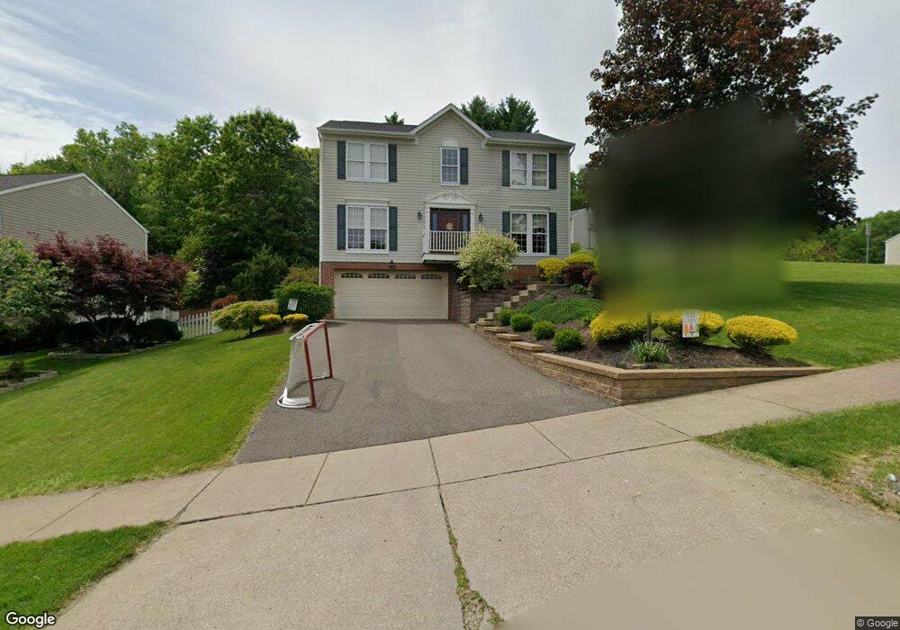
301 Shady Glen Dr Coraopolis, PA 15108
Estimated Value: $385,000 - $443,000
3
Beds
3
Baths
1,872
Sq Ft
$215/Sq Ft
Est. Value
About This Home
This home is located at 301 Shady Glen Dr, Coraopolis, PA 15108 and is currently estimated at $403,273, approximately $215 per square foot. 301 Shady Glen Dr is a home located in Allegheny County with nearby schools including Moon Area High School.
Ownership History
Date
Name
Owned For
Owner Type
Purchase Details
Closed on
Dec 16, 2011
Sold by
Koger Frank C
Bought by
Mosesso Andrew A
Current Estimated Value
Home Financials for this Owner
Home Financials are based on the most recent Mortgage that was taken out on this home.
Original Mortgage
$219,055
Outstanding Balance
$152,625
Interest Rate
4.4%
Mortgage Type
FHA
Estimated Equity
$250,648
Create a Home Valuation Report for This Property
The Home Valuation Report is an in-depth analysis detailing your home's value as well as a comparison with similar homes in the area
Home Values in the Area
Average Home Value in this Area
Purchase History
| Date | Buyer | Sale Price | Title Company |
|---|---|---|---|
| Mosesso Andrew A | $227,000 | -- |
Source: Public Records
Mortgage History
| Date | Status | Borrower | Loan Amount |
|---|---|---|---|
| Open | Mosesso Andrew A | $219,055 |
Source: Public Records
Tax History Compared to Growth
Tax History
| Year | Tax Paid | Tax Assessment Tax Assessment Total Assessment is a certain percentage of the fair market value that is determined by local assessors to be the total taxable value of land and additions on the property. | Land | Improvement |
|---|---|---|---|---|
| 2025 | $5,417 | $173,300 | $45,200 | $128,100 |
| 2024 | $5,417 | $173,300 | $45,200 | $128,100 |
| 2023 | $5,224 | $173,300 | $45,200 | $128,100 |
| 2022 | $5,224 | $173,300 | $45,200 | $128,100 |
| 2021 | $5,223 | $173,300 | $45,200 | $128,100 |
| 2020 | $5,093 | $173,300 | $45,200 | $128,100 |
| 2019 | $4,954 | $173,300 | $45,200 | $128,100 |
| 2018 | $820 | $173,300 | $45,200 | $128,100 |
| 2017 | $4,684 | $173,300 | $45,200 | $128,100 |
| 2016 | $820 | $173,300 | $45,200 | $128,100 |
| 2015 | $820 | $173,300 | $45,200 | $128,100 |
| 2014 | $4,561 | $173,300 | $45,200 | $128,100 |
Source: Public Records
Map
Nearby Homes
- 105 Springwater Ct
- 001 Spring Run Road Extension
- 116 Mesa Dr
- 0 Spring Run Road Extension Unit 1684623
- 121 Shelbourne Dr
- 168 Victoria Dr
- 108 Economy Grade Rd
- Somerset Plan at Victoria Ridge
- Rockford Plan at Victoria Ridge
- Birmingham Plan at Victoria Ridge
- Eisenhower Plan at Victoria Ridge
- Carlisle Plan at Victoria Ridge
- Truman Plan at Victoria Ridge
- Chattanooga Plan at Victoria Ridge
- Cleveland Plan at Victoria Ridge
- 120 Scottsdale Dr
- 121 Victoria Dr
- 110 Victoria Dr
- Bristol Plan at Victoria Ridge
- Galen Plan at Victoria Ridge
- 303 Shady Glen Dr
- 138 Elmhurst Dr
- 300 Shady Glen Dr
- 281 Shady Glen Dr
- 305 Shady Glen Dr
- 136 Elmhurst Dr
- 298 Shady Glen Dr
- 296 Shady Glen Dr
- 302 Shady Glen Dr
- 401 Poplar Ct
- 294 Shady Glen Dr
- 307 Shady Glen Dr
- 139 Elmhurst Dr
- 283 Shady Glen Dr
- 134 Elmhurst Dr
- 292 Shady Glen Dr
- 137 Elmhurst Dr
- 285 Shady Glen Dr
- 309 Shady Glen Dr
- 403 Poplar Ct