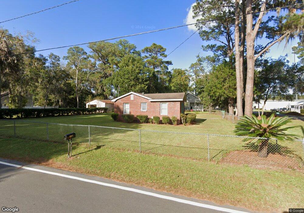
301 Sixth St E Darien, GA 31305
Estimated Value: $216,000 - $284,000
2
Beds
1
Bath
900
Sq Ft
$266/Sq Ft
Est. Value
About This Home
This home is located at 301 Sixth St E, Darien, GA 31305 and is currently estimated at $239,801, approximately $266 per square foot. 301 Sixth St E is a home with nearby schools including Todd Grant Elementary School, McIntosh County Middle School, and McIntosh County Academy.
Ownership History
Date
Name
Owned For
Owner Type
Purchase Details
Closed on
Oct 10, 2023
Sold by
Reeves John W
Bought by
Reeves Debra E and Reeves John W
Current Estimated Value
Purchase Details
Closed on
Jun 2, 2023
Sold by
Reeves John W
Bought by
Reeves John W
Purchase Details
Closed on
Jun 28, 2004
Sold by
Wells Fargo Bank Minnessota
Bought by
Reeves John W
Purchase Details
Closed on
Mar 22, 2004
Sold by
Catlin Pica
Bought by
Wells Fargo Bank Minnessota
Purchase Details
Closed on
May 24, 2000
Sold by
Holzman Stephen
Bought by
Catlin Pica
Purchase Details
Closed on
Oct 8, 1997
Sold by
Mcghee Carol A
Bought by
Holzman Stephen
Purchase Details
Closed on
Jul 26, 1996
Sold by
Fisher Scott and Fisher Denis
Bought by
Mcghee Carol A
Purchase Details
Closed on
Jun 6, 1990
Bought by
Fisher Scott and Fisher Denis
Create a Home Valuation Report for This Property
The Home Valuation Report is an in-depth analysis detailing your home's value as well as a comparison with similar homes in the area
Purchase History
| Date | Buyer | Sale Price | Title Company |
|---|---|---|---|
| Reeves Debra E | -- | -- | |
| Reeves John W | -- | -- | |
| Reeves John W | $45,000 | -- | |
| Wells Fargo Bank Minnessota | -- | -- | |
| Catlin Pica | $55,000 | -- | |
| Holzman Stephen | $50,000 | -- | |
| Mcghee Carol A | $42,000 | -- | |
| Fisher Scott | $37,200 | -- |
Source: Public Records
Tax History
| Year | Tax Paid | Tax Assessment Tax Assessment Total Assessment is a certain percentage of the fair market value that is determined by local assessors to be the total taxable value of land and additions on the property. | Land | Improvement |
|---|---|---|---|---|
| 2024 | $2,741 | $73,422 | $36,320 | $37,102 |
| 2023 | $2,398 | $63,502 | $27,240 | $36,262 |
| 2022 | $1,384 | $44,222 | $13,600 | $30,622 |
| 2021 | $1,171 | $36,582 | $13,600 | $22,982 |
| 2020 | $1,104 | $33,782 | $11,360 | $22,422 |
| 2019 | $1,108 | $35,942 | $13,600 | $22,342 |
| 2018 | $1,092 | $35,942 | $13,600 | $22,342 |
| 2017 | $1,039 | $34,742 | $13,600 | $21,142 |
| 2016 | $1,076 | $34,742 | $13,600 | $21,142 |
| 2015 | $900 | $28,981 | $9,000 | $19,982 |
| 2014 | $901 | $28,982 | $9,000 | $19,982 |
Source: Public Records
Map
Nearby Homes
- 905 SE Wayne Street None Unit 40-B
- 711 Adams St
- 709 Adams St
- 1103 E Broad St
- 601 Fort King George Dr
- 508 Fort King George Dr
- 1401 Wayne St
- 452 Adams St
- 410 Munro St
- 902 Martin Luther King jr Blvd
- 227 Fort King George Dr
- 227 Fort King George Dr Unit H
- 211 Trumbull St
- 1001 Poppell Dr
- Tract B 38 Acres
- 0 Georgia 99 Unit 1648162
- 0 Georgia 99 Unit 1647831
- Lot 4 Fort King George
- Lot 3 Fort King George
- 105 Broad Unit C St
Your Personal Tour Guide
Ask me questions while you tour the home.