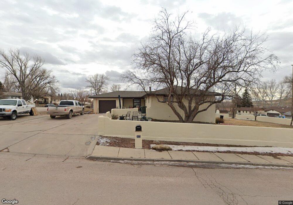
301 W 10th St Gillette, WY 82716
Estimated Value: $221,000 - $273,504
3
Beds
2
Baths
1,777
Sq Ft
$146/Sq Ft
Est. Value
About This Home
This home is located at 301 W 10th St, Gillette, WY 82716 and is currently estimated at $259,376, approximately $145 per square foot. 301 W 10th St is a home located in Campbell County with nearby schools including Westwood High School, Stocktrail Elementary School, and Prairie Wind Elementary School.
Ownership History
Date
Name
Owned For
Owner Type
Purchase Details
Closed on
May 31, 2019
Sold by
Rosenbaum David F and Rosenbaum Wanda J
Bought by
Gunnare Kip and Gunnare Tina
Current Estimated Value
Home Financials for this Owner
Home Financials are based on the most recent Mortgage that was taken out on this home.
Original Mortgage
$115,862
Outstanding Balance
$100,637
Interest Rate
3.62%
Mortgage Type
FHA
Estimated Equity
$158,739
Create a Home Valuation Report for This Property
The Home Valuation Report is an in-depth analysis detailing your home's value as well as a comparison with similar homes in the area
Home Values in the Area
Average Home Value in this Area
Purchase History
| Date | Buyer | Sale Price | Title Company |
|---|---|---|---|
| Gunnare Kip | -- | None Available |
Source: Public Records
Mortgage History
| Date | Status | Borrower | Loan Amount |
|---|---|---|---|
| Open | Gunnare Kip | $115,862 |
Source: Public Records
Tax History Compared to Growth
Tax History
| Year | Tax Paid | Tax Assessment Tax Assessment Total Assessment is a certain percentage of the fair market value that is determined by local assessors to be the total taxable value of land and additions on the property. | Land | Improvement |
|---|---|---|---|---|
| 2025 | $755 | $10,662 | $3,060 | $7,602 |
| 2024 | $961 | $13,670 | $3,924 | $9,746 |
| 2023 | $935 | $13,295 | $3,924 | $9,371 |
| 2022 | $774 | $10,972 | $3,449 | $7,523 |
| 2021 | $726 | $10,637 | $3,449 | $7,188 |
| 2020 | $714 | $10,494 | $3,449 | $7,045 |
| 2019 | $714 | $10,514 | $3,449 | $7,065 |
| 2018 | $1,256 | $18,581 | $3,449 | $15,132 |
| 2017 | $1,265 | $18,757 | $3,292 | $15,465 |
| 2016 | $1,355 | $20,060 | $3,292 | $16,768 |
| 2015 | -- | $18,538 | $3,292 | $15,246 |
| 2014 | -- | $18,387 | $3,292 | $15,095 |
Source: Public Records
Map
Nearby Homes
- 911 S Warren Ave
- 808 S Gillette Ave
- 100 W Hogeye Dr
- 706 S Gillette Ave
- 713 W 9th St
- 0000 Tract A6 Broad Axe Rd
- 204 W Juniper Ln
- 309 Rockpile Blvd
- 308 S Warren Ave
- 1801 S Gillette Ave
- 506 S Osborne Ave
- 409 S Emerson Ave
- 700 S Brooks Ave
- 304 S Emerson Ave
- 404 Laurel Ct
- 829 & 849 Burma Ave S
- 609 S Miller Ave
- 300 E Tonk St
- 480 Boxelder Rd
- 300 E Laurel St
- 1004 Dalbey Ave
- 1006 Dalbey Ave
- 309 W 10th St
- 1003 Richards Ave
- 910 Dalbey Ave
- 908 Dalbey Ave
- 1008 Dalbey Ave
- 1007 Richards Ave
- 310 W 10th St
- 209 W 10th St
- 1003 Dalbey Ave
- 906 Dalbey Ave
- 1009 S Richards Ave
- 1010 Dalbey Ave
- 1005 Dalbey Ave
- 1009 Richards Ave
- 909 Richards Ave
- 1007 Dalbey Ave
- 210 W 10th St
- 1009 Dalbey Ave