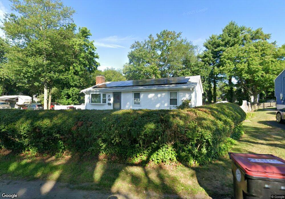
301 W Chestnut St Brockton, MA 02301
Clifton Heights NeighborhoodEstimated Value: $415,000 - $475,000
3
Beds
1
Bath
950
Sq Ft
$465/Sq Ft
Est. Value
About This Home
This home is located at 301 W Chestnut St, Brockton, MA 02301 and is currently estimated at $441,442, approximately $464 per square foot. 301 W Chestnut St is a home located in Plymouth County with nearby schools including John F. Kennedy Elementary School, Davis K-8 School, and South Middle School.
Ownership History
Date
Name
Owned For
Owner Type
Purchase Details
Closed on
Jan 28, 2021
Sold by
Ellcock Kim R
Bought by
Woodson-Ellcock Kim R
Current Estimated Value
Home Financials for this Owner
Home Financials are based on the most recent Mortgage that was taken out on this home.
Original Mortgage
$196,000
Outstanding Balance
$141,976
Interest Rate
2.6%
Mortgage Type
New Conventional
Estimated Equity
$299,466
Purchase Details
Closed on
May 14, 1992
Sold by
Piantoni Richard E and Piantoni Anna M
Bought by
Ellcock Kim R
Home Financials for this Owner
Home Financials are based on the most recent Mortgage that was taken out on this home.
Original Mortgage
$87,500
Interest Rate
8.89%
Mortgage Type
Purchase Money Mortgage
Create a Home Valuation Report for This Property
The Home Valuation Report is an in-depth analysis detailing your home's value as well as a comparison with similar homes in the area
Home Values in the Area
Average Home Value in this Area
Purchase History
| Date | Buyer | Sale Price | Title Company |
|---|---|---|---|
| Woodson-Ellcock Kim R | -- | None Available | |
| Ellcock Kim R | $89,000 | -- | |
| Ellcock Kim R | $89,000 | -- |
Source: Public Records
Mortgage History
| Date | Status | Borrower | Loan Amount |
|---|---|---|---|
| Open | Woodson-Ellcock Kim R | $196,000 | |
| Previous Owner | Ellcock Kim R | $87,500 |
Source: Public Records
Tax History Compared to Growth
Tax History
| Year | Tax Paid | Tax Assessment Tax Assessment Total Assessment is a certain percentage of the fair market value that is determined by local assessors to be the total taxable value of land and additions on the property. | Land | Improvement |
|---|---|---|---|---|
| 2025 | $4,370 | $360,900 | $140,500 | $220,400 |
| 2024 | $4,369 | $363,500 | $140,500 | $223,000 |
| 2023 | $4,195 | $323,200 | $106,200 | $217,000 |
| 2022 | $4,171 | $298,600 | $96,600 | $202,000 |
| 2021 | $3,906 | $269,400 | $80,600 | $188,800 |
| 2020 | $4,060 | $268,000 | $75,100 | $192,900 |
| 2019 | $3,942 | $253,700 | $73,100 | $180,600 |
| 2018 | $3,283 | $230,200 | $73,100 | $157,100 |
| 2017 | $3,080 | $191,300 | $73,100 | $118,200 |
| 2016 | $2,956 | $170,300 | $71,000 | $99,300 |
| 2015 | $2,713 | $149,500 | $71,000 | $78,500 |
| 2014 | $2,781 | $153,400 | $71,000 | $82,400 |
Source: Public Records
Map
Nearby Homes
- 295 W Chestnut St
- 288 Falconer Ave
- 289 W Chestnut St
- 291 Falconer Ave
- 311 W Chestnut St
- 269 Market St
- 287 Falconer Ave
- 284 Falconer Ave
- 283 W Chestnut St
- 310 Ettrick St
- 321 W Chestnut St
- 304 Ettrick St
- 312 W Chestnut St
- 284 Market St
- 292 Ettrick St
- 276 Falconer Ave
- 278 Market St
- 273 W Chestnut St
- 325 W Chestnut St
- 318 W Chestnut St