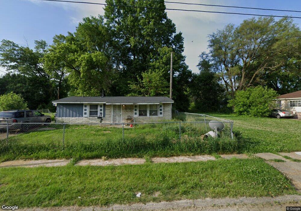
301 W Foss Ave Flint, MI 48505
MLK Circle NeighborhoodEstimated Value: $35,000 - $54,891
3
Beds
1
Bath
865
Sq Ft
$55/Sq Ft
Est. Value
About This Home
This home is located at 301 W Foss Ave, Flint, MI 48505 and is currently estimated at $47,223, approximately $54 per square foot. 301 W Foss Ave is a home located in Genesee County with nearby schools including Brownell STEM Academy, The New Standard Academy, and Eagle's Nest Academy.
Ownership History
Date
Name
Owned For
Owner Type
Purchase Details
Closed on
Mar 20, 2018
Sold by
Brown Kevin
Bought by
Mcfarland Steve
Current Estimated Value
Purchase Details
Closed on
Jun 3, 2016
Sold by
Turner Desiree Leslie Antonio
Bought by
Brown Kevin L
Purchase Details
Closed on
Mar 7, 2014
Sold by
Johnson Charlene
Bought by
Johnson Charlene and Mcclester James
Purchase Details
Closed on
Apr 14, 2006
Sold by
Mcchester Pamela Sandra
Bought by
Johnson Charlene
Purchase Details
Closed on
Apr 6, 2001
Sold by
Wesson Leon and Wesson Earlean
Bought by
Mcchester Pamela Sandra
Create a Home Valuation Report for This Property
The Home Valuation Report is an in-depth analysis detailing your home's value as well as a comparison with similar homes in the area
Home Values in the Area
Average Home Value in this Area
Purchase History
| Date | Buyer | Sale Price | Title Company |
|---|---|---|---|
| Mcfarland Steve | -- | Cislo Title Co | |
| Brown Kevin L | -- | Cislo Title Company | |
| Johnson Charlene | -- | None Available | |
| Johnson Charlene | $40,000 | First Me | |
| Mcchester Pamela Sandra | -- | -- |
Source: Public Records
Tax History Compared to Growth
Tax History
| Year | Tax Paid | Tax Assessment Tax Assessment Total Assessment is a certain percentage of the fair market value that is determined by local assessors to be the total taxable value of land and additions on the property. | Land | Improvement |
|---|---|---|---|---|
| 2025 | $512 | $9,600 | $0 | $0 |
| 2024 | $480 | $7,700 | $0 | $0 |
| 2023 | $481 | $5,900 | $0 | $0 |
| 2022 | $0 | $4,600 | $0 | $0 |
| 2021 | $489 | $4,600 | $0 | $0 |
| 2020 | $458 | $4,300 | $0 | $0 |
| 2019 | $478 | $4,800 | $0 | $0 |
| 2018 | $966 | $4,300 | $0 | $0 |
| 2017 | $968 | $0 | $0 | $0 |
| 2016 | $455 | $0 | $0 | $0 |
| 2015 | -- | $0 | $0 | $0 |
| 2014 | -- | $0 | $0 | $0 |
| 2012 | -- | $6,300 | $0 | $0 |
Source: Public Records
Map
Nearby Homes
- 405 W Lorado Ave
- 605 W Foss Ave
- 405 W Bundy Ave
- 613 W Foss Ave
- 614 W Holbrook Ave
- 610 W Austin Ave
- 618 W Austin Ave
- 525 W Bundy Ave
- 225 E Piper Ave
- 536 W Home Ave
- 6610 Cranwood Dr
- 6702 Cranwood Dr
- 345 E Austin Ave
- 421 E Lorado Ave
- 425 E Lorado Ave
- 422 E Foss Ave
- 5714 Suburban Ct
- 1499 W Juliah Ave
- 6914 Daryll Dr
- 1015 W Carpenter Rd
- 305 W Foss Ave
- 217 W Foss Ave
- 213 W Foss Ave
- 309 W Foss Ave
- 218 W Lorado Ave
- 209 W Foss Ave
- 313 W Foss Ave
- 302 W Foss Ave
- 314 W Lorado Ave
- 306 W Foss Ave
- 218 W Foss Ave
- 210 W Lorado Ave
- 317 W Foss Ave
- 214 W Foss Ave
- 310 W Foss Ave
- 206 W Lorado Ave
- 318 W Lorado Ave
- 210 W Foss Ave
- 201 W Foss Ave
- 321 W Foss Ave