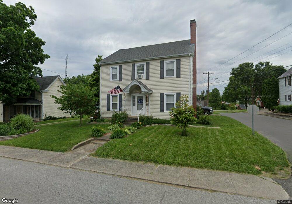
301 W High St Springfield, KY 40069
Estimated Value: $186,564 - $242,000
2
Beds
2
Baths
1,922
Sq Ft
$106/Sq Ft
Est. Value
About This Home
This home is located at 301 W High St, Springfield, KY 40069 and is currently estimated at $204,391, approximately $106 per square foot. 301 W High St is a home located in Washington County with nearby schools including Washington County Elementary School, North Washington Elementary School, and Washington County Middle School.
Ownership History
Date
Name
Owned For
Owner Type
Purchase Details
Closed on
Apr 29, 2019
Sold by
Reams Properties Llc
Bought by
Collins Lester B and Collins Amy D
Current Estimated Value
Home Financials for this Owner
Home Financials are based on the most recent Mortgage that was taken out on this home.
Original Mortgage
$127,153
Outstanding Balance
$112,014
Interest Rate
4.5%
Mortgage Type
FHA
Estimated Equity
$92,377
Purchase Details
Closed on
May 27, 2005
Sold by
Simms Maria G
Bought by
Reams Properties Llc
Create a Home Valuation Report for This Property
The Home Valuation Report is an in-depth analysis detailing your home's value as well as a comparison with similar homes in the area
Home Values in the Area
Average Home Value in this Area
Purchase History
| Date | Buyer | Sale Price | Title Company |
|---|---|---|---|
| Collins Lester B | $129,500 | None Available | |
| Reams Properties Llc | $89,000 | None Available |
Source: Public Records
Mortgage History
| Date | Status | Borrower | Loan Amount |
|---|---|---|---|
| Open | Collins Lester B | $127,153 |
Source: Public Records
Tax History
| Year | Tax Paid | Tax Assessment Tax Assessment Total Assessment is a certain percentage of the fair market value that is determined by local assessors to be the total taxable value of land and additions on the property. | Land | Improvement |
|---|---|---|---|---|
| 2025 | $1,337 | $140,000 | $0 | $0 |
| 2024 | $1,268 | $129,500 | $0 | $0 |
| 2023 | $1,289 | $129,500 | $0 | $0 |
| 2022 | $1,302 | $129,500 | $0 | $0 |
| 2021 | $1,322 | $129,500 | $0 | $0 |
| 2020 | $1,336 | $129,500 | $0 | $0 |
| 2019 | $924 | $89,000 | $0 | $0 |
| 2018 | $921 | $89,000 | $0 | $0 |
| 2017 | $912 | $89,000 | $89,000 | $0 |
| 2016 | $916 | $89,000 | $0 | $0 |
| 2014 | $874 | $89,000 | $89,000 | $0 |
| 2010 | -- | $89,000 | $89,000 | $0 |
Source: Public Records
Map
Nearby Homes
- 208 W Virginia Ave
- 220 W Main St
- 203 Commercial Ave
- 256 Eagle Ridge Way
- 402 N Walnut St
- 401 N Walnut St
- 204 E Virginia Ave
- 123 Lebanon Hill
- 516 N Walnut St
- 212 Covington Ave
- 308 Covington Ave
- 328 E Main St
- 153 Armory Hill
- 314 Covington Ave
- 300 E Grundy Ave
- 638 Lincoln Park Rd
- 119 Short St
- 203 Lebanon Hill
- 730 Lincoln Park Rd
- 314 E Grundy Ave
- 303 W High St
- 217 W High St
- 302 N Locust St
- 204 N Locust St
- 305 W High St
- 212 W High St
- 303 N Locust St
- 213 W High St
- 202 N Locust St
- 304 N Locust St
- 307 W High St
- 203 N Locust St
- 210 W High St
- 305 N Locust St
- 200 N Locust St
- 201 N Locust St
- 207 W High St Unit 205
- 311 W High St
- 308 W Virginia Ave
- 208 W High St
Your Personal Tour Guide
Ask me questions while you tour the home.