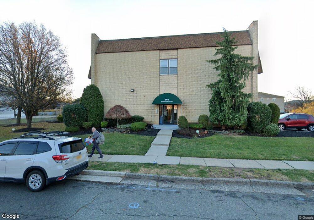
301 W Morris Ave Unit B5 Linden, NJ 07036
Estimated Value: $210,000 - $244,000
1
Bed
--
Bath
--
Sq Ft
741
Sq Ft Lot
About This Home
This home is located at 301 W Morris Ave Unit B5, Linden, NJ 07036 and is currently estimated at $221,971. 301 W Morris Ave Unit B5 is a home located in Union County with nearby schools including School No. 6, Joseph E. Soehl Middle School, and Linden High School.
Ownership History
Date
Name
Owned For
Owner Type
Purchase Details
Closed on
Apr 20, 2021
Sold by
Piskorz Irena and Purchla Pawel
Bought by
Purchla Pawel and Purchla Anna
Current Estimated Value
Purchase Details
Closed on
Nov 22, 2004
Sold by
Szajowski Josephine
Bought by
Piskorz Irena and Purchla Pawel
Home Financials for this Owner
Home Financials are based on the most recent Mortgage that was taken out on this home.
Original Mortgage
$108,800
Interest Rate
5.75%
Create a Home Valuation Report for This Property
The Home Valuation Report is an in-depth analysis detailing your home's value as well as a comparison with similar homes in the area
Home Values in the Area
Average Home Value in this Area
Purchase History
| Date | Buyer | Sale Price | Title Company |
|---|---|---|---|
| Purchla Pawel | -- | None Available | |
| Purchla Pawel | -- | None Listed On Document | |
| Piskorz Irena | $136,000 | -- |
Source: Public Records
Mortgage History
| Date | Status | Borrower | Loan Amount |
|---|---|---|---|
| Previous Owner | Piskorz Irena | $108,800 |
Source: Public Records
Tax History Compared to Growth
Tax History
| Year | Tax Paid | Tax Assessment Tax Assessment Total Assessment is a certain percentage of the fair market value that is determined by local assessors to be the total taxable value of land and additions on the property. | Land | Improvement |
|---|---|---|---|---|
| 2025 | $3,516 | $50,000 | $23,000 | $27,000 |
| 2024 | $3,439 | $50,000 | $23,000 | $27,000 |
| 2023 | $3,439 | $50,000 | $23,000 | $27,000 |
| 2022 | $3,457 | $50,000 | $23,000 | $27,000 |
| 2021 | $3,475 | $50,000 | $23,000 | $27,000 |
| 2020 | $3,456 | $50,000 | $23,000 | $27,000 |
| 2019 | $3,445 | $50,000 | $23,000 | $27,000 |
| 2018 | $3,444 | $50,000 | $23,000 | $27,000 |
| 2017 | $4,043 | $60,000 | $28,000 | $32,000 |
| 2016 | $3,916 | $60,000 | $28,000 | $32,000 |
| 2015 | $3,766 | $60,000 | $28,000 | $32,000 |
| 2014 | $3,693 | $60,000 | $28,000 | $32,000 |
Source: Public Records
Map
Nearby Homes
- 212 W Morris Ave
- 221 Jefferson Ave
- 210 W Elizabeth Ave
- 317 Mitchell Ave
- 28 W Elizabeth Ave Unit A3
- 10 N Wood Ave Unit 706
- 10 N Wood Ave Unit 213
- 10 N Wood Ave Unit 406
- 10 N Wood Ave Unit 700
- 10 N Wood Ave Unit 515
- 10 N Wood Ave Unit 314
- 10 N Wood Ave Unit 722
- 104 E Elizabeth Ave Unit 202
- 324 Dewitt St
- 350 Dewitt St
- 18 Hussa St
- 20 W 10th St
- 606 Knopf St
- 118 Union Ave Unit 2
- 1112 Winans Ave
- 301 W Morris Ave Unit B2
- 301 W Morris Ave Unit C5
- 301 W Morris Ave Unit C4
- 301 W Morris Ave Unit B6
- 301 W Morris Ave Unit B3
- 301 W Morris Ave Unit C1
- 301 W Morris Ave Unit A5
- 301 W Morris Ave Unit B4
- 301 W Morris Ave Unit C6
- 301 W Morris Ave Unit C2
- 301 W Morris Ave Unit B1
- 301 W Morris Ave Unit A6
- 301 W Morris Ave Unit A4
- 301 W Morris Ave Unit A3
- 301 W Morris Ave Unit A2
- 301 W Morris Ave Unit A1
- 301 W Morris Ave Unit 3
- 301 W Morris Ave
- 300 W Munsell Ave Cc3
- 300 W Munsell Ave Bb1 Unit B1