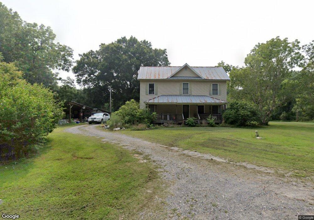
301 Whiteside Rd Clover, SC 29710
Estimated Value: $201,119 - $435,000
Studio
--
Bath
2,643
Sq Ft
$127/Sq Ft
Est. Value
About This Home
This home is located at 301 Whiteside Rd, Clover, SC 29710 and is currently estimated at $336,030, approximately $127 per square foot. 301 Whiteside Rd is a home with nearby schools including Bethany Elementary School, Clover Middle School, and Clover High School.
Ownership History
Date
Name
Owned For
Owner Type
Purchase Details
Closed on
May 24, 2021
Sold by
Denton Sarah Price
Bought by
Moses Martin and Moses Allison
Current Estimated Value
Home Financials for this Owner
Home Financials are based on the most recent Mortgage that was taken out on this home.
Original Mortgage
$86,150
Outstanding Balance
$50,450
Interest Rate
2.9%
Mortgage Type
Seller Take Back
Estimated Equity
$285,580
Purchase Details
Closed on
May 30, 2019
Sold by
Denton Sarah P
Bought by
Denton Sarah Price
Purchase Details
Closed on
Dec 20, 2011
Sold by
Mitchell Linda D
Bought by
Denton Aubrey Dale
Create a Home Valuation Report for This Property
The Home Valuation Report is an in-depth analysis detailing your home's value as well as a comparison with similar homes in the area
Home Values in the Area
Average Home Value in this Area
Purchase History
| Date | Buyer | Sale Price | Title Company |
|---|---|---|---|
| Moses Martin | $102,000 | None Listed On Document | |
| Denton Sarah Price | -- | None Available | |
| Denton Aubrey Dale | -- | -- |
Source: Public Records
Mortgage History
| Date | Status | Borrower | Loan Amount |
|---|---|---|---|
| Open | Moses Martin | $86,150 |
Source: Public Records
Tax History
| Year | Tax Paid | Tax Assessment Tax Assessment Total Assessment is a certain percentage of the fair market value that is determined by local assessors to be the total taxable value of land and additions on the property. | Land | Improvement |
|---|---|---|---|---|
| 2025 | $332 | $4,572 | $535 | $4,037 |
| 2024 | $264 | $3,980 | $311 | $3,669 |
| 2023 | $271 | $3,980 | $311 | $3,669 |
| 2022 | $435 | $3,980 | $311 | $3,669 |
| 2021 | -- | $4,021 | $352 | $3,669 |
| 2020 | $442 | $4,021 | $0 | $0 |
| 2019 | $406 | $3,351 | $0 | $0 |
| 2018 | $409 | $11,130 | $0 | $0 |
| 2017 | $2,659 | $11,130 | $0 | $0 |
| 2016 | $2,595 | $11,130 | $0 | $0 |
| 2014 | $1,682 | $11,130 | $8,170 | $2,960 |
| 2013 | $1,682 | $9,738 | $6,618 | $3,120 |
Source: Public Records
Map
Nearby Homes
- 290 S Grandview Rd
- 218 Muldoon Ln
- 00 State Road S-46-883
- 522 Whitworth Rd
- 335 S Fork Meadows Rd
- 953 Bollinger Pond Dr
- 108 Twisted Oaks Ln
- 101 Twisted Oaks Ln
- 5200 Morning Dove Ct
- 946 Laurelwood Dr
- 5944 Lewis Rd
- 5264 Battleground Rd
- 865 Highway 161 N
- Lot 2 Rhyne Rd
- 994 Rhyne Rd
- Lot 1 Rhyne Rd
- 515 Hwy 161 None N
- 1500 Crowders Creek Rd
- 2205 Pinnacle View Dr
- 615 Short Stroll Ct
- 289 Whiteside Rd
- 257 and 265 Whiteside Rd
- 257 Whiteside Rd
- 345 Whiteside Rd
- 345 Whitesides Rd
- 265 Whiteside Rd
- 481 Whiteside Rd
- 249 Whiteside Rd
- 339 Whiteside Rd
- 430 Whiteside Rd
- 3270 Henry's Knob Rd
- 3270 Henrys Knob Rd
- 3274 Henrys Knob Rd
- 0 Mallard Ln
- 3282 Henry's Knob Rd
- 495 Whiteside Rd
- 495 Whiteside Rd
- 3282 Henrys Knob Rd
- 158 N Grandview Rd
- 104 Whitesides Rd
Your Personal Tour Guide
Ask me questions while you tour the home.