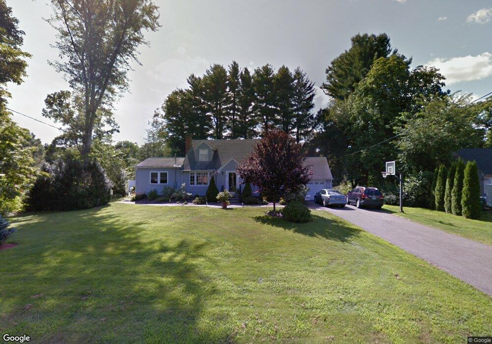
301 Wiese Rd Cheshire, CT 06410
Estimated Value: $451,764 - $503,000
3
Beds
2
Baths
1,637
Sq Ft
$297/Sq Ft
Est. Value
About This Home
This home is located at 301 Wiese Rd, Cheshire, CT 06410 and is currently estimated at $486,191, approximately $297 per square foot. 301 Wiese Rd is a home located in New Haven County with nearby schools including Darcey School, Highland School, and Dodd Middle School.
Ownership History
Date
Name
Owned For
Owner Type
Purchase Details
Closed on
Aug 1, 2011
Sold by
Winch Ann K
Bought by
Winch Ann K and Winch Michael T
Current Estimated Value
Home Financials for this Owner
Home Financials are based on the most recent Mortgage that was taken out on this home.
Original Mortgage
$10,000
Interest Rate
4.52%
Purchase Details
Closed on
Sep 19, 1994
Sold by
Horn Vera E Est
Bought by
Winch Michael T and Winch Ann K
Create a Home Valuation Report for This Property
The Home Valuation Report is an in-depth analysis detailing your home's value as well as a comparison with similar homes in the area
Home Values in the Area
Average Home Value in this Area
Purchase History
| Date | Buyer | Sale Price | Title Company |
|---|---|---|---|
| Winch Ann K | -- | -- | |
| Winch Ann K | -- | -- | |
| Winch Michael T | $150,000 | -- | |
| Winch Michael T | $150,000 | -- |
Source: Public Records
Mortgage History
| Date | Status | Borrower | Loan Amount |
|---|---|---|---|
| Closed | Winch Michael T | $10,000 | |
| Open | Winch Michael T | $205,000 |
Source: Public Records
Tax History Compared to Growth
Tax History
| Year | Tax Paid | Tax Assessment Tax Assessment Total Assessment is a certain percentage of the fair market value that is determined by local assessors to be the total taxable value of land and additions on the property. | Land | Improvement |
|---|---|---|---|---|
| 2025 | $6,801 | $228,690 | $87,850 | $140,840 |
| 2024 | $6,280 | $228,690 | $87,850 | $140,840 |
| 2023 | $6,377 | $181,730 | $87,880 | $93,850 |
| 2022 | $6,237 | $181,730 | $87,880 | $93,850 |
| 2021 | $6,128 | $181,730 | $87,880 | $93,850 |
| 2020 | $3,867 | $181,730 | $87,880 | $93,850 |
| 2019 | $6,037 | $181,730 | $87,880 | $93,850 |
| 2018 | $5,952 | $182,450 | $88,560 | $93,890 |
| 2017 | $7,683 | $182,450 | $88,560 | $93,890 |
| 2016 | $5,599 | $182,450 | $88,560 | $93,890 |
| 2015 | $5,599 | $182,450 | $88,560 | $93,890 |
| 2014 | $5,519 | $182,450 | $88,560 | $93,890 |
Source: Public Records
Map
Nearby Homes
- 17 Melrose Dr Unit Lot 3
- 21 Melrose Dr Unit Lot 2
- 462 Castle Glenn
- 3 Melrose Dr Unit Lot 9
- 324 S Meriden Rd
- 315 Greens Loop Unit 315
- 435 Maple Ave
- 689 S Meriden Rd
- 6 Melrose Dr Unit Lot 10
- 9 Melrose Dr Unit 6
- 8 Melrose Dr
- 23 Melrose Dr
- 2 Tunxis Place
- 167 Spring St
- 975 Wolf Hill Rd
- 130 Edwards Rd
- 445 Lincoln Dr
- 4 Brookfield Ct
- 112 Laurel Terrace
- 48 Willow St