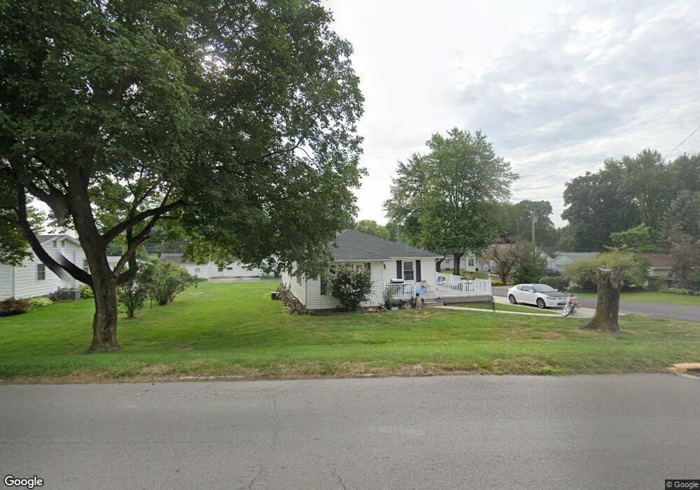
301 Zanesfield Rd West Liberty, OH 43357
Estimated Value: $173,262 - $228,000
3
Beds
1
Bath
1,256
Sq Ft
$161/Sq Ft
Est. Value
About This Home
This home is located at 301 Zanesfield Rd, West Liberty, OH 43357 and is currently estimated at $202,816, approximately $161 per square foot. 301 Zanesfield Rd is a home located in Logan County with nearby schools including West Liberty-Salem Elementary School, West Liberty-Salem Middle School, and West Liberty-Salem Middle/High School.
Ownership History
Date
Name
Owned For
Owner Type
Purchase Details
Closed on
Feb 1, 2017
Sold by
Thompson Dayla and Cook Bert L
Bought by
Cook Bert L
Current Estimated Value
Purchase Details
Closed on
Jan 24, 2017
Sold by
Cook Joset A
Bought by
Cook Bert L
Purchase Details
Closed on
Feb 14, 2008
Bought by
Cook Bert L
Purchase Details
Closed on
Dec 6, 2004
Bought by
Cook Bert L
Purchase Details
Closed on
Sep 14, 2004
Bought by
Mccrees Creek Chapel
Create a Home Valuation Report for This Property
The Home Valuation Report is an in-depth analysis detailing your home's value as well as a comparison with similar homes in the area
Home Values in the Area
Average Home Value in this Area
Purchase History
| Date | Buyer | Sale Price | Title Company |
|---|---|---|---|
| Cook Bert L | -- | None Available | |
| Cook Bert L | -- | None Available | |
| Cook Bert L | -- | -- | |
| Cook Bert L | $96,000 | -- | |
| Mccrees Creek Chapel | -- | -- |
Source: Public Records
Tax History Compared to Growth
Tax History
| Year | Tax Paid | Tax Assessment Tax Assessment Total Assessment is a certain percentage of the fair market value that is determined by local assessors to be the total taxable value of land and additions on the property. | Land | Improvement |
|---|---|---|---|---|
| 2024 | $1,732 | $44,350 | $13,780 | $30,570 |
| 2023 | $1,732 | $44,350 | $13,780 | $30,570 |
| 2022 | $1,734 | $36,950 | $11,480 | $25,470 |
| 2021 | $1,547 | $36,950 | $11,480 | $25,470 |
| 2020 | $1,549 | $33,740 | $10,600 | $23,140 |
| 2019 | $1,550 | $33,740 | $10,600 | $23,140 |
| 2018 | $1,404 | $33,740 | $10,600 | $23,140 |
| 2016 | $1,344 | $30,680 | $9,640 | $21,040 |
| 2014 | $1,299 | $30,680 | $9,640 | $21,040 |
| 2013 | $1,286 | $30,680 | $9,640 | $21,040 |
| 2012 | $1,138 | $30,680 | $9,640 | $21,040 |
Source: Public Records
Map
Nearby Homes
- 414 N Detroit St
- 116 E Newell St
- 215 N Detroit St
- 308 Reynolds St
- 0 County Road 189
- 512 W Columbus St
- 619 W Baird St
- . Co Rd 189
- 5714 Hickory Dr
- Lot 1 County Road 1
- 129 Tanglewood Dr
- 5197 County Road 1
- 4164 County Road 1
- 7885 N Ludlow Rd
- 6404 Township Road 55
- Lot 3 County Road 1
- Lot 2 County Road 1
- Lot 1 County Road 1
- 4124 State Route 245 W
- 501 Gunntown Rd Unit Lot 66
- 309 Zanesfield Rd
- 112 Linden St
- 215 Zanesfield Rd
- 116 Linden St
- 302 Us Route 68
- 109 Linden St
- 211 Zanesfield Rd
- 516 Center St
- 196 Linden St
- 214 Zanesfield Rd
- 300 Zanesfield Rd
- 306 Zanesfield Rd
- 200 Linden St
- 210 Zanesfield Rd
- 209 Zanesfield Rd
- 204 Linden St
- 112 Pickrelltown Rd
- 525 Center St
- 120 Pickrelltown Rd
- 208 Linden St