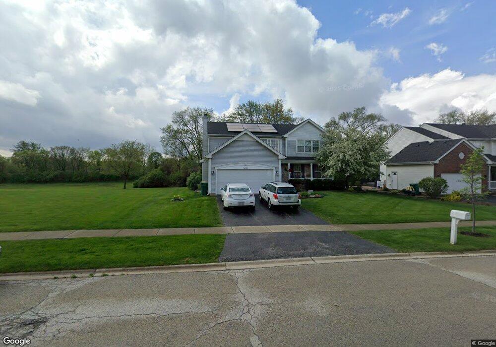
3010 Chestnut Pointe Dr New Lenox, IL 60451
Estimated Value: $424,825 - $448,000
--
Bed
--
Bath
--
Sq Ft
10,019
Sq Ft Lot
About This Home
This home is located at 3010 Chestnut Pointe Dr, New Lenox, IL 60451 and is currently estimated at $438,456. 3010 Chestnut Pointe Dr is a home located in Will County with nearby schools including Haines Elementary School, Oster-Oakview School, and Lincoln Way West.
Ownership History
Date
Name
Owned For
Owner Type
Purchase Details
Closed on
May 16, 2013
Sold by
Thompson Ted M
Bought by
Thompson Ted M and Ted Thompson Trust
Current Estimated Value
Purchase Details
Closed on
Apr 10, 2000
Sold by
First United Bank
Bought by
Thompson Ted M and Thompson Roberta Joy
Home Financials for this Owner
Home Financials are based on the most recent Mortgage that was taken out on this home.
Original Mortgage
$184,900
Outstanding Balance
$62,890
Interest Rate
8.13%
Estimated Equity
$375,566
Create a Home Valuation Report for This Property
The Home Valuation Report is an in-depth analysis detailing your home's value as well as a comparison with similar homes in the area
Home Values in the Area
Average Home Value in this Area
Purchase History
| Date | Buyer | Sale Price | Title Company |
|---|---|---|---|
| Thompson Ted M | -- | None Available | |
| Thompson Ted M | $231,500 | -- |
Source: Public Records
Mortgage History
| Date | Status | Borrower | Loan Amount |
|---|---|---|---|
| Open | Thompson Ted M | $184,900 |
Source: Public Records
Tax History Compared to Growth
Tax History
| Year | Tax Paid | Tax Assessment Tax Assessment Total Assessment is a certain percentage of the fair market value that is determined by local assessors to be the total taxable value of land and additions on the property. | Land | Improvement |
|---|---|---|---|---|
| 2024 | $10,263 | $131,659 | $31,482 | $100,177 |
| 2023 | $10,263 | $120,017 | $28,698 | $91,319 |
| 2022 | $9,251 | $110,564 | $26,438 | $84,126 |
| 2021 | $8,812 | $103,982 | $24,864 | $79,118 |
| 2020 | $8,543 | $100,272 | $23,977 | $76,295 |
| 2019 | $8,265 | $97,163 | $23,234 | $73,929 |
| 2018 | $8,039 | $93,814 | $22,433 | $71,381 |
| 2017 | $7,816 | $91,117 | $21,788 | $69,329 |
| 2016 | $7,624 | $88,678 | $21,205 | $67,473 |
| 2015 | $7,368 | $85,887 | $20,538 | $65,349 |
| 2014 | $7,368 | $84,826 | $20,284 | $64,542 |
| 2013 | $7,368 | $85,969 | $20,557 | $65,412 |
Source: Public Records
Map
Nearby Homes
- 3301 Irondale Ct
- 1001 Scottsdale Ln
- 506 Navajo Dr
- 3420 Avondale Ln
- 1006 Mountain View Dr
- 1106 Weston Way
- 14119 W Maple Rd
- 937 Saddle Ridge Dr
- 939 Saddle Ridge Dr
- 2602 Timber Springs Dr
- 0 Silver Cross Blvd
- 2417 Fleetwood Dr
- 1999 Silver Cross Blvd
- 2412 Fleetwood Dr
- 1111 Colonial Dr Unit 1
- 1301 Silver Cross Blvd
- 2208 Fiesta Dr
- 2202 Tamarack Dr
- 200 Montieth St
- 15711 Mueller Way
- 3008 Chestnut Pointe Dr
- 3006 Chestnut Pointe Dr
- 3009 Chestnut Pointe Dr
- 3011 Chestnut Pointe Dr
- 3007 Chestnut Pointe Dr Unit 1
- 3004 Chestnut Pointe Dr
- 3013 Chestnut Pointe Dr
- 3005 Chestnut Pointe Dr
- 3003 Chestnut Pointe Dr
- 3002 Chestnut Pointe Dr Unit 1
- 1980 Gougar Rd
- 3010 Carlyle Ct
- 3012 Carlyle Ct
- 812 Carlyle Dr
- 3008 Carlyle Ct
- 3014 Carlyle Ct
- 3006 Carlyle Ct
- 814 Carlyle Dr
- 3001 Chestnut Pointe Dr
- 807 Blandford Ave