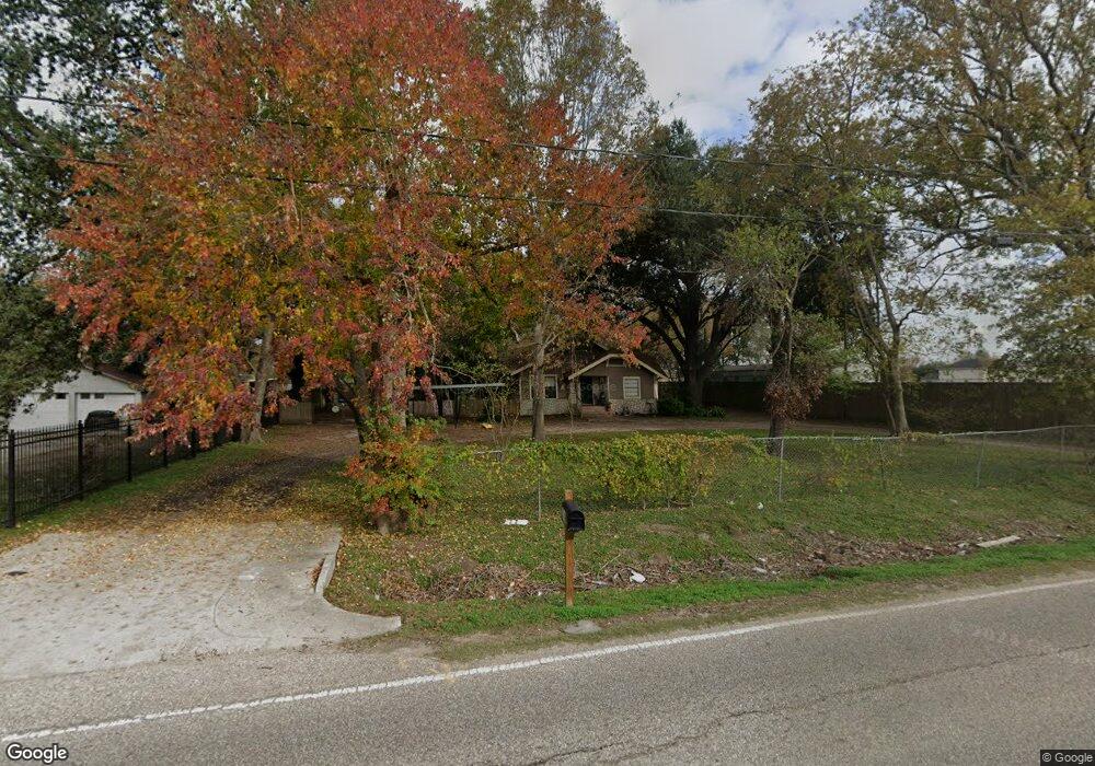
3010 Frick Rd Houston, TX 77038
North Houston NeighborhoodEstimated Value: $389,000 - $620,000
3
Beds
1
Bath
1,673
Sq Ft
$304/Sq Ft
Est. Value
About This Home
This home is located at 3010 Frick Rd, Houston, TX 77038 and is currently estimated at $508,974, approximately $304 per square foot. 3010 Frick Rd is a home located in Harris County with nearby schools including Gloria B. Sammons Elementary School, Stovall School, and Dr. Viola K. Garcia Middle School.
Ownership History
Date
Name
Owned For
Owner Type
Purchase Details
Closed on
Oct 31, 2008
Sold by
Schmidt Wilhelm Johannas and Schmidt Lillian B
Bought by
Reynolds John M and Reynolds Sandra F
Current Estimated Value
Purchase Details
Closed on
Oct 24, 1996
Sold by
Schmidt Wilhelm Johannas and Schmidt Lillian B
Bought by
Reynolds John M and Reynolds Sandra F
Home Financials for this Owner
Home Financials are based on the most recent Mortgage that was taken out on this home.
Original Mortgage
$40,000
Interest Rate
8.31%
Mortgage Type
Seller Take Back
Purchase Details
Closed on
Apr 2, 1996
Sold by
Hutchinson Julie A and Schmidt Wilhelm Johannas
Bought by
Schmidt Wilhelm Johannas and Schmidt Lillian B
Create a Home Valuation Report for This Property
The Home Valuation Report is an in-depth analysis detailing your home's value as well as a comparison with similar homes in the area
Home Values in the Area
Average Home Value in this Area
Purchase History
| Date | Buyer | Sale Price | Title Company |
|---|---|---|---|
| Reynolds John M | -- | None Available | |
| Reynolds John M | -- | Regency Title | |
| Schmidt Wilhelm Johannas | $45,433 | -- |
Source: Public Records
Mortgage History
| Date | Status | Borrower | Loan Amount |
|---|---|---|---|
| Previous Owner | Reynolds John M | $40,000 |
Source: Public Records
Tax History Compared to Growth
Tax History
| Year | Tax Paid | Tax Assessment Tax Assessment Total Assessment is a certain percentage of the fair market value that is determined by local assessors to be the total taxable value of land and additions on the property. | Land | Improvement |
|---|---|---|---|---|
| 2025 | -- | $499,347 | $439,956 | $59,391 |
| 2024 | -- | $533,932 | $479,160 | $54,772 |
| 2023 | $6,217 | $379,322 | $313,632 | $65,690 |
| 2022 | $6,242 | $376,874 | $313,632 | $63,242 |
| 2021 | $5,948 | $308,667 | $239,580 | $69,087 |
| 2020 | $5,699 | $290,524 | $239,580 | $50,944 |
| 2019 | $5,425 | $293,314 | $248,292 | $45,022 |
| 2018 | $0 | $285,158 | $248,292 | $36,866 |
| 2017 | $8,544 | $285,158 | $248,292 | $36,866 |
| 2016 | $3,883 | $237,242 | $200,376 | $36,866 |
| 2015 | -- | $208,173 | $174,240 | $33,933 |
| 2014 | -- | $141,613 | $102,120 | $39,493 |
Source: Public Records
Map
Nearby Homes
- 2838 Packard Elm St
- 2835 Oakland Brook St
- 2831 Oakland Brook St
- 2811 Oakland Brook St
- 3127 Frick Rd
- 13308 Ann Louise Rd
- 2719 Magnolia Hill Trail
- 2614 Lemonwood Ln
- 2530 Woodtown Dr
- 3265 Frick Rd
- 12623 Ann Louise Rd
- 2919 Sunwood Dr
- 5914 Stirring Winds Ln
- 00 Essie Rd
- 13803 Bearwood Rd
- 12718 Sai Baba Dr
- 3240 Brownie Campbell Rd
- 13518 Kaltenbrun Rd
- 2203 Chalet Rd
- 13610 Kaltenbrun Rd
- 3018 Frick Rd
- 0 Frick Road & Rochester Rd Unit 5451676
- 0 Frick Road & Rochester Rd Unit 4460579
- 0 Frick Road & Rochester Rd Unit 4486545
- 0 Frick Road & Rochester Rd Unit 4493889
- 0 Frick Road & Rochester Rd Unit 4501124
- 0 Frick Road & Rochester Rd Unit 4508376
- 0 Frick Road & Rochester Rd Unit 4523361
- 3034 Frick Rd
- 3017 Frick Rd
- 3009 Frick Rd
- 2854 Packard Elm St
- 13101 Sundale Rd
- 2855 Oakland Brook St
- 3102 Frick Rd
- 2855 Packard Elm St
- 3033 Frick Rd
- 13119 Sundale Rd
- 2851 Oakland Brook St
- 2851 Oakland