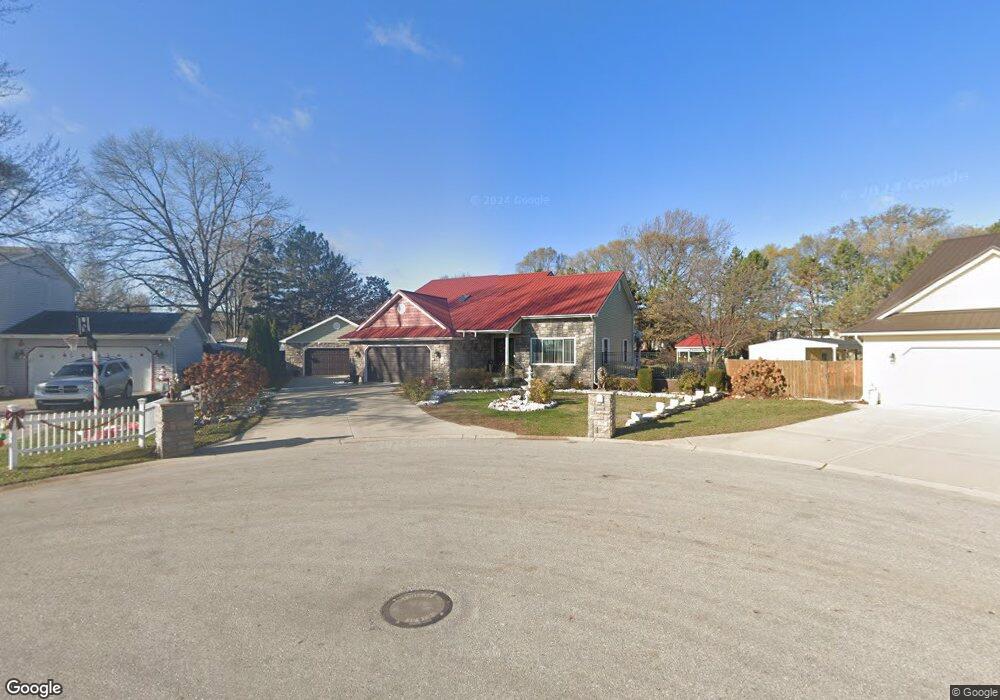
3011 Thornhill Ct Port Huron, MI 48060
Estimated Value: $205,000 - $256,000
--
Bed
--
Bath
1,732
Sq Ft
$137/Sq Ft
Est. Value
About This Home
This home is located at 3011 Thornhill Ct, Port Huron, MI 48060 and is currently estimated at $237,249, approximately $136 per square foot. 3011 Thornhill Ct is a home located in St. Clair County with nearby schools including Cleveland Elementary School, Central Middle School, and Port Huron High School.
Ownership History
Date
Name
Owned For
Owner Type
Purchase Details
Closed on
May 15, 2014
Sold by
Richards Anthony F and Richards Althea D
Bought by
Althea D Richards Living Trust
Current Estimated Value
Purchase Details
Closed on
Aug 16, 2013
Sold by
Richards Anthony F and Richards Althea D
Bought by
Suarez Noel
Purchase Details
Closed on
Jan 18, 2006
Sold by
Richards Anthony F and Richards Althea D
Bought by
Scandalito Connie J
Purchase Details
Closed on
Oct 18, 2005
Sold by
Campbell Donald E
Bought by
Richards Anthony F and Richards Althea D
Create a Home Valuation Report for This Property
The Home Valuation Report is an in-depth analysis detailing your home's value as well as a comparison with similar homes in the area
Home Values in the Area
Average Home Value in this Area
Purchase History
| Date | Buyer | Sale Price | Title Company |
|---|---|---|---|
| Althea D Richards Living Trust | -- | None Available | |
| Suarez Noel | -- | None Available | |
| Scandalito Connie J | -- | None Available | |
| Richards Anthony F | -- | None Available |
Source: Public Records
Tax History Compared to Growth
Tax History
| Year | Tax Paid | Tax Assessment Tax Assessment Total Assessment is a certain percentage of the fair market value that is determined by local assessors to be the total taxable value of land and additions on the property. | Land | Improvement |
|---|---|---|---|---|
| 2025 | $2,816 | $122,400 | $0 | $0 |
| 2024 | $2,428 | $119,500 | $0 | $0 |
| 2023 | $2,293 | $106,000 | $0 | $0 |
| 2022 | $2,447 | $91,000 | $0 | $0 |
| 2021 | $2,323 | $82,500 | $0 | $0 |
| 2020 | $2,349 | $78,000 | $78,000 | $0 |
| 2019 | $2,307 | $56,700 | $0 | $0 |
| 2018 | $2,256 | $56,700 | $0 | $0 |
| 2017 | $2,013 | $51,200 | $0 | $0 |
| 2016 | $1,728 | $51,200 | $0 | $0 |
| 2015 | $1,517 | $44,100 | $44,100 | $0 |
| 2014 | $1,517 | $42,300 | $42,300 | $0 |
| 2013 | -- | $41,300 | $0 | $0 |
Source: Public Records
Map
Nearby Homes
- 3230 Ashland Ct
- 2506 Vanness St
- 2511 Vanness St
- 2513 Vanness St
- 9999 Cleveland Ave
- 2600 Vanness St
- 2702 Vanness St
- 3136 Military St
- 2627 24th St
- 0 Dove Rd Unit G31368528
- 3830 Military St
- 9999 24th St
- 3548 Cleveland St
- 3104 Sturges St
- Lot 3 24th St
- 000 Gratiot Blvd
- 00 Gratiot Blvd
- 1403 Catherine McAuley Dr
- 69 Gratiot Blvd
- 2752 Military St
- 2303 Grant Place
- 2303 Grant Place Unit PLC
- 3019 Thornhill Ct
- 3027 Thornhill Ct
- 3024 Thornhill Ct
- 3018 24th St
- 3035 Thornhill Ct
- 2221 Grant Place Unit Bldg-Unit
- 2221 Grant Place
- 3028 24th St
- 3008 24th St
- 2220 Grant Place
- 3101 Thornhill Ct
- 2301 Thornhill St
- 2214 Grant Place
- 2217 Thornhill St
- 2400 Nern St
- 3025 24th St
- 3100 24th St
- 2201 Grant Place Unit Bldg-Unit