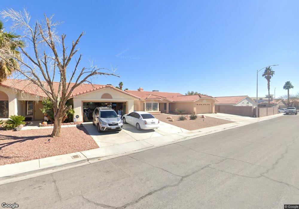
3012 Nutwood St Las Vegas, NV 89108
Michael Way NeighborhoodEstimated Value: $410,290 - $488,000
4
Beds
2
Baths
1,918
Sq Ft
$233/Sq Ft
Est. Value
About This Home
This home is located at 3012 Nutwood St, Las Vegas, NV 89108 and is currently estimated at $446,573, approximately $232 per square foot. 3012 Nutwood St is a home located in Clark County with nearby schools including Berkeley L. Bunker Elementary School, Irwin & Susan Molasky Junior High School, and Cimarron Memorial High School.
Ownership History
Date
Name
Owned For
Owner Type
Purchase Details
Closed on
Jan 25, 2003
Sold by
Newton Ouida M
Bought by
Stover Terry E and Stover Donna G
Current Estimated Value
Home Financials for this Owner
Home Financials are based on the most recent Mortgage that was taken out on this home.
Original Mortgage
$138,600
Interest Rate
5.76%
Purchase Details
Closed on
Oct 25, 1999
Sold by
Ballard Juanita and Ballard Mark A
Bought by
Ballard Juanita
Create a Home Valuation Report for This Property
The Home Valuation Report is an in-depth analysis detailing your home's value as well as a comparison with similar homes in the area
Home Values in the Area
Average Home Value in this Area
Purchase History
| Date | Buyer | Sale Price | Title Company |
|---|---|---|---|
| Stover Terry E | $178,000 | United Title Of Nevada | |
| Ballard Juanita | -- | Nevada Title Company |
Source: Public Records
Mortgage History
| Date | Status | Borrower | Loan Amount |
|---|---|---|---|
| Closed | Stover Terry E | $138,600 |
Source: Public Records
Tax History Compared to Growth
Tax History
| Year | Tax Paid | Tax Assessment Tax Assessment Total Assessment is a certain percentage of the fair market value that is determined by local assessors to be the total taxable value of land and additions on the property. | Land | Improvement |
|---|---|---|---|---|
| 2025 | $1,771 | $88,993 | $31,150 | $57,843 |
| 2024 | $1,720 | $88,993 | $31,150 | $57,843 |
| 2023 | $1,720 | $88,949 | $33,250 | $55,699 |
| 2022 | $1,670 | $76,942 | $25,550 | $51,392 |
| 2021 | $1,621 | $73,045 | $23,800 | $49,245 |
| 2020 | $1,571 | $72,518 | $23,450 | $49,068 |
| 2019 | $1,552 | $70,765 | $22,050 | $48,715 |
| 2018 | $1,481 | $63,985 | $16,800 | $47,185 |
| 2017 | $2,128 | $64,921 | $16,800 | $48,121 |
| 2016 | $1,387 | $61,592 | $12,950 | $48,642 |
| 2015 | $1,383 | $50,572 | $10,500 | $40,072 |
| 2014 | $1,343 | $39,746 | $7,000 | $32,746 |
Source: Public Records
Map
Nearby Homes
- 6325 Barkstone Ave
- 2915 Maverick St
- 3100 Garehime St
- 6100 W Brooks Ave
- 2840 Sterling Silver St Unit 3
- 3021 Garehime St
- 6544 Old Oxford Ave
- 6428 Yarmouth Dr
- 6632 Coastal Breeze Ct
- 6536 Castor Tree Way
- 6632 Light Breeze Dr
- 2720 Cathedral Ln
- 2879 N Jones Blvd
- 2764 Trotwood Ln
- 2624 Shakespeare Rd
- 6673 Silver Penny Ave
- 2624 Cathedral Ln
- 2616 Island Brook Dr
- 6216 Molino St
- 6561 Avon Ct
- 3016 Nutwood St
- 6308 Blossomwood Ave
- 3017 Leafwood St
- 6304 Blossomwood Ave
- 3020 Nutwood St
- 3013 Nutwood St
- 3009 Nutwood St
- 6241 Heather Mist Ln
- 3021 Leafwood St
- 6300 Blossomwood Ave
- 3017 Nutwood St
- 3005 Nutwood St
- 3021 Nutwood St
- 3025 Leafwood St
- 6240 Blossomwood Ave
- 6309 Blossomwood Ave
- 6237 Heather Mist Ln
- 6313 Blossomwood Ave
- 3001 Nutwood St
- 6305 Blossomwood Ave