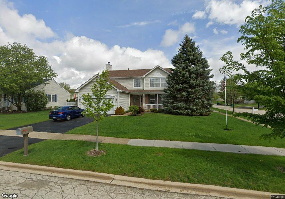
3013 Chestnut Pointe Dr New Lenox, IL 60451
Estimated Value: $412,316 - $448,000
--
Bed
--
Bath
--
Sq Ft
0.26
Acres
About This Home
This home is located at 3013 Chestnut Pointe Dr, New Lenox, IL 60451 and is currently estimated at $434,329. 3013 Chestnut Pointe Dr is a home located in Will County with nearby schools including Haines Elementary School, Oster-Oakview School, and Lincoln Way West.
Ownership History
Date
Name
Owned For
Owner Type
Purchase Details
Closed on
Dec 27, 1999
Sold by
First United Bank
Bought by
Manser Michael L and Manser Holly A
Current Estimated Value
Home Financials for this Owner
Home Financials are based on the most recent Mortgage that was taken out on this home.
Original Mortgage
$185,300
Interest Rate
8.16%
Create a Home Valuation Report for This Property
The Home Valuation Report is an in-depth analysis detailing your home's value as well as a comparison with similar homes in the area
Home Values in the Area
Average Home Value in this Area
Purchase History
| Date | Buyer | Sale Price | Title Company |
|---|---|---|---|
| Manser Michael L | $207,500 | -- |
Source: Public Records
Mortgage History
| Date | Status | Borrower | Loan Amount |
|---|---|---|---|
| Previous Owner | Manser Michael L | $185,300 |
Source: Public Records
Tax History Compared to Growth
Tax History
| Year | Tax Paid | Tax Assessment Tax Assessment Total Assessment is a certain percentage of the fair market value that is determined by local assessors to be the total taxable value of land and additions on the property. | Land | Improvement |
|---|---|---|---|---|
| 2024 | $9,102 | $125,669 | $31,482 | $94,187 |
| 2023 | $9,102 | $114,557 | $28,698 | $85,859 |
| 2022 | $8,675 | $105,534 | $26,438 | $79,096 |
| 2021 | $8,386 | $99,251 | $24,864 | $74,387 |
| 2020 | $8,129 | $95,710 | $23,977 | $71,733 |
| 2019 | $7,865 | $92,743 | $23,234 | $69,509 |
| 2018 | $7,648 | $89,546 | $22,433 | $67,113 |
| 2017 | $7,435 | $86,972 | $21,788 | $65,184 |
| 2016 | $7,252 | $84,644 | $21,205 | $63,439 |
| 2015 | $7,064 | $81,980 | $20,538 | $61,442 |
| 2014 | $7,064 | $80,967 | $20,284 | $60,683 |
| 2013 | $7,064 | $82,058 | $20,557 | $61,501 |
Source: Public Records
Map
Nearby Homes
- 3301 Irondale Ct
- 1001 Scottsdale Ln
- 3420 Avondale Ln
- 506 Navajo Dr
- 1006 Mountain View Dr
- 14119 W Maple Rd
- 1106 Weston Way
- 937 Saddle Ridge Dr
- 939 Saddle Ridge Dr
- 0 Silver Cross Blvd
- 2602 Timber Springs Dr
- 1999 Silver Cross Blvd
- 2417 Fleetwood Dr
- 2412 Fleetwood Dr
- 1111 Colonial Dr Unit 1
- 1301 Silver Cross Blvd
- 15711 Mueller Way
- The Grace Plan at Prairie Ridge of New Lenox
- The Lauren Plan at Prairie Ridge of New Lenox
- The Katherine Front Porch Elevation Plan at Prairie Ridge of New Lenox
- 3011 Chestnut Pointe Dr
- 3014 Carlyle Ct
- 3009 Chestnut Pointe Dr
- 3012 Carlyle Ct
- 812 Carlyle Dr
- 814 Carlyle Dr
- 3010 Carlyle Ct
- 900 Carlyle Dr
- 3007 Chestnut Pointe Dr Unit 1
- 3010 Chestnut Pointe Dr
- 902 Carlyle Dr
- 3008 Carlyle Ct
- 3008 Chestnut Pointe Dr
- 3005 Chestnut Pointe Dr
- 811 Blandford Ave
- 813 Blandford Ave
- 904 Carlyle Dr Unit 1
- 901 Blandford Ave
- 3006 Carlyle Ct
- 3011 Carlyle Ct