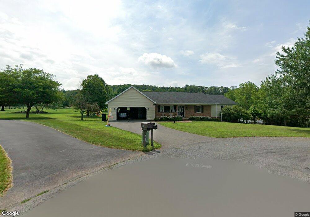
3013 Circle Dr Bloomsburg, PA 17815
Estimated Value: $334,234 - $396,000
--
Bed
--
Bath
1,600
Sq Ft
$224/Sq Ft
Est. Value
About This Home
This home is located at 3013 Circle Dr, Bloomsburg, PA 17815 and is currently estimated at $358,309, approximately $223 per square foot. 3013 Circle Dr is a home located in Columbia County with nearby schools including Central Columbia Elementary School, Central Columbia Middle School, and Central Columbia Senior High School.
Ownership History
Date
Name
Owned For
Owner Type
Purchase Details
Closed on
Sep 27, 2023
Sold by
Maciejewski Mary Jean
Bought by
Hower Stefanie A and Hower Adam R
Current Estimated Value
Home Financials for this Owner
Home Financials are based on the most recent Mortgage that was taken out on this home.
Original Mortgage
$190,000
Outstanding Balance
$186,243
Interest Rate
7.09%
Mortgage Type
New Conventional
Estimated Equity
$172,066
Purchase Details
Closed on
Jun 8, 2007
Sold by
Ikeler Susan and The Estate Of Harold B Spotts
Bought by
Maciejewski Mary Jean
Home Financials for this Owner
Home Financials are based on the most recent Mortgage that was taken out on this home.
Original Mortgage
$148,000
Interest Rate
6.14%
Mortgage Type
New Conventional
Create a Home Valuation Report for This Property
The Home Valuation Report is an in-depth analysis detailing your home's value as well as a comparison with similar homes in the area
Home Values in the Area
Average Home Value in this Area
Purchase History
| Date | Buyer | Sale Price | Title Company |
|---|---|---|---|
| Hower Stefanie A | $315,000 | Hometown Abstract | |
| Maciejewski Mary Jean | $185,000 | None Available |
Source: Public Records
Mortgage History
| Date | Status | Borrower | Loan Amount |
|---|---|---|---|
| Open | Hower Stefanie A | $190,000 | |
| Previous Owner | Maciejewski Mary Jean | $148,000 |
Source: Public Records
Tax History Compared to Growth
Tax History
| Year | Tax Paid | Tax Assessment Tax Assessment Total Assessment is a certain percentage of the fair market value that is determined by local assessors to be the total taxable value of land and additions on the property. | Land | Improvement |
|---|---|---|---|---|
| 2025 | $3,604 | $50,666 | $0 | $0 |
| 2024 | $3,466 | $50,666 | $8,985 | $41,681 |
| 2023 | $3,289 | $50,666 | $8,985 | $41,681 |
| 2022 | $3,086 | $50,666 | $8,985 | $41,681 |
| 2021 | $3,086 | $50,666 | $8,985 | $41,681 |
| 2020 | $2,976 | $50,666 | $8,985 | $41,681 |
| 2019 | $2,913 | $50,666 | $8,985 | $41,681 |
| 2018 | $2,913 | $50,666 | $8,985 | $41,681 |
| 2017 | $2,804 | $50,666 | $8,985 | $41,681 |
| 2016 | -- | $49,418 | $8,985 | $40,433 |
| 2015 | -- | $49,418 | $8,985 | $40,433 |
| 2014 | -- | $49,418 | $8,985 | $40,433 |
Source: Public Records
Map
Nearby Homes
- 63 Brentwood Cir
- 139 Rotary St
- 135 Ash St
- 107 E Pebble Ln
- 34 Fowlersville Rd
- 14 Fowlersville Rd
- 21 Levi St
- 56 Whitmire Rd
- 568 Beilys Rd
- 407 Main St
- 238 Horse Farm Rd
- LOT #3 Sawmill Rd
- 0 Alliance Park Dr
- 0 Alliance Park Lot 6 Dr
- 53 Fox Hollow Rd
- 717 Fowlersville Rd
- 9 Crestmont Cir
- 11 Amanda Dr
- 4071 Wolf Hollow Rd
- 3664 Red Maple Ln
- 3014 Circle Dr
- 3040 W Woods Edge Dr
- 3011 Circle Dr
- 159 Draketown Rd
- 103 Draketown Rd
- 3042 W Woods Edge Dr
- 3038 W Woods Edge Dr
- 3004 Woods Edge Dr
- 3012 Circle Dr
- 3006 Woods Edge Dr
- 3009 Circle Dr
- 3010 Woods Edge Dr
- 3012 Woods Edge Dr
- 3036 W Woods Edge Dr
- 3010 Circle Dr
- 3002 Woods Edge Dr
- 3053 W Woods Edge Dr
- 3051 W Woods Edge Dr
- 3008 Woods Edge Dr
- 3014 Woods Edge Dr