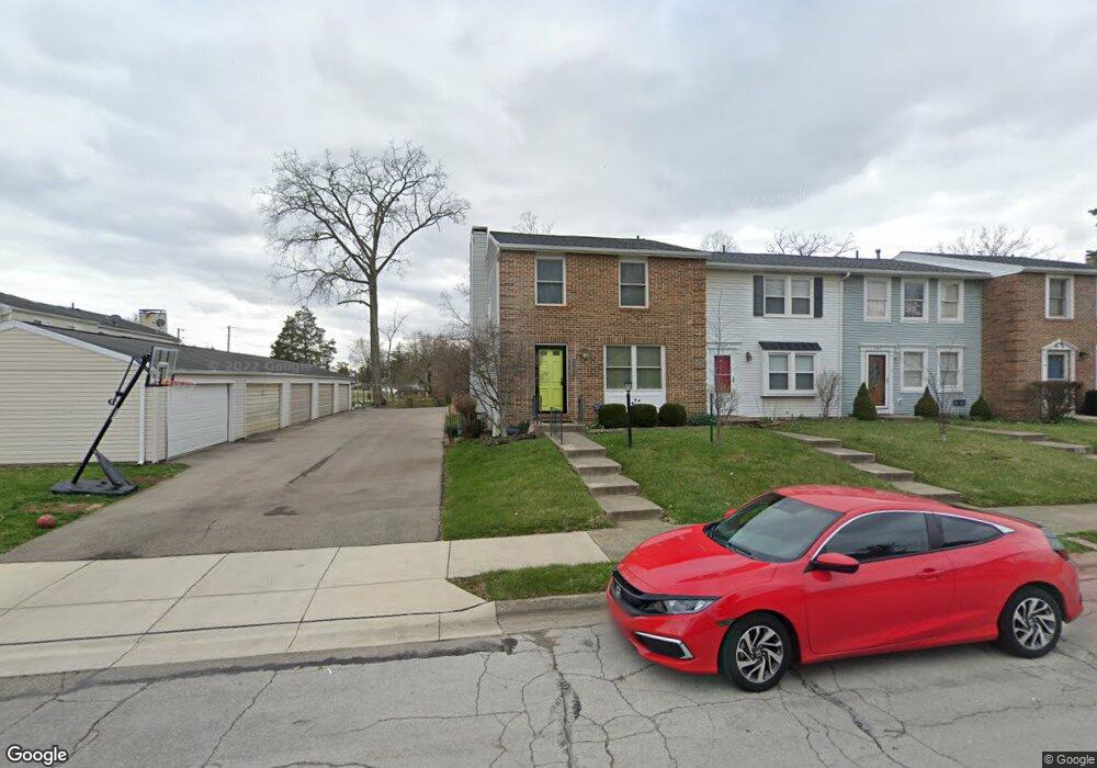
3013 Colony Ln Springfield, OH 45503
Estimated Value: $135,000 - $188,000
3
Beds
3
Baths
1,200
Sq Ft
$139/Sq Ft
Est. Value
About This Home
This home is located at 3013 Colony Ln, Springfield, OH 45503 and is currently estimated at $166,840, approximately $139 per square foot. 3013 Colony Ln is a home located in Clark County with nearby schools including Rolling Hills Elementary School, Northridge Middle School, and Kenton Ridge Middle & High School.
Ownership History
Date
Name
Owned For
Owner Type
Purchase Details
Closed on
Nov 29, 2016
Sold by
Hunt Randall L
Bought by
Hunt Kathleen M
Current Estimated Value
Purchase Details
Closed on
Feb 28, 2007
Sold by
Labrador Francisco P and Labrador Jill K
Bought by
Hunt Randall L
Home Financials for this Owner
Home Financials are based on the most recent Mortgage that was taken out on this home.
Original Mortgage
$72,000
Interest Rate
6.27%
Mortgage Type
Purchase Money Mortgage
Purchase Details
Closed on
Jun 4, 2003
Sold by
Surowicz Parsons Jennifer and Surowicz Connie
Bought by
Labrador Francisco P
Home Financials for this Owner
Home Financials are based on the most recent Mortgage that was taken out on this home.
Original Mortgage
$53,000
Interest Rate
5.88%
Mortgage Type
Purchase Money Mortgage
Create a Home Valuation Report for This Property
The Home Valuation Report is an in-depth analysis detailing your home's value as well as a comparison with similar homes in the area
Home Values in the Area
Average Home Value in this Area
Purchase History
| Date | Buyer | Sale Price | Title Company |
|---|---|---|---|
| Hunt Kathleen M | -- | None Available | |
| Hunt Randall L | $91,000 | Attorney | |
| Labrador Francisco P | $93,000 | -- |
Source: Public Records
Mortgage History
| Date | Status | Borrower | Loan Amount |
|---|---|---|---|
| Closed | Hunt Randall L | $72,000 | |
| Previous Owner | Labrador Francisco P | $53,000 |
Source: Public Records
Tax History Compared to Growth
Tax History
| Year | Tax Paid | Tax Assessment Tax Assessment Total Assessment is a certain percentage of the fair market value that is determined by local assessors to be the total taxable value of land and additions on the property. | Land | Improvement |
|---|---|---|---|---|
| 2024 | $1,495 | $35,650 | $5,150 | $30,500 |
| 2023 | $1,495 | $35,650 | $5,150 | $30,500 |
| 2022 | $750 | $35,650 | $5,150 | $30,500 |
| 2021 | $1,383 | $28,190 | $4,030 | $24,160 |
| 2020 | $1,384 | $28,190 | $4,030 | $24,160 |
| 2019 | $1,412 | $28,190 | $4,030 | $24,160 |
| 2018 | $1,408 | $27,160 | $5,250 | $21,910 |
| 2017 | $1,202 | $27,160 | $5,250 | $21,910 |
| 2016 | $1,160 | $27,160 | $5,250 | $21,910 |
| 2015 | $667 | $27,160 | $5,250 | $21,910 |
| 2014 | $1,200 | $27,160 | $5,250 | $21,910 |
| 2013 | $1,856 | $27,160 | $5,250 | $21,910 |
Source: Public Records
Map
Nearby Homes
- 1732 Falmouth Ave
- 3032 Armsgate Rd Unit 25
- 3046 Brixton Dr W Unit 173
- 3129 Haverhill St
- 3307 Tackett St
- 1148 Foxboro Rd
- 2022 Westboro Ave
- 1939 Providence Ave
- 3214 Revels St
- 1225 Vester Ave
- 3231 Vineyard St
- 2907 Mystic Ln
- 1922 Wedgewood Cir
- 1920 Wedgewood Cir
- 3631 Kingsgate Ln
- 3316 Sudbury St
- 1501 Kingsgate Rd
- 1509 Kingsgate Rd
- 1507 Kingsgate Rd
- 1505 Kingsgate Rd
- 3013 Colony Ln Unit D
- 3015 Colony Ln
- 3017 Colony Ln
- 3019 Colony Ln
- 3019 Colony Ln Unit A
- 1306 Villa Rd
- 1308 Villa Rd
- 1304 Villa Rd Unit C
- 1302 Villa Rd Unit D
- 3023 Colony Ln Unit D
- 1300 Villa Rd Unit E
- 3014 Colony Ln
- 3012 Colony Ln
- 3025 Colony Ln
- 3016 Colony Ln Unit 3016
- 3018 Colony Ln Unit 3018
- 3027 Colony Ln
- 1318 Villa Rd
- 3029 Colony Ln
- 3029 Colony Ln Unit A