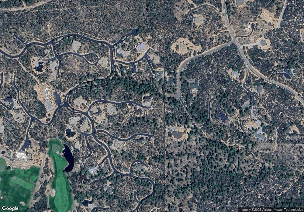
3014 E Thunder Point Unit 226 Payson, AZ 85541
Estimated Value: $44,984 - $164,000
Studio
--
Bath
--
Sq Ft
0.52
Acres
About This Home
This home is located at 3014 E Thunder Point Unit 226, Payson, AZ 85541 and is currently estimated at $104,492. 3014 E Thunder Point Unit 226 is a home located in Gila County with nearby schools including Julia Randall Elementary School, Payson Elementary School, and Rim Country Middle School.
Ownership History
Date
Name
Owned For
Owner Type
Purchase Details
Closed on
May 4, 2012
Sold by
Helow Mark
Bought by
Hinkelman Gerald C
Current Estimated Value
Purchase Details
Closed on
Jan 15, 2009
Sold by
Oconnell Dennis and Oconnell Barbara
Bought by
M & I Marshall & Ilsley Bank
Purchase Details
Closed on
Jun 23, 2005
Sold by
First American Title Insurance Company
Bought by
Oconneil Dennis and Oconnell Barbara
Home Financials for this Owner
Home Financials are based on the most recent Mortgage that was taken out on this home.
Original Mortgage
$300,000
Interest Rate
5.51%
Mortgage Type
New Conventional
Create a Home Valuation Report for This Property
The Home Valuation Report is an in-depth analysis detailing your home's value as well as a comparison with similar homes in the area
Purchase History
| Date | Buyer | Sale Price | Title Company |
|---|---|---|---|
| Hinkelman Gerald C | $40,000 | Pioneer Title Agency | |
| M & I Marshall & Ilsley Bank | $116,948 | Pioneer Title Agency | |
| Oconneil Dennis | $300,000 | First American Title |
Source: Public Records
Mortgage History
| Date | Status | Borrower | Loan Amount |
|---|---|---|---|
| Previous Owner | Oconneil Dennis | $300,000 |
Source: Public Records
Tax History Compared to Growth
Tax History
| Year | Tax Paid | Tax Assessment Tax Assessment Total Assessment is a certain percentage of the fair market value that is determined by local assessors to be the total taxable value of land and additions on the property. | Land | Improvement |
|---|---|---|---|---|
| 2025 | $493 | -- | -- | -- |
| 2024 | $460 | $10,332 | $6,492 | $3,840 |
| 2023 | $460 | $11,327 | $7,670 | $3,657 |
| 2022 | $446 | $7,731 | $4,248 | $3,483 |
| 2021 | $419 | $7,565 | $4,248 | $3,317 |
| 2020 | $402 | $0 | $0 | $0 |
| 2019 | $391 | $0 | $0 | $0 |
| 2018 | $367 | $0 | $0 | $0 |
| 2017 | $343 | $0 | $0 | $0 |
| 2016 | $335 | $0 | $0 | $0 |
| 2015 | $351 | $0 | $0 | $0 |
Source: Public Records
Map
Nearby Homes
- 3005 E Arrow Point Unit 238
- 3005 E Arrow Point
- 3002 E Arrow Point Unit 235
- 3100 E Pleasant Valley
- 3100 E Pleasant Valley Unit 244
- 106 S Stewart Vista Rd
- 106 S Stewart Vista Rd Unit 201
- 3002 E Game Trail
- 3004 E Game Trail Unit 243
- 3004 E Game Trail
- 2900 E Lions Pocket
- 2900 E Lions Pocket -- Unit 271
- Lot 63 Highline Dr
- 108 S Rim Club Dr
- 128 E Saddleback Trail
- 3103 S Monument Peak
- 3103 S Monument Peak -- Unit 168
- Lot 37 Saddleback Trail
- 203 S Crescent Moon
- 201 S Crescent Moon -- Unit 304
- 3014 E Thunder Point
- 3013 E Thunder Point Unit 231
- 3013 E Thunder Point
- 3012 E Thunder Point Unit 48
- 3012 E Thunder Point Unit 225
- 3012 E Thunder Point
- 3109 E Indian Ruin Unit 214
- 3109 E Indian Ruin
- 148 W Monument Trail
- 3011 E Thunder Point
- 1002 Monument Trail
- 3009 E Thunder Point Unit 229
- 3009 E Thunder Point
- 3008 E Thunder Point Unit 223
- 3103 E Indian Ruin
- 3103 E Indian Ruin Unit 215
- 3103 E Indian Ruin--215 -- Unit 215
- 3103 E Indian Ruin--Lot 215 -- Unit 215
- 3103 E Indian Ruin--Lot 216 -- Unit 216
- 3103 E Indian Ruin--216 -- Unit 216
