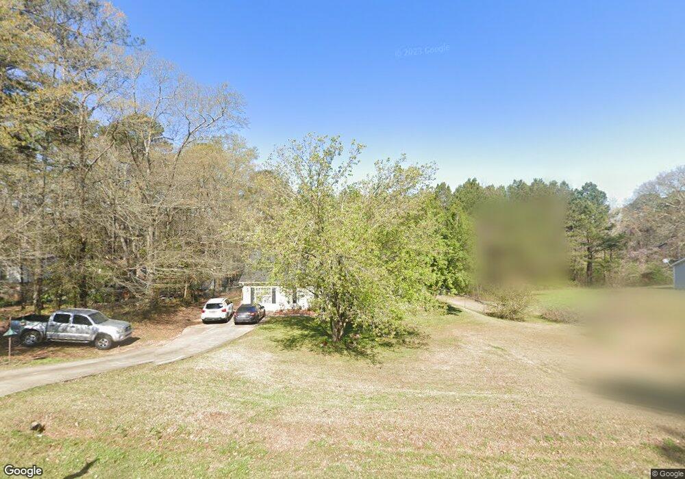
3014 Old West Point Rd Lagrange, GA 30240
Estimated Value: $212,000 - $251,000
3
Beds
2
Baths
1,680
Sq Ft
$136/Sq Ft
Est. Value
About This Home
This home is located at 3014 Old West Point Rd, Lagrange, GA 30240 and is currently estimated at $228,812, approximately $136 per square foot. 3014 Old West Point Rd is a home located in Troup County with nearby schools including Long Cane Elementary School, Berta Weathersbee Elementary School, and Whitesville Road Elementary School.
Ownership History
Date
Name
Owned For
Owner Type
Purchase Details
Closed on
May 31, 2000
Sold by
Venco Llc & Dempsey K Freeman
Bought by
Nolin Kenneth T
Current Estimated Value
Purchase Details
Closed on
May 30, 2000
Sold by
Mrs Willie L Raby
Bought by
Venco Llc & Dempsey K Freeman
Purchase Details
Closed on
Nov 2, 1999
Sold by
Mrs Allen C Raby and Mrs Willie L
Bought by
Mrs Willie L Raby
Purchase Details
Closed on
May 30, 1975
Bought by
Mrs Allen C Raby and Mrs Willie L
Purchase Details
Closed on
Jan 1, 1954
Create a Home Valuation Report for This Property
The Home Valuation Report is an in-depth analysis detailing your home's value as well as a comparison with similar homes in the area
Purchase History
| Date | Buyer | Sale Price | Title Company |
|---|---|---|---|
| Nolin Kenneth T | $92,500 | -- | |
| Venco Llc & Dempsey K Freeman | -- | -- | |
| Mrs Willie L Raby | $8,000 | -- | |
| Mrs Allen C Raby | -- | -- | |
| -- | -- | -- |
Source: Public Records
Tax History
| Year | Tax Paid | Tax Assessment Tax Assessment Total Assessment is a certain percentage of the fair market value that is determined by local assessors to be the total taxable value of land and additions on the property. | Land | Improvement |
|---|---|---|---|---|
| 2025 | $2,064 | $75,680 | $14,000 | $61,680 |
| 2024 | $1,789 | $65,600 | $14,000 | $51,600 |
| 2023 | $1,753 | $64,280 | $14,000 | $50,280 |
| 2022 | $1,617 | $57,920 | $10,000 | $47,920 |
| 2021 | $1,514 | $50,200 | $10,000 | $40,200 |
| 2020 | $1,393 | $46,200 | $6,000 | $40,200 |
| 2019 | $1,303 | $43,200 | $6,000 | $37,200 |
| 2018 | $1,147 | $38,040 | $6,800 | $31,240 |
| 2017 | $1,147 | $38,040 | $6,800 | $31,240 |
| 2016 | $1,125 | $37,296 | $6,800 | $30,496 |
| 2015 | $1,121 | $37,099 | $6,800 | $30,299 |
| 2014 | $1,074 | $35,504 | $6,800 | $28,704 |
| 2013 | -- | $37,799 | $6,800 | $30,999 |
Source: Public Records
Map
Nearby Homes
- 3009 Old West Point Rd
- 105 Redwood Dr
- 22 Freeman Rd
- 288 Bradfield Dr
- 0 Glass Bridge Rd Unit 10679358
- 2239 Pegasus Pkwy
- 808 S Fling Rd
- 0 Bradfield Dr Unit 10568803
- 266 Glass Bridge Rd
- 640 Hudson Rd
- 8 Horace Carter Rd
- 427 Fling Rd
- 509 Connie Dr
- 402 Ginger Cir
- 112 Foxdale Dr
- 119 Plymouth Dr
- 3 Reed Dr
- 0 Cannonville Rd
- 205 Grady St
- 135 Planters Ridge Dr
- 3012 Old West Point Rd
- 3018 Old West Point Rd
- 126 Redwood Dr
- 128 Redwood Dr
- 3013 Old Point W
- 124 Redwood Dr
- 3013 Old West Point Rd
- 3008 Old West Point Rd
- 3020 Old West Point Rd
- 3011 Old West Point Rd
- 122 Redwood Dr
- 130 Redwood Dr
- 3017 Old West Point Rd
- 3007 Old West Point Rd
- 3006 Old West Point Rd
- 3019 Old West Point Rd
- 120 Redwood Dr
- 129 Redwood Dr
- 125 Redwood Dr
- 4000 Old West Point Rd
Your Personal Tour Guide
Ask me questions while you tour the home.