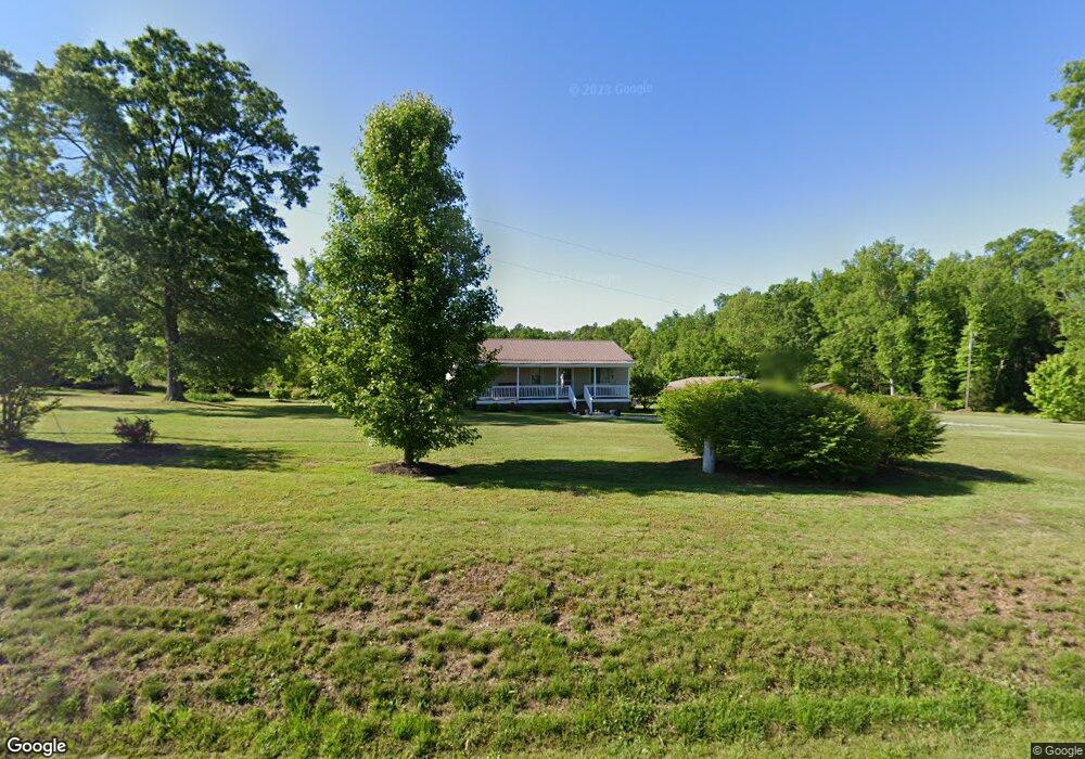
3014 Wolf Trap Rd South Boston, VA 24592
Estimated Value: $115,000 - $190,000
3
Beds
1
Bath
1,050
Sq Ft
$132/Sq Ft
Est. Value
About This Home
This home is located at 3014 Wolf Trap Rd, South Boston, VA 24592 and is currently estimated at $138,791, approximately $132 per square foot. 3014 Wolf Trap Rd is a home located in Halifax County with nearby schools including South Boston Elementary School, Halifax County Middle School, and Halifax County High School.
Ownership History
Date
Name
Owned For
Owner Type
Purchase Details
Closed on
Aug 30, 2012
Sold by
Newton Dean L
Bought by
Hazelwood Timothy R
Current Estimated Value
Home Financials for this Owner
Home Financials are based on the most recent Mortgage that was taken out on this home.
Original Mortgage
$78,551
Outstanding Balance
$54,328
Interest Rate
3.56%
Mortgage Type
FHA
Estimated Equity
$84,463
Create a Home Valuation Report for This Property
The Home Valuation Report is an in-depth analysis detailing your home's value as well as a comparison with similar homes in the area
Home Values in the Area
Average Home Value in this Area
Purchase History
| Date | Buyer | Sale Price | Title Company |
|---|---|---|---|
| Hazelwood Timothy R | $80,000 | -- |
Source: Public Records
Mortgage History
| Date | Status | Borrower | Loan Amount |
|---|---|---|---|
| Open | Hazelwood Timothy R | $78,551 |
Source: Public Records
Tax History Compared to Growth
Tax History
| Year | Tax Paid | Tax Assessment Tax Assessment Total Assessment is a certain percentage of the fair market value that is determined by local assessors to be the total taxable value of land and additions on the property. | Land | Improvement |
|---|---|---|---|---|
| 2025 | $358 | $71,669 | $14,398 | $57,271 |
| 2024 | $358 | $71,669 | $14,398 | $57,271 |
| 2023 | $357 | $71,392 | $14,398 | $56,994 |
| 2022 | $357 | $71,392 | $14,398 | $56,994 |
| 2021 | $214 | $42,710 | $14,398 | $28,312 |
| 2020 | $214 | $42,710 | $14,398 | $28,312 |
| 2019 | $214 | $42,710 | $14,398 | $28,312 |
| 2018 | $205 | $42,710 | $14,398 | $28,312 |
| 2016 | $208 | $43,233 | $14,398 | $28,835 |
| 2015 | $208 | $41,079 | $14,398 | $26,681 |
| 2014 | $189 | $41,079 | $14,398 | $26,681 |
| 2013 | $192 | $42,614 | $14,398 | $28,216 |
Source: Public Records
Map
Nearby Homes
- 0 Wolf Trap Rd
- 00 Good Trail
- 1194 Wolf Trap Rd
- 1039 Azalea Ln
- 1058 James D Hagood Hwy
- 00 Alphonse Dairy Rd
- 00 Boyds Ferry Trail
- 0 S Terry's Bridge Rd
- 4507 Brentwood Dr
- 509 Bellwood Ln
- 302 Dunncroft Ct
- 1002 John Randolph Blvd
- 1031 Macdonald Rd
- 0 Parker Ave
- 2100 Rivoli St
- 618 Cedar Ave
- 8 LOTS Vaughan St
- 1-16 Vaughan St
- 104 Elizabeth Ct
- 1312 Willingham Ave
- 3028 Wolf Trap Rd
- 00 Wolf Trap Rd
- 1021 Mcgregor Trail
- 3044 Wolf Trap Rd
- 3039 Wolf Trap Rd
- 2244 Wolf Trap Rd
- 2210 Wolf Trap Rd
- 1015 Walker Trail
- 3075 Wolf Trap Rd
- 3111 Wolf Trap Rd
- 3110 Wolf Trap Rd
- 3121 Wolf Trap Rd
- 2186 Wolf Trap Rd
- 2179 Wolf Trap Rd
- 2130 Wolf Trap Rd
- 2176 Wolf Trap Rd
- 1018 N Nichols Ferry Trail
- 1055 Conner Trail
- 1056 Conner Trail
- 1063 Walker Trail