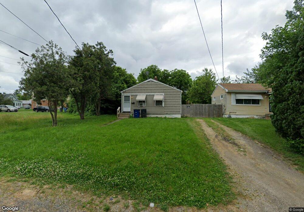
3015 E St Toledo, OH 43608
Lagrange NeighborhoodEstimated Value: $58,988 - $86,000
4
Beds
1
Bath
1,000
Sq Ft
$70/Sq Ft
Est. Value
About This Home
This home is located at 3015 E St, Toledo, OH 43608 and is currently estimated at $70,497, approximately $70 per square foot. 3015 E St is a home located in Lucas County with nearby schools including Spring Elementary School, Woodward High School, and Imagine Environmental Science Academy.
Ownership History
Date
Name
Owned For
Owner Type
Purchase Details
Closed on
Jan 19, 2024
Sold by
Lawhorn Robert J
Bought by
R O T Realty Llc
Current Estimated Value
Purchase Details
Closed on
Sep 19, 2018
Sold by
Ross Byrd Nicole N
Bought by
Lawhorn Robert J
Purchase Details
Closed on
Mar 16, 1995
Sold by
Jones Corine
Bought by
Ross-Byrd Nicole N
Home Financials for this Owner
Home Financials are based on the most recent Mortgage that was taken out on this home.
Original Mortgage
$14,725
Interest Rate
8.97%
Mortgage Type
New Conventional
Create a Home Valuation Report for This Property
The Home Valuation Report is an in-depth analysis detailing your home's value as well as a comparison with similar homes in the area
Home Values in the Area
Average Home Value in this Area
Purchase History
| Date | Buyer | Sale Price | Title Company |
|---|---|---|---|
| R O T Realty Llc | -- | None Listed On Document | |
| Lawhorn Robert J | $300 | None Available | |
| Ross-Byrd Nicole N | $15,500 | -- |
Source: Public Records
Mortgage History
| Date | Status | Borrower | Loan Amount |
|---|---|---|---|
| Previous Owner | Ross-Byrd Nicole N | $14,725 |
Source: Public Records
Tax History
| Year | Tax Paid | Tax Assessment Tax Assessment Total Assessment is a certain percentage of the fair market value that is determined by local assessors to be the total taxable value of land and additions on the property. | Land | Improvement |
|---|---|---|---|---|
| 2025 | -- | $8,890 | $2,940 | $5,950 |
| 2024 | $2,929 | $8,890 | $2,940 | $5,950 |
| 2023 | $690 | $8,750 | $2,030 | $6,720 |
| 2022 | $671 | $8,750 | $2,030 | $6,720 |
| 2021 | $694 | $8,750 | $2,030 | $6,720 |
| 2020 | $755 | $8,330 | $1,890 | $6,440 |
| 2019 | $729 | $8,330 | $1,890 | $6,440 |
| 2018 | $653 | $8,330 | $1,890 | $6,440 |
| 2017 | $9,863 | $5,705 | $1,855 | $3,850 |
| 2016 | $8,258 | $16,300 | $5,300 | $11,000 |
| 2015 | $578 | $16,300 | $5,300 | $11,000 |
| 2014 | $539 | $5,710 | $1,860 | $3,850 |
| 2013 | $359 | $5,710 | $1,860 | $3,850 |
Source: Public Records
Map
Nearby Homes
- 1016 E Central Ave
- 916 Saint John Ave
- 2816 A St
- 1101 Ketcham Ave
- 3220 Maher St
- 1027 Ketcham Ave
- 3225 Maher St
- 1102 Woodward Ave
- 3233 Jeannette Ave
- 3250 Brigham St
- 915 Ketcham Ave
- 3256 Jeannette Ave
- 2927 Stickney Ave
- 910 Woodward Ave
- 735 Maywood Ave
- 815 Woodward Ave
- 3333 Beaumont Dr
- 1817 Ridgewood Ave
- 1441 Yates St
- 1821 Ridgewood Ave
- 3021 E St
- 1221 Bronson Ave
- 1225 Bronson Ave
- 1231 Bronson Ave
- 1215 Bronson Ave
- 1209 Bronson Ave
- 1301 Bronson Ave
- 1214 E Central Ave
- 3016 E St
- 3020 E St
- 1307 Bronson Ave
- 1208 E Central Ave
- 1203 Bronson Ave
- 1311 Bronson Ave
- 1233 E Central Ave
- 1315 Bronson Ave
- 1222 Bronson Ave
- 1220 Bronson Ave
- 2931 E St
- 1218 Bronson Ave
Your Personal Tour Guide
Ask me questions while you tour the home.