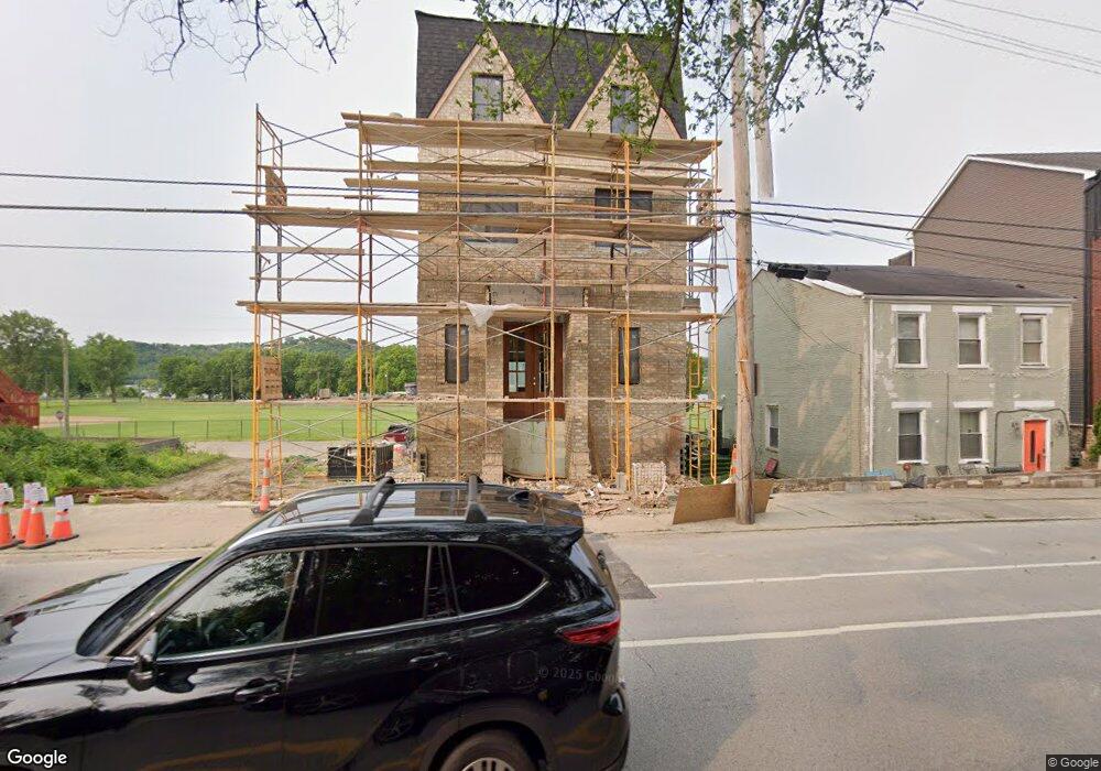
3015 Riverside Dr Cincinnati, OH 45226
East End NeighborhoodEstimated Value: $104,000 - $255,000
3
Beds
1
Bath
1,344
Sq Ft
$133/Sq Ft
Est. Value
About This Home
This home is located at 3015 Riverside Dr, Cincinnati, OH 45226 and is currently estimated at $178,333, approximately $132 per square foot. 3015 Riverside Dr is a home located in Hamilton County with nearby schools including Clark Montessori High School, Withrow University High School, and Robert A. Taft Information Technology High School.
Ownership History
Date
Name
Owned For
Owner Type
Purchase Details
Closed on
Mar 15, 2023
Sold by
R And L Riverside Properties Llc
Bought by
Schell Mark Beth and Schell Mary Beth
Current Estimated Value
Purchase Details
Closed on
Jan 29, 2010
Sold by
Ross Charles H and Ross Hazel
Bought by
R & L Riverside Properties Llc
Purchase Details
Closed on
Jul 20, 2005
Sold by
Ross Faye E
Bought by
Ross Charlie H
Create a Home Valuation Report for This Property
The Home Valuation Report is an in-depth analysis detailing your home's value as well as a comparison with similar homes in the area
Home Values in the Area
Average Home Value in this Area
Purchase History
| Date | Buyer | Sale Price | Title Company |
|---|---|---|---|
| Schell Mark Beth | $90,000 | Prodigy Title | |
| Schell Mark Beth | $90,000 | Prodigy Title | |
| R & L Riverside Properties Llc | -- | Attorney | |
| Ross Charlie H | -- | None Available |
Source: Public Records
Tax History
| Year | Tax Paid | Tax Assessment Tax Assessment Total Assessment is a certain percentage of the fair market value that is determined by local assessors to be the total taxable value of land and additions on the property. | Land | Improvement |
|---|---|---|---|---|
| 2025 | $2,012 | $31,500 | $5,957 | $25,543 |
| 2024 | $2,009 | $31,500 | $5,957 | $25,543 |
| 2023 | $2,013 | $31,500 | $5,957 | $25,543 |
| 2022 | $1,081 | $15,103 | $3,994 | $11,109 |
| 2021 | $1,058 | $15,103 | $3,994 | $11,109 |
| 2020 | $1,061 | $15,103 | $3,994 | $11,109 |
| 2019 | $1,022 | $13,248 | $3,504 | $9,744 |
| 2018 | $1,023 | $13,248 | $3,504 | $9,744 |
| 2017 | $985 | $13,248 | $3,504 | $9,744 |
| 2016 | $790 | $10,336 | $3,574 | $6,762 |
| 2015 | $707 | $10,336 | $3,574 | $6,762 |
| 2014 | $711 | $10,336 | $3,574 | $6,762 |
| 2013 | $709 | $10,133 | $3,504 | $6,629 |
Source: Public Records
Map
Nearby Homes
- 3003 Riverside Dr
- 3021 Riverside Dr
- 3219 Riverside Dr
- 3089 Walworth Ave
- 2939 Walworth Ave
- 260 Watson St
- 312 Audubon St
- 2851 Hoff Ave
- 3304 Columbia Pkwy
- 259 Strader Ave
- 261 Strader Ave
- 263 Strader Ave
- 265 Strader Ave
- 267 Strader Ave
- 269 Strader Ave
- 271 Strader Ave
- 2734 Hoff Ave
- 226 Worth St
- 3435 Golden Ave
- 3441 Wool St
- 3011 Riverside Dr
- 3025 Riverside Dr
- 3005 Riverside Dr
- 3001 Riverside Dr Unit A
- 3001 Riverside Dr
- 0 Mayapple Ln Unit 21522743
- 0 Mayapple Ln Unit 21522730
- 0 Mayapple Ln Unit MBR21924562
- 0 Mayapple Ln Unit 21760486
- 2987 Riverside Dr Unit Lot 21
- 2963 Riverside Dr Unit 25
- 2955 Riverside Dr
- 3033 Riverside Dr
- L Riverside Dr
- 2953 Riverside Dr
- 3023 Walworth Ave
- 3029 Walworth Ave Unit Lot 14
- 3017 Walworth Ave
- 2977 Riverside Dr
- 2951 Riverside Dr
Your Personal Tour Guide
Ask me questions while you tour the home.