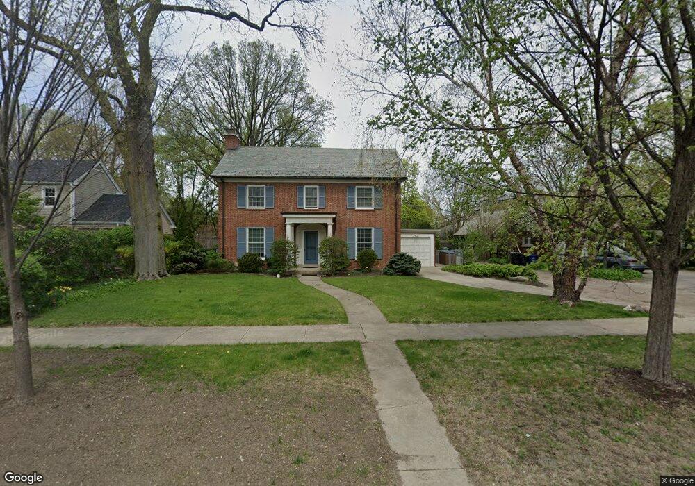
3015 Simpson St Evanston, IL 60201
North Evanston NeighborhoodEstimated Value: $898,000 - $1,594,460
3
Beds
3
Baths
2,693
Sq Ft
$454/Sq Ft
Est. Value
About This Home
This home is located at 3015 Simpson St, Evanston, IL 60201 and is currently estimated at $1,221,865, approximately $453 per square foot. 3015 Simpson St is a home located in Cook County with nearby schools including Lincolnwood Elementary School, Haven Middle School, and Evanston Township High School.
Ownership History
Date
Name
Owned For
Owner Type
Purchase Details
Closed on
Dec 8, 2010
Sold by
Browne Michael H and Browne Maureen Thomas
Bought by
Buda Fabio and Hart Aimee
Current Estimated Value
Purchase Details
Closed on
May 27, 2003
Sold by
Kay Browne Michael H and Kay Thomas Maureen
Bought by
Browne Michael H and Browne Maureen Thomas
Purchase Details
Closed on
May 15, 2002
Sold by
Weil Rolf A
Bought by
Browne Michael H and Thomas Maureen K
Home Financials for this Owner
Home Financials are based on the most recent Mortgage that was taken out on this home.
Original Mortgage
$300,000
Interest Rate
7.07%
Create a Home Valuation Report for This Property
The Home Valuation Report is an in-depth analysis detailing your home's value as well as a comparison with similar homes in the area
Home Values in the Area
Average Home Value in this Area
Purchase History
| Date | Buyer | Sale Price | Title Company |
|---|---|---|---|
| Buda Fabio | $572,500 | Cti | |
| Browne Michael H | -- | -- | |
| Browne Michael H | -- | -- | |
| Browne Michael H | $500,000 | -- |
Source: Public Records
Mortgage History
| Date | Status | Borrower | Loan Amount |
|---|---|---|---|
| Previous Owner | Browne Michael H | $300,000 | |
| Closed | Browne Michael H | $100,000 |
Source: Public Records
Tax History
| Year | Tax Paid | Tax Assessment Tax Assessment Total Assessment is a certain percentage of the fair market value that is determined by local assessors to be the total taxable value of land and additions on the property. | Land | Improvement |
|---|---|---|---|---|
| 2025 | $25,585 | $126,176 | $37,307 | $88,869 |
| 2024 | $25,585 | $110,270 | $31,416 | $78,854 |
| 2023 | $24,525 | $110,270 | $31,416 | $78,854 |
| 2022 | $24,525 | $110,270 | $31,416 | $78,854 |
| 2021 | $17,596 | $69,637 | $18,980 | $50,657 |
| 2020 | $17,421 | $69,637 | $18,980 | $50,657 |
| 2019 | $17,146 | $76,609 | $18,980 | $57,629 |
| 2018 | $16,665 | $64,263 | $15,708 | $48,555 |
| 2017 | $16,246 | $64,263 | $15,708 | $48,555 |
| 2016 | $15,631 | $64,263 | $15,708 | $48,555 |
| 2015 | $14,143 | $55,370 | $13,090 | $42,280 |
| 2014 | $13,749 | $54,338 | $13,090 | $41,248 |
| 2013 | $13,417 | $54,338 | $13,090 | $41,248 |
Source: Public Records
Map
Nearby Homes
- 2921 Simpson St
- 3701 Foster St
- 9435 Central Park Ave
- 2337 Ridgeway Ave
- 9433 Lincolnwood Dr
- 9532 Springfield Ave
- 2955 Colfax St
- 2951 Colfax St
- 3310 Hayes St
- 9337 Lincolnwood Dr
- 9301 Drake Ave
- 2439 Cowper Ave
- 2523 Hastings Ave
- 3131 Central St
- 9200 Avers Ave
- 9132 Lincolnwood Dr
- 2717 Harrison St
- 1915 - 2 Grant St
- 3233 Central St
- 2726 Central St Unit 3D
- 3021 Simpson St
- 3021 Simpson St
- 2100 Central Park Ave
- 2110 Central Park Ave
- 3029 Simpson St
- 9555 Monticello Ave
- 2116 Central Park Ave
- 3033 Simpson St
- 3014 Payne St
- 3022 Payne St
- 3601 Golf Rd
- 2122 Central Park Ave
- 9549 Monticello Ave
- 9554 Central Park Ave
- 3026 Payne St
- 3039 Simpson St
- 3030 Payne St
- 9543 Monticello Ave
- 2130 Central Park Ave
- 9550 Central Park Ave
Your Personal Tour Guide
Ask me questions while you tour the home.