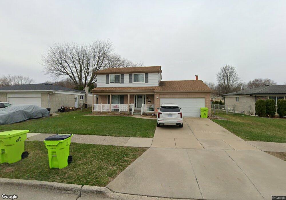
30169 Avondale Dr Unit Bldg-Unit Madison Heights, MI 48071
Estimated Value: $313,000 - $341,000
4
Beds
2
Baths
1,745
Sq Ft
$185/Sq Ft
Est. Value
About This Home
This home is located at 30169 Avondale Dr Unit Bldg-Unit, Madison Heights, MI 48071 and is currently estimated at $323,632, approximately $185 per square foot. 30169 Avondale Dr Unit Bldg-Unit is a home located in Oakland County with nearby schools including Lamphere High School, Immaculate Conception Catholic Schools, and Temple Christian Academy.
Ownership History
Date
Name
Owned For
Owner Type
Purchase Details
Closed on
Jul 25, 2018
Sold by
Tong Kenneth
Bought by
Gappi Hather
Current Estimated Value
Purchase Details
Closed on
Aug 23, 2013
Sold by
The Ding Kin Tong Living Trust 2010 and Tong Kenneth
Bought by
Tong Kenneth
Purchase Details
Closed on
Aug 19, 2010
Sold by
The Ding Kin Tong Living Trust and Tong Ding Kin
Bought by
The Ding Kin Tong Living Trust and Tong Ding Kin
Purchase Details
Closed on
Jun 29, 2002
Sold by
Tong King K
Bought by
Ding Kin Tong Tr
Create a Home Valuation Report for This Property
The Home Valuation Report is an in-depth analysis detailing your home's value as well as a comparison with similar homes in the area
Home Values in the Area
Average Home Value in this Area
Purchase History
| Date | Buyer | Sale Price | Title Company |
|---|---|---|---|
| Gappi Hather | $194,000 | Title Express Llc | |
| Tong Kenneth | -- | None Available | |
| The Ding Kin Tong Living Trust | -- | None Available | |
| Ding Kin Tong Tr | -- | -- |
Source: Public Records
Tax History Compared to Growth
Tax History
| Year | Tax Paid | Tax Assessment Tax Assessment Total Assessment is a certain percentage of the fair market value that is determined by local assessors to be the total taxable value of land and additions on the property. | Land | Improvement |
|---|---|---|---|---|
| 2024 | $4,808 | $129,470 | $0 | $0 |
| 2023 | $4,618 | $118,390 | $0 | $0 |
| 2022 | $5,371 | $108,720 | $0 | $0 |
| 2021 | $5,307 | $104,790 | $0 | $0 |
| 2020 | $4,321 | $91,100 | $0 | $0 |
| 2019 | $5,055 | $84,350 | $0 | $0 |
| 2018 | $3,673 | $77,950 | $0 | $0 |
| 2017 | $3,717 | $77,950 | $0 | $0 |
| 2016 | $3,573 | $72,060 | $0 | $0 |
| 2015 | -- | $63,590 | $0 | $0 |
| 2014 | -- | $56,270 | $0 | $0 |
| 2011 | -- | $63,970 | $0 | $0 |
Source: Public Records
Map
Nearby Homes
- 30140 Manor Dr
- 30600 Manor Dr
- 30885 Lee Frank Ln
- 1886 E 13 Mile Rd
- 1405 Dulong Ave
- 30469 Winthrop Dr
- 1563 Beaupre Ave
- 1219 Moulin Ave
- 29585 Milton Ave
- 761 Tanglewood Dr
- 740 Sheffield Dr
- 1936 Roman Ct
- 1958 Roman Ct
- 31227 Dequindre Rd
- 1233 Elliott Ave
- 2338 Walter Ave
- 2362 Walter Ave
- 2403 Walter Ave
- 2408 Otter St
- 30232 Austin Dr
- 30169 Avondale Dr
- 30179 Avondale Dr
- 30159 Avondale Dr
- 30170 Elmhurst Dr
- 30160 Elmhurst Dr
- 30189 Avondale Dr
- 30149 Avondale Dr
- 30180 Elmhurst Dr
- 30170 Avondale Dr
- 30150 Elmhurst Dr
- 30190 Elmhurst Dr
- 30160 Avondale Dr
- 30180 Avondale Dr
- 30139 Avondale Dr
- 30150 Avondale Dr
- 30190 Avondale Dr
- 30140 Elmhurst Dr
- 30140 Avondale Dr
- 1761 Oakland Dr Unit Bldg-Unit
- 1761 Oakland Dr