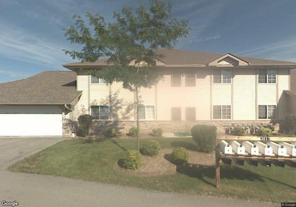
3017 Meyer Ct Unit 4 Mount Pleasant, WI 53406
Estimated Value: $184,000 - $224,086
2
Beds
2
Baths
1,311
Sq Ft
$157/Sq Ft
Est. Value
About This Home
This home is located at 3017 Meyer Ct Unit 4, Mount Pleasant, WI 53406 and is currently estimated at $205,772, approximately $156 per square foot. 3017 Meyer Ct Unit 4 is a home located in Racine County with nearby schools including Schulte Elementary School, Mitchell Middle School, and Case High School.
Ownership History
Date
Name
Owned For
Owner Type
Purchase Details
Closed on
Aug 15, 2024
Sold by
Albro Michael
Bought by
Mcfarlane Nigel
Current Estimated Value
Home Financials for this Owner
Home Financials are based on the most recent Mortgage that was taken out on this home.
Original Mortgage
$188,977
Outstanding Balance
$186,797
Interest Rate
6.77%
Mortgage Type
VA
Estimated Equity
$18,975
Purchase Details
Closed on
Feb 2, 2006
Sold by
Jacobs Raymond O and Jacobs Jennifer L
Bought by
Albro Michael
Home Financials for this Owner
Home Financials are based on the most recent Mortgage that was taken out on this home.
Original Mortgage
$111,650
Interest Rate
6.3%
Mortgage Type
FHA
Create a Home Valuation Report for This Property
The Home Valuation Report is an in-depth analysis detailing your home's value as well as a comparison with similar homes in the area
Home Values in the Area
Average Home Value in this Area
Purchase History
| Date | Buyer | Sale Price | Title Company |
|---|---|---|---|
| Mcfarlane Nigel | $185,000 | Capital Title | |
| Albro Michael | $127,000 | -- |
Source: Public Records
Mortgage History
| Date | Status | Borrower | Loan Amount |
|---|---|---|---|
| Open | Mcfarlane Nigel | $188,977 | |
| Previous Owner | Albro Michael | $111,650 |
Source: Public Records
Tax History Compared to Growth
Tax History
| Year | Tax Paid | Tax Assessment Tax Assessment Total Assessment is a certain percentage of the fair market value that is determined by local assessors to be the total taxable value of land and additions on the property. | Land | Improvement |
|---|---|---|---|---|
| 2024 | $3,027 | $185,900 | $9,400 | $176,500 |
| 2023 | $2,976 | $176,500 | $8,800 | $167,700 |
| 2022 | $2,748 | $162,800 | $8,800 | $154,000 |
| 2021 | $2,722 | $143,300 | $8,000 | $135,300 |
| 2020 | $2,511 | $129,900 | $7,000 | $122,900 |
| 2019 | $2,251 | $121,600 | $7,000 | $114,600 |
| 2018 | $2,151 | $108,200 | $7,000 | $101,200 |
| 2017 | $1,925 | $96,000 | $7,000 | $89,000 |
| 2016 | $1,841 | $86,500 | $7,000 | $79,500 |
| 2015 | $1,785 | $86,500 | $7,000 | $79,500 |
| 2014 | $1,688 | $86,500 | $7,000 | $79,500 |
| 2013 | $1,821 | $86,500 | $7,000 | $79,500 |
Source: Public Records
Map
Nearby Homes
- 3029 Meachem Rd
- 3202 Meachem Rd
- 5001 Maryland Ave
- 3403 Oakwood Dr
- 3607 Meachem Rd
- 2121 Ohio St
- 2112 Virginia St
- 4620 Taylor Ave
- 3154 Wood Rd Unit 11
- 3331 Green Meadows Ln
- 3810 Durand Ave
- 2113 Kentucky St
- 2627 Lathrop Ave
- 4025 21st St
- 3929 Southwood Dr
- 2414 Cleveland Ave
- 2026 Lathrop Ave
- 3738 Warren Cir
- 3845 Lakeview Dr
- 3111 Wheelock Dr
- 3017 Meyer Ct Unit 8
- 3017 Meyer Ct Unit 7
- 3017 Meyer Ct Unit 6
- 3017 Meyer Ct Unit 5
- 3017 Meyer Ct Unit 3
- 3017 Meyer Ct Unit 2
- 3017 Meyer Ct Unit 1
- 3017 Meyer Ct
- 4717 Durand Ave
- 3027 Meyer Ct Unit 8
- 3027 Meyer Ct Unit 7
- 3027 Meyer Ct Unit 6
- 3027 Meyer Ct Unit 5
- 3027 Meyer Ct Unit 4
- 3027 Meyer Ct Unit 3
- 3027 Meyer Ct Unit 2
- 3027 Meyer Ct Unit 1
- 3027 Meyer Ct Unit 3027
- 3016 Meyer Ct Unit 8
- 3016 Meyer Ct Unit 6