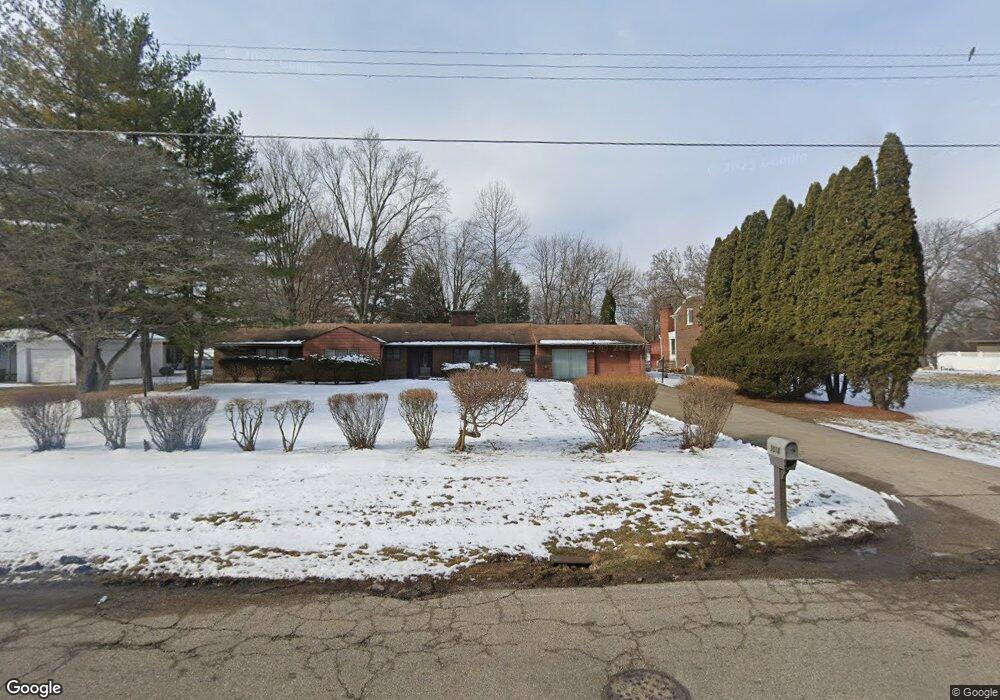
3018 Circle Dr Flint, MI 48507
Circle NeighborhoodEstimated Value: $142,079 - $158,000
3
Beds
3
Baths
1,789
Sq Ft
$85/Sq Ft
Est. Value
About This Home
This home is located at 3018 Circle Dr, Flint, MI 48507 and is currently estimated at $151,520, approximately $84 per square foot. 3018 Circle Dr is a home located in Genesee County with nearby schools including Freeman Elementary School, Flint Southwestern Classical Academy, and International Academy of Flint (K-12).
Ownership History
Date
Name
Owned For
Owner Type
Purchase Details
Closed on
Dec 20, 2010
Sold by
Johnson Ruby L
Bought by
Johnson Ruby L
Current Estimated Value
Purchase Details
Closed on
Oct 7, 2004
Sold by
Leaym Charles W and Fisher Aschandria
Bought by
Johnson Ruby L
Purchase Details
Closed on
Mar 28, 2003
Sold by
Leaym Charles W
Bought by
Leaym Charles W and Fisher Aschandria
Home Financials for this Owner
Home Financials are based on the most recent Mortgage that was taken out on this home.
Original Mortgage
$52,050
Interest Rate
5.95%
Mortgage Type
VA
Purchase Details
Closed on
Mar 26, 2003
Sold by
Leaym Charles William and Leaym Schineice
Bought by
Leaym Charles W
Home Financials for this Owner
Home Financials are based on the most recent Mortgage that was taken out on this home.
Original Mortgage
$52,050
Interest Rate
5.95%
Mortgage Type
VA
Create a Home Valuation Report for This Property
The Home Valuation Report is an in-depth analysis detailing your home's value as well as a comparison with similar homes in the area
Home Values in the Area
Average Home Value in this Area
Purchase History
We collect this data history from publicly available records. To have your information removed, we recommend requesting removal directly through your county’s website.
| Date | Buyer | Sale Price | Title Company |
|---|---|---|---|
| Johnson Ruby L | -- | None Available | |
| Johnson Ruby L | $128,700 | Metropolitan Title Co | |
| Leaym Charles W | -- | Cislo Title Company | |
| Leaym Charles W | -- | Cislo Title Company |
Source: Public Records
Mortgage History
We collect this data history from publicly available records. To have your information removed, we recommend requesting removal directly through your county’s website.
| Date | Status | Borrower | Loan Amount |
|---|---|---|---|
| Previous Owner | Leaym Charles W | $52,050 |
Source: Public Records
Tax History
| Year | Tax Paid | Tax Assessment Tax Assessment Total Assessment is a certain percentage of the fair market value that is determined by local assessors to be the total taxable value of land and additions on the property. | Land | Improvement |
|---|---|---|---|---|
| 2025 | $2,119 | $67,400 | $0 | $0 |
| 2024 | $2,080 | $67,600 | $0 | $0 |
| 2023 | $2,016 | $62,800 | $0 | $0 |
| 2022 | $0 | $52,100 | $0 | $0 |
| 2021 | $2,127 | $50,300 | $0 | $0 |
| 2020 | $1,870 | $47,600 | $0 | $0 |
| 2019 | $1,792 | $39,000 | $0 | $0 |
| 2018 | $1,896 | $36,000 | $0 | $0 |
| 2017 | $1,832 | $0 | $0 | $0 |
| 2016 | $1,817 | $0 | $0 | $0 |
| 2015 | -- | $0 | $0 | $0 |
| 2014 | -- | $0 | $0 | $0 |
| 2012 | -- | $37,200 | $0 | $0 |
Source: Public Records
Map
Nearby Homes
- 3208 Comanche Ave
- 3106 Cherokee Ave
- 2910 Shawnee Ave
- 701 Algonquin Ave
- 2610 Pewanaga Place
- 3505 Comanche Ave
- 720 Algonquin Ave
- 1213 Mohawk Ave
- 3009 Menominee Ave
- 3102 S Dort Hwy
- 454 E Atherton Rd
- 2833 S Dort Hwy
- 621 Burroughs Ave
- 2221 Howard Ave
- 420 Burroughs Ave
- 352 Buckingham Ave
- 601 Mckinley Ave
- 511 Mckinley Ave
- 213 E Lakeview Ave
- 218 E Livingston Dr
- 3030 Circle Dr
- 3010 Circle Dr
- 3009 Circle Dr
- 3102 Circle Dr
- 3002 Circle Dr
- 3001 Circle Dr
- 3019 Circle Dr
- 3029 Circle Dr
- 714 Country Club Ln
- 3114 Circle Dr
- 2946 Circle Dr
- 3101 Circle Dr
- 2921 Hillcrest Ave
- 2914 Dearborn Ave
- 2908 Dearborn Ave
- 3002 Dearborn Ave
- 707 Country Club Ln
- 2902 Dearborn Ave
- 3018 Dearborn Ave
- 3122 Circle Dr
Your Personal Tour Guide
Ask me questions while you tour the home.