Estimated Value: $151,000 - $197,723
4
Beds
1
Bath
1,168
Sq Ft
$150/Sq Ft
Est. Value
About This Home
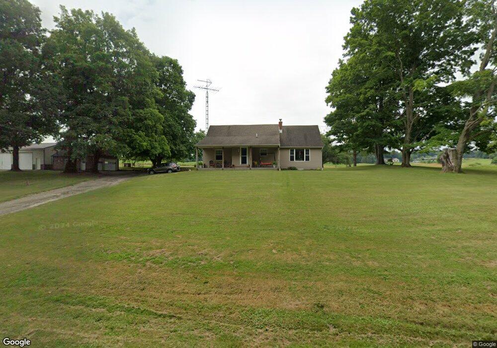
This home is located at 3018 Lucas Perrysville Rd, Lucas, OH 44843 and is currently estimated at $175,181, approximately $149 per square foot. 3018 Lucas Perrysville Rd is a home located in Richland County with nearby schools including Lucas Elementary School, Lucas Heritage Middle School, and Lucas High School.
Ownership History
Date
Name
Owned For
Owner Type
Purchase Details
Closed on
Oct 1, 1985
Current Estimated Value
Create a Home Valuation Report for This Property
The Home Valuation Report is an in-depth analysis detailing your home's value as well as a comparison with similar homes in the area
Home Values in the Area
Average Home Value in this Area
Purchase History
| Date | Buyer | Sale Price | Title Company |
|---|---|---|---|
| -- | $55,000 | -- |
Source: Public Records
Tax History Compared to Growth
Tax History
| Year | Tax Paid | Tax Assessment Tax Assessment Total Assessment is a certain percentage of the fair market value that is determined by local assessors to be the total taxable value of land and additions on the property. | Land | Improvement |
|---|---|---|---|---|
| 2024 | $1,823 | $43,370 | $13,400 | $29,970 |
| 2023 | $1,823 | $43,370 | $13,400 | $29,970 |
| 2022 | $1,669 | $35,410 | $11,980 | $23,430 |
| 2021 | $1,672 | $35,410 | $11,980 | $23,430 |
| 2020 | $1,699 | $35,410 | $11,980 | $23,430 |
| 2019 | $1,549 | $30,330 | $10,150 | $20,180 |
| 2018 | $1,594 | $30,330 | $10,150 | $20,180 |
| 2017 | $1,485 | $30,330 | $10,150 | $20,180 |
| 2016 | $1,366 | $26,150 | $9,200 | $16,950 |
| 2015 | $1,366 | $26,150 | $9,200 | $16,950 |
| 2014 | $1,372 | $26,150 | $9,200 | $16,950 |
| 2012 | $676 | $26,150 | $9,200 | $16,950 |
Source: Public Records
Map
Nearby Homes
- 0 Moffett Rd
- 174 W Main St
- 2905 Tucker Rd
- 3261 Moffett Rd
- 2221 Pleasant Valley Rd
- 0 Applegate Rd
- 2428 Applegate Rd
- 0 Tucker Rd
- 0 Mount Zion Rd Unit 9069748
- 1679 Pulver Rd
- 1307 Sweetbriar Dr
- 1135 E Hanley Rd
- 2061 Washington North Rd
- 0 Garver Rd Washington Rd S Unit 20253648
- 1875 Mansfield Lucas Rd
- 0 Garver Washington Rd S
- 0 State Route 39 & I-71 Northeast Quadrant
- 0 State Route 39 & I-71 Southeast Quadrant
- 3386 Trumpower Rd
- 68.40 Acres Trumpower Rd
- 3021 Lucas Perrysville Rd
- 3045 Lucas Perrysville Rd
- 0 Dickes Rd
- 3053 Lucas Perrysville Rd
- 2943 Lucas Perrysville Rd
- 2976 Lucas Perrysville Rd
- 3085 Lucas Perrysville Rd
- 2913 Lucas Perrysville Rd
- 2752 Dickes Rd
- 3101 Lucas Perrysville Rd
- 2865 Lucas Perrysville Rd
- 2928 Lucas Perrysville Rd
- 2980 Lucas Perrysville Rd
- 2700 Dickes Rd
- 210
- 0 Pleasant Valley Rd Unit 605417
- 0 Pleasant Valley Rd Unit 607710
- 0 Pleasant Valley Rd Unit 607496
- 0 Pleasant Valley Rd Unit 604239
- 0 Pleasant Valley Rd Unit 51619