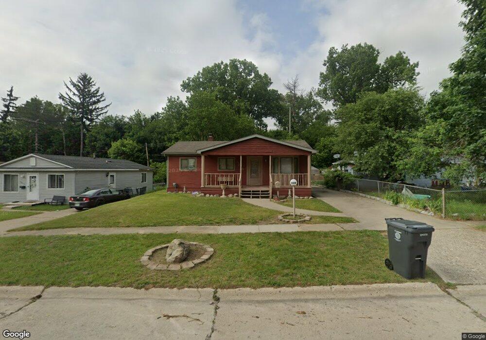
3019 Hampstead Dr Flint, MI 48506
Northeast Flint NeighborhoodEstimated Value: $67,140 - $92,000
3
Beds
1
Bath
900
Sq Ft
$86/Sq Ft
Est. Value
About This Home
This home is located at 3019 Hampstead Dr, Flint, MI 48506 and is currently estimated at $77,035, approximately $85 per square foot. 3019 Hampstead Dr is a home located in Genesee County with nearby schools including Brownell STEM Academy, Richfield Public School Academy, and Richfield Early Learning Center.
Ownership History
Date
Name
Owned For
Owner Type
Purchase Details
Closed on
Aug 16, 2019
Sold by
Anspaugh Dylan
Bought by
Haywood Ricky
Current Estimated Value
Purchase Details
Closed on
Jul 9, 2014
Sold by
Sargent Jason
Bought by
Ansperugh Dylan
Purchase Details
Closed on
Jan 1, 2011
Sold by
Secretary Of Housing & Urban Development
Bought by
Sargent Jason
Purchase Details
Closed on
Jun 28, 2010
Sold by
Flagstar Bank
Bought by
Secretary Of Housing & Urban Development
Purchase Details
Closed on
Oct 21, 2009
Sold by
Zeh Karen N
Bought by
Mortgage Electronic Registration Systems
Create a Home Valuation Report for This Property
The Home Valuation Report is an in-depth analysis detailing your home's value as well as a comparison with similar homes in the area
Home Values in the Area
Average Home Value in this Area
Purchase History
| Date | Buyer | Sale Price | Title Company |
|---|---|---|---|
| Haywood Ricky | $6,500 | None Available | |
| Ansperugh Dylan | -- | None Available | |
| Sargent Jason | $6,325 | None Available | |
| Secretary Of Housing & Urban Development | -- | None Available | |
| Flagstar Bank | -- | None Available | |
| Mortgage Electronic Registration Systems | $62,579 | None Available |
Source: Public Records
Tax History
| Year | Tax Paid | Tax Assessment Tax Assessment Total Assessment is a certain percentage of the fair market value that is determined by local assessors to be the total taxable value of land and additions on the property. | Land | Improvement |
|---|---|---|---|---|
| 2025 | $942 | $28,400 | $0 | $0 |
| 2024 | $855 | $24,200 | $0 | $0 |
| 2023 | $841 | $20,300 | $0 | $0 |
| 2022 | $0 | $14,500 | $0 | $0 |
| 2021 | $872 | $13,800 | $0 | $0 |
| 2020 | $789 | $11,000 | $0 | $0 |
| 2019 | $1,137 | $11,800 | $0 | $0 |
| 2018 | $1,151 | $11,700 | $0 | $0 |
| 2017 | $1,224 | $0 | $0 | $0 |
| 2016 | $1,009 | $0 | $0 | $0 |
| 2015 | -- | $0 | $0 | $0 |
| 2014 | -- | $0 | $0 | $0 |
| 2012 | -- | $15,500 | $0 | $0 |
Source: Public Records
Map
Nearby Homes
- 2919 Hampstead Dr
- 5919 Western Rd
- 2825 Eaton Place
- 2909 E Pierson Rd
- 2727 Eaton Place
- 4907 Delta Dr
- 3364 E Pierson Rd
- 4298 N Center Rd
- 3456 E Pierson Rd
- 4072 Crosby Rd
- 1704 E Webster Rd
- 5190 Branch Rd
- 4141 Hidden View Dr
- 3294 Huggins Ave
- 5910 N Dort Hwy
- 4127 Coggins Ave
- 2935 Richfield Rd
- 00 Richfield Rd
- 2975 Henry St
- 0 Sugar Maple Farms Unit 50195365
- 3013 Hampstead Dr
- 6211 Branch Rd
- 3007 Hampstead Dr
- 3001 Hampstead Dr
- 3222 Branch Rd
- 3010 Hampstead Dr
- 5825 Branch Rd
- 3002 Hampstead Dr
- G4342 Branch Rd
- G4326 Branch Rd
- G4358 Branch Rd
- G4314 Branch Rd
- 5821 Branch Rd
- 2913 Hampstead Dr
- 2914 Hampstead Dr
- 5817 Branch Rd
- 2909 Hampstead Dr
- 5813 Branch Rd
- 2905 Hampstead Dr
- 4214 Branch Rd
Your Personal Tour Guide
Ask me questions while you tour the home.