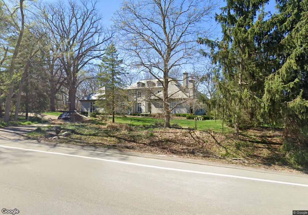
3019 N Maple Rd Ann Arbor, MI 48103
Estimated Value: $2,149,585 - $3,881,000
4
Beds
4
Baths
10,000
Sq Ft
$303/Sq Ft
Est. Value
About This Home
This home is located at 3019 N Maple Rd, Ann Arbor, MI 48103 and is currently estimated at $3,030,195, approximately $303 per square foot. 3019 N Maple Rd is a home located in Washtenaw County with nearby schools including Wines Elementary School, Forsythe Middle School, and Skyline High School.
Ownership History
Date
Name
Owned For
Owner Type
Purchase Details
Closed on
Dec 5, 2011
Sold by
Lippman Marc E and Silvers Jill R
Bought by
Ulgen Onur M
Current Estimated Value
Home Financials for this Owner
Home Financials are based on the most recent Mortgage that was taken out on this home.
Original Mortgage
$975,000
Outstanding Balance
$633,805
Interest Rate
3%
Mortgage Type
Adjustable Rate Mortgage/ARM
Estimated Equity
$2,396,390
Purchase Details
Closed on
May 18, 2001
Sold by
White Robert L
Bought by
Lippman Marc E
Purchase Details
Closed on
Oct 9, 1994
Sold by
Shafer Russell P
Bought by
Kemp Thomas P
Home Financials for this Owner
Home Financials are based on the most recent Mortgage that was taken out on this home.
Original Mortgage
$88,000
Interest Rate
6.75%
Mortgage Type
New Conventional
Create a Home Valuation Report for This Property
The Home Valuation Report is an in-depth analysis detailing your home's value as well as a comparison with similar homes in the area
Home Values in the Area
Average Home Value in this Area
Purchase History
| Date | Buyer | Sale Price | Title Company |
|---|---|---|---|
| Ulgen Onur M | $1,750,000 | Sur | |
| Lippman Marc E | $455,000 | -- | |
| Kemp Thomas P | $90,000 | -- |
Source: Public Records
Mortgage History
| Date | Status | Borrower | Loan Amount |
|---|---|---|---|
| Open | Ulgen Onur M | $975,000 | |
| Previous Owner | Kemp Thomas P | $88,000 |
Source: Public Records
Tax History
| Year | Tax Paid | Tax Assessment Tax Assessment Total Assessment is a certain percentage of the fair market value that is determined by local assessors to be the total taxable value of land and additions on the property. | Land | Improvement |
|---|---|---|---|---|
| 2025 | $29,965 | $1,310,800 | $0 | $0 |
| 2024 | $29,248 | $1,192,500 | $0 | $0 |
| 2023 | $28,103 | $1,112,900 | $0 | $0 |
| 2022 | $39,568 | $1,095,800 | $0 | $0 |
| 2021 | $38,625 | $1,061,900 | $0 | $0 |
| 2020 | $39,571 | $1,048,260 | $0 | $0 |
| 2019 | $37,242 | $1,048,950 | $1,048,950 | $0 |
| 2018 | $36,813 | $1,059,590 | $121,600 | $937,990 |
| 2017 | $35,538 | $1,003,340 | $0 | $0 |
| 2016 | $23,547 | $927,675 | $0 | $0 |
| 2015 | -- | $924,901 | $0 | $0 |
| 2014 | -- | $896,000 | $0 | $0 |
| 2013 | -- | $896,000 | $0 | $0 |
Source: Public Records
Map
Nearby Homes
- 2844 Whippoorwill Ln
- 2929 Laurentide Dr
- 2770 Byington Blvd
- 2776 Holyoke Ln
- 2086 Autumn Hill Dr Unit 82
- 0 Cottontail Ln
- 3486 Woodlea Dr
- 3481 Cottontail Ln
- 2136 Newport Rd
- 2108 Newport Rd Unit Parcel 2108
- 2108 Newport Rd
- 2374 Newport Rd
- 2134 Overlook Ct
- 2174 Overlook Ct Unit 326
- 2176 Overlook Ct
- 1390 Patricia Ave Unit 17
- 1025 Duncan St
- 244 Barton Shore Dr
- 1019 Hasper Dr
- 2344 S Circle Dr
- 3041 N Maple Rd
- 0 W Huron River Dr
- 3020 N Maple Rd
- 2981 Newport Rd
- 2987 Newport Rd
- 2876 N Maple Rd
- 4800 W Huron River Dr
- 2848 N Maple Rd
- 2846 Whippoorwill Ln
- 2969 Newport Rd
- 2950 Newport Rd
- 2865 Whippoorwill Ln
- 2855 Whippoorwill Ln
- 2943 Laurentide Dr
- 2951 Laurentide Dr
- 3619 W Huron River Dr
- 2945 Newport Rd
- 2851 Whippoorwill Ln
- 2938 Newport Rd
- 2909 Laurentide Dr
Your Personal Tour Guide
Ask me questions while you tour the home.