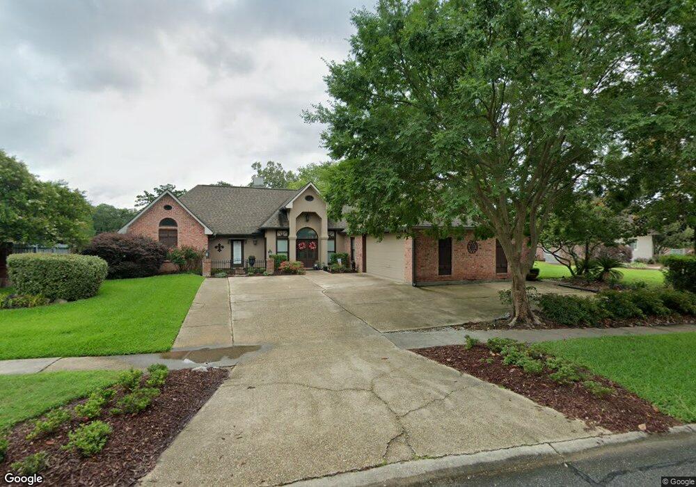
3019 Silver Sand Dr Baton Rouge, LA 70816
Shenandoah NeighborhoodEstimated Value: $360,000 - $394,000
4
Beds
3
Baths
2,500
Sq Ft
$153/Sq Ft
Est. Value
About This Home
This home is located at 3019 Silver Sand Dr, Baton Rouge, LA 70816 and is currently estimated at $381,363, approximately $152 per square foot. 3019 Silver Sand Dr is a home located in East Baton Rouge Parish with nearby schools including Wedgewood Elementary School, Southeast Middle School, and Tara High School.
Ownership History
Date
Name
Owned For
Owner Type
Purchase Details
Closed on
Jan 6, 1999
Sold by
Clearlake Estates Inc
Bought by
Thibodeaux Carl Paul and Thibodeaux Elizabeth Thompson
Current Estimated Value
Home Financials for this Owner
Home Financials are based on the most recent Mortgage that was taken out on this home.
Original Mortgage
$37,000
Outstanding Balance
$8,567
Interest Rate
6.74%
Mortgage Type
Purchase Money Mortgage
Estimated Equity
$372,796
Create a Home Valuation Report for This Property
The Home Valuation Report is an in-depth analysis detailing your home's value as well as a comparison with similar homes in the area
Home Values in the Area
Average Home Value in this Area
Purchase History
| Date | Buyer | Sale Price | Title Company |
|---|---|---|---|
| Thibodeaux Carl Paul | $41,500 | -- |
Source: Public Records
Mortgage History
| Date | Status | Borrower | Loan Amount |
|---|---|---|---|
| Open | Thibodeaux Carl Paul | $37,000 |
Source: Public Records
Tax History Compared to Growth
Tax History
| Year | Tax Paid | Tax Assessment Tax Assessment Total Assessment is a certain percentage of the fair market value that is determined by local assessors to be the total taxable value of land and additions on the property. | Land | Improvement |
|---|---|---|---|---|
| 2024 | $3,111 | $32,414 | $7,500 | $24,914 |
| 2023 | $3,111 | $28,810 | $7,500 | $21,310 |
| 2022 | $3,639 | $28,810 | $7,500 | $21,310 |
| 2021 | $3,575 | $28,810 | $7,500 | $21,310 |
| 2020 | $3,617 | $28,810 | $7,500 | $21,310 |
| 2019 | $3,561 | $28,800 | $7,500 | $21,300 |
| 2018 | $3,518 | $28,800 | $7,500 | $21,300 |
| 2017 | $3,518 | $28,800 | $7,500 | $21,300 |
| 2016 | $1,667 | $21,345 | $7,500 | $13,845 |
| 2015 | $2,404 | $27,600 | $7,500 | $20,100 |
| 2014 | $2,396 | $27,600 | $7,500 | $20,100 |
| 2013 | -- | $27,600 | $7,500 | $20,100 |
Source: Public Records
Map
Nearby Homes
- 3146 Silver Sand Dr
- 3246 Pine Grove Dr
- 3112 Grassy Lake Dr
- 3306 Grassy Lake Dr
- 3336 Grassy Lake Dr
- 3439 Timber Grove Dr
- 2929 Palatine Place
- 2909 Palatine Place
- 16222 Thorncrown Ln
- 16210 Thorncrown Ln
- 17561 Martin Lake Dr
- 2906 Niccoline Way
- 3305 Oneal Ln Unit D
- 3421 O'Neal Ln Unit D
- 3421 Oneal Ln Unit A
- 2924 Oneal Ln
- 3482 King Bradford Dr
- 16161 Chancel Ave Unit A1
- 16023 Derby Ave
- 16117 Chancel Ave
- 3029 Silver Sand Dr
- 3009 Silver Sand Dr
- 3039 Silver Sand Dr
- 3018 Silver Sand Dr
- 3008 Silver Sand Dr
- 3028 Silver Sand Dr
- 16817 White Springs Ave
- 3049 Silver Sand Dr
- 16888 S Harrells Ferry Rd
- 3038 Silver Sand Dr
- 16827 White Springs Ave
- 3037 Simpson Bayou Dr
- 0000 Silver Sand Dr
- 29 Silver Sand Dr
- 12 Silver Sand Dr
- 58 Silver Sand Dr
- 1 Silver Sand Dr
- 0 Silver Sand Dr Unit OT 8 BR199849485
- 59 Silver Sand Dr
- 38 Silver Sand Dr