Estimated Value: $272,000 - $352,000
3
Beds
1
Bath
1,260
Sq Ft
$238/Sq Ft
Est. Value
About This Home
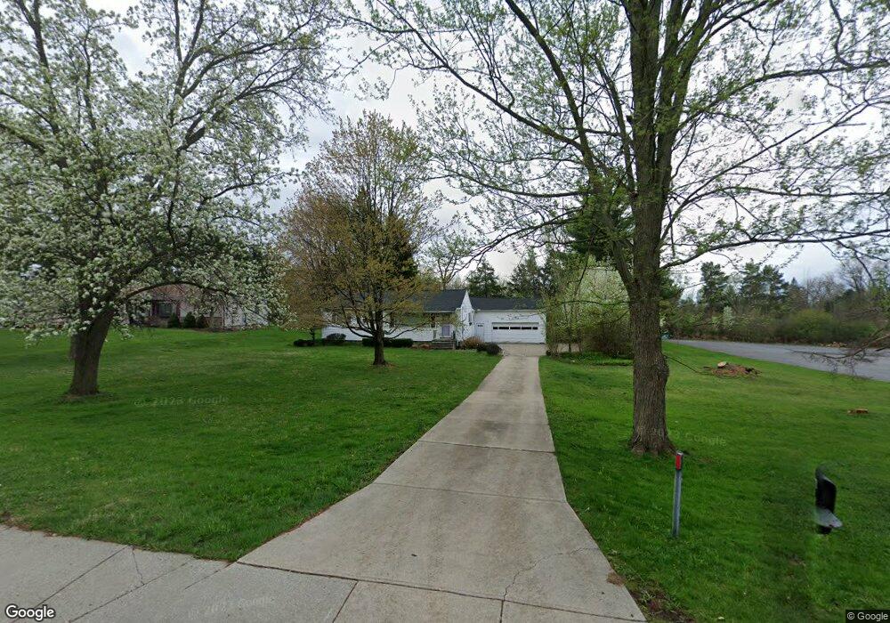
This home is located at 30190 Cannon Rd, Solon, OH 44139 and is currently estimated at $300,111, approximately $238 per square foot. 30190 Cannon Rd is a home located in Cuyahoga County with nearby schools including Dorothy E Lewis Elementary School, Orchard Middle School, and Solon Middle School.
Ownership History
Date
Name
Owned For
Owner Type
Purchase Details
Closed on
Mar 23, 2015
Sold by
Betz Stephen F and Betz Claudia C
Bought by
Sternberg David E
Current Estimated Value
Purchase Details
Closed on
Apr 28, 1995
Sold by
Zito Paul J
Bought by
Betz Stephen F and Betz Claudia C
Home Financials for this Owner
Home Financials are based on the most recent Mortgage that was taken out on this home.
Original Mortgage
$92,000
Interest Rate
8.42%
Mortgage Type
New Conventional
Purchase Details
Closed on
Mar 16, 1981
Sold by
Zito John Paul
Bought by
Paul J Zito
Purchase Details
Closed on
Jan 27, 1981
Sold by
Zito Paul J
Bought by
Zito John Paul
Purchase Details
Closed on
Nov 3, 1980
Sold by
Zito John P and Zito Josephine A
Bought by
Zito Paul J
Purchase Details
Closed on
Jan 1, 1975
Bought by
Zito John P and Zito Josephine A
Create a Home Valuation Report for This Property
The Home Valuation Report is an in-depth analysis detailing your home's value as well as a comparison with similar homes in the area
Home Values in the Area
Average Home Value in this Area
Purchase History
| Date | Buyer | Sale Price | Title Company |
|---|---|---|---|
| Sternberg David E | $134,000 | U S Title Agency | |
| Betz Stephen F | $115,000 | -- | |
| Paul J Zito | -- | -- | |
| Zito John Paul | -- | -- | |
| Zito Paul J | -- | -- | |
| Zito John P | -- | -- |
Source: Public Records
Mortgage History
| Date | Status | Borrower | Loan Amount |
|---|---|---|---|
| Previous Owner | Betz Stephen F | $92,000 |
Source: Public Records
Tax History
| Year | Tax Paid | Tax Assessment Tax Assessment Total Assessment is a certain percentage of the fair market value that is determined by local assessors to be the total taxable value of land and additions on the property. | Land | Improvement |
|---|---|---|---|---|
| 2024 | $4,127 | $71,890 | $26,005 | $45,885 |
| 2023 | $3,617 | $52,960 | $22,540 | $30,420 |
| 2022 | $3,734 | $52,960 | $22,540 | $30,420 |
| 2021 | $3,572 | $52,960 | $22,540 | $30,420 |
| 2020 | $3,583 | $48,580 | $20,690 | $27,900 |
| 2019 | $3,472 | $138,800 | $59,100 | $79,700 |
| 2018 | $2,868 | $48,580 | $20,690 | $27,900 |
| 2017 | $3,185 | $46,910 | $27,690 | $19,220 |
| 2016 | $3,155 | $46,910 | $27,690 | $19,220 |
| 2015 | $6,497 | $46,910 | $27,690 | $19,220 |
| 2014 | $6,497 | $45,680 | $25,620 | $20,060 |
Source: Public Records
Map
Nearby Homes
- 30705 Cannon Rd
- 30875 Cannon Rd
- 5560 Elm Hill Dr
- S/L 12 Neptune Oval
- S/L 1 Neptune Oval
- S/L 2 Neptune Oval
- S/L 3 Neptune Oval
- S/L 11 Neptune Oval
- S/L 4 Neptune Oval
- S/L 13 Neptune Oval
- 32760 Ledge Hill Dr
- 5068 Neptune Oval
- 5060 Neptune Oval
- 5270 Brainard Rd
- 32957 Springside Ln
- 5721 Som Center Rd Unit 25
- 5721 Som Center Rd Unit 18
- 5151 Som Center Rd
- 26440 Cannon Rd
- 300 Woodridge Ln
- 30220 Cannon Rd
- 30270 Cannon Rd
- 30320 Cannon Rd
- 30195 Cannon Rd
- 30055 Cannon Rd
- 30125 Cannon Rd
- 30255 Cannon Rd
- 30380 Cannon Rd
- 5575 Harper Rd
- 30355 Cannon Rd
- 5499 Cannon Rd
- 30400 Cannon Rd
- 5585 Harper Rd
- 5505 Cannon Rd
- 30450 Cannon Rd
- 5 S/L Brookside Trail
- 30415 Cannon Rd
- 29950 Cannon Rd
- 5614 Westminster Dr
- 5500 Cannon Rd
Your Personal Tour Guide
Ask me questions while you tour the home.