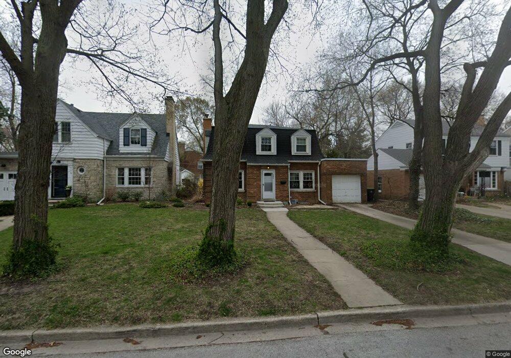
302 Ashland Ave Evanston, IL 60202
Southwest Evanston NeighborhoodEstimated Value: $593,000 - $652,000
About This Home
This home is located at 302 Ashland Ave, Evanston, IL 60202 and is currently estimated at $623,162, approximately $357 per square foot. 302 Ashland Ave is a home located in Cook County with nearby schools including Dawes Elementary School, Chute Middle School, and Evanston Township High School.
Ownership History
We collect this data history from publicly available records. To have your information removed, we recommend requesting removal directly through your county’s website.
Purchase Details
Home Financials for this Owner
Home Financials are based on the most recent Mortgage that was taken out on this home.Purchase Details
Home Values in the Area
Average Home Value in this Area
Purchase History
We collect this data history from publicly available records. To have your information removed, we recommend requesting removal directly through your county’s website.
| Date | Buyer | Sale Price | Title Company |
|---|---|---|---|
| $365,000 | Chicago Title | ||
| -- | -- |
Mortgage History
We collect this data history from publicly available records. To have your information removed, we recommend requesting removal directly through your county’s website.
| Date | Status | Borrower | Loan Amount |
|---|---|---|---|
| Closed | $327,500 |
Tax History
We collect this data history from publicly available records. To have your information removed, we recommend requesting removal directly through your county’s website.
| Year | Tax Paid | Tax Assessment Tax Assessment Total Assessment is a certain percentage of the fair market value that is determined by local assessors to be the total taxable value of land and additions on the property. | Land | Improvement |
|---|---|---|---|---|
| 2025 | $10,225 | $58,000 | $11,700 | $46,300 |
| 2024 | $10,225 | $45,000 | $9,900 | $35,100 |
| 2023 | $9,784 | $45,000 | $9,900 | $35,100 |
| 2022 | $9,784 | $45,000 | $9,900 | $35,100 |
| 2021 | $7,890 | $32,667 | $7,200 | $25,467 |
| 2020 | $7,843 | $32,667 | $7,200 | $25,467 |
| 2019 | $7,850 | $36,500 | $7,200 | $29,300 |
| 2018 | $10,727 | $42,074 | $6,000 | $36,074 |
| 2017 | $11,373 | $42,074 | $6,000 | $36,074 |
| 2016 | $10,785 | $42,074 | $6,000 | $36,074 |
| 2015 | $9,017 | $33,156 | $4,950 | $28,206 |
| 2014 | $8,930 | $33,156 | $4,950 | $28,206 |
| 2013 | $8,724 | $33,156 | $4,950 | $28,206 |
Map
- 1400 Brummel St Unit 2E
- 1321 Brummel St
- 215 Dodge Ave Unit F
- 1604 Dobson St
- 1609 Howard St Unit 2
- 1219 Hull Terrace Unit 2b
- 2540 W Jerome St Unit D
- 319 Dodge Ave
- 221 Dodge Ave Unit D
- 1823 Dobson St
- 2646 W Birchwood Ave
- 7555 N Claremont Ave
- 7448 N Rockwell St
- 1016 Austin St
- 380 Ridge Ave Unit 13G
- 7516 N California Ave
- 250 Ridge Ave Unit 1C
- 410 Ridge Ave Unit 23-2
- 200 Ridge Ave Unit 1K
- 1621 Seward St
- 1512 Mulford St Unit ID1306466P
- 1514 Mulford St
- 1508 Mulford St
- 1518 Mulford St
- 1506 Mulford St
- 1522 Mulford St
- 1502 Mulford St
- 1432 Mulford St
- 300 Ashland Ave
- 1517 Mulford St
- 1430 Mulford St
- 1521 Mulford St
- 1511 Mulford St
- 1527 Mulford St
- 1426 Mulford St
- 310 Ashland Ave
- 311 Florence Ave
- 1422 Mulford St
- 1600 Mulford St
- 316 Ashland Ave
Ask me questions while you tour the home.