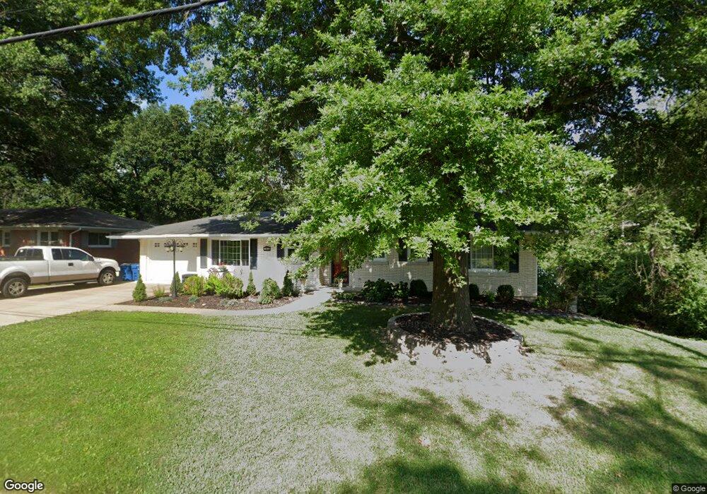
302 Binder Dr Jefferson City, MO 65109
Estimated Value: $235,000 - $251,000
3
Beds
3
Baths
1,460
Sq Ft
$166/Sq Ft
Est. Value
About This Home
This home is located at 302 Binder Dr, Jefferson City, MO 65109 and is currently estimated at $242,986, approximately $166 per square foot. 302 Binder Dr is a home located in Cole County with nearby schools including West Elementary School, Thomas Jefferson Middle School, and Jefferson City High School.
Ownership History
Date
Name
Owned For
Owner Type
Purchase Details
Closed on
Aug 27, 2020
Sold by
Forbis-Bonnot Nancy L and Bonnot Douglas J
Bought by
Burnett Rodney D and Burnett Lori A
Current Estimated Value
Home Financials for this Owner
Home Financials are based on the most recent Mortgage that was taken out on this home.
Original Mortgage
$199,700
Outstanding Balance
$140,456
Interest Rate
2.9%
Mortgage Type
New Conventional
Estimated Equity
$102,530
Create a Home Valuation Report for This Property
The Home Valuation Report is an in-depth analysis detailing your home's value as well as a comparison with similar homes in the area
Home Values in the Area
Average Home Value in this Area
Purchase History
| Date | Buyer | Sale Price | Title Company |
|---|---|---|---|
| Burnett Rodney D | -- | None Available |
Source: Public Records
Mortgage History
| Date | Status | Borrower | Loan Amount |
|---|---|---|---|
| Open | Burnett Rodney D | $199,700 |
Source: Public Records
Tax History Compared to Growth
Tax History
| Year | Tax Paid | Tax Assessment Tax Assessment Total Assessment is a certain percentage of the fair market value that is determined by local assessors to be the total taxable value of land and additions on the property. | Land | Improvement |
|---|---|---|---|---|
| 2025 | $1,541 | $25,850 | $3,330 | $22,520 |
| 2024 | $1,541 | $25,850 | $3,330 | $22,520 |
| 2023 | $1,542 | $25,850 | $3,330 | $22,520 |
| 2022 | $1,470 | $24,570 | $0 | $24,570 |
| 2021 | $1,478 | $24,570 | $0 | $24,570 |
| 2020 | $1,496 | $27,911 | $3,325 | $24,586 |
| 2019 | $1,455 | $26,809 | $3,325 | $23,484 |
| 2018 | $1,453 | $25,042 | $3,325 | $21,717 |
| 2017 | $1,418 | $24,567 | $3,325 | $21,242 |
| 2016 | $1,208 | $24,567 | $3,325 | $21,242 |
| 2015 | $1,213 | $0 | $0 | $0 |
| 2014 | $1,213 | $24,567 | $3,325 | $21,242 |
Source: Public Records
Map
Nearby Homes
- 301 Binder Dr
- 406 Meier Dr
- 325 Crest Dr
- 401 Norris Dr
- 604 Norris Dr
- 117 Bolton Dr
- 1934 Hayselton Dr
- 2016 W Main St
- 0 Jaycee Dr
- 134 W Circle Dr
- 130 Lavinia St
- 812 Boonville Rd
- 713 Belmont Dr
- 140 Riverwood Dr
- 1837 W Mccarty St
- 2628 Lola Dr
- 1615 Paddlewheel Cir
- 2616 Huntleigh Place
- 1626 W Main St
- 1618 W Main St Unit A & B
- 306 Binder Dr
- 2211 Marilyn Dr
- 2213 Marilyn Dr
- 308 Binder Dr
- 2209 Marilyn Dr
- 305 Binder Dr
- 2226 Hillsdale Dr
- 2205 Marilyn Dr
- 310 Binder Dr
- 2228 Hillsdale Dr
- 2230 Hillsdale Dr
- 2222 Hillsdale Dr
- 309 Binder Dr
- 2218 Hillsdale Dr
- 312 Binder Dr
- 2208 Marilyn Dr
- 211 Binder Dr
- 2203 Marilyn Dr
- 311 Binder Dr
- 2214 Hillsdale Dr